MyTopo
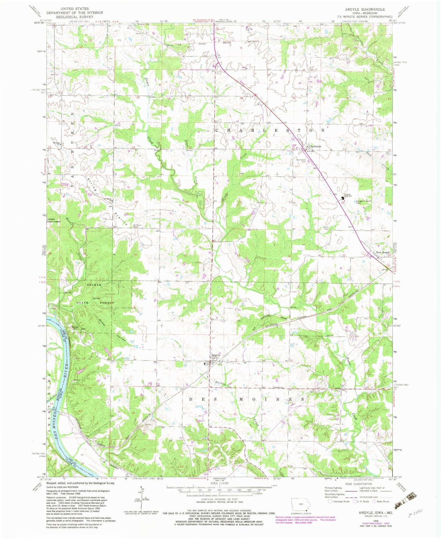
Classic USGS Argyle Iowa 7.5'x7.5' Topo Map
Couldn't load pickup availability
Historical USGS topographic quad map of Argyle in the states of Iowa, Missouri. Map scale may vary for some years, but is generally around 1:24,000. Print size is approximately 24" x 27"
This quadrangle is in the following counties: Clark, Lee.
The map contains contour lines, roads, rivers, towns, and lakes. Printed on high-quality waterproof paper with UV fade-resistant inks, and shipped rolled.
Contains the following named places: Ambrosia Cemetery, Argyle, Argyle Census Designated Place, Argyle City Hall, Argyle Memorial Cemetery, Argyle Post Office, Argyle Presbyterian Church, Belfast, Belfast Post Office, Bethel Bible Church, Birch Creek, Bowman Cemetery, Bryan Hill, Central Lee Elementary School, Central Lee High School, Central Lee Middle School, Charleston, Charleston Cemetery, Charleston Post Office, Charleston Roadside Park, Des Moines Township Fire and Rescue, Donnellson Airport, Dumas Creek, Embury Cemetery, Embury Church, Ghost Hollow, Goose Creek, Hinsdale, Hinsdale Post Office, Monks Creek, New Boston, New Boston Cemetery, New Boston Mennonite Church, New Boston Post Office, Saint Marys Church, South Cemetery, String Prairie, String Prairie Cemetery, String Prairie Post Office, Township of Charleston, Township of Des Moines, Turkey Run Access, ZIP Code: 52619