MyTopo
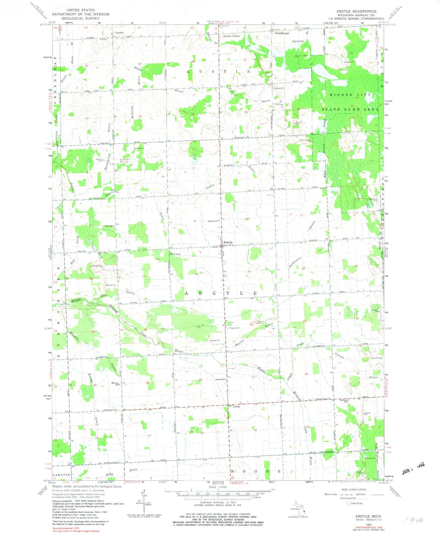
Classic USGS Argyle Michigan 7.5'x7.5' Topo Map
Couldn't load pickup availability
Historical USGS topographic quad map of Argyle in the state of Michigan. Map scale may vary for some years, but is generally around 1:24,000. Print size is approximately 24" x 27"
This quadrangle is in the following counties: Sanilac.
The map contains contour lines, roads, rivers, towns, and lakes. Printed on high-quality waterproof paper with UV fade-resistant inks, and shipped rolled.
Contains the following named places: Argyle, Argyle Cemetery, Argyle Drain, Argyle Post Office, Argyle School, Argyle Township Fire Department, Argyle United Methodist Church, Austin Center, Brice Wightman Drain, Brown Drain, Carson Drain, Cumber, Cumber Post Office, Flannery Drain, Franzel Drain, Freiburgers Post Office, Freidberger, Hartel Drain, Hawksworth Drain, Hobbs Drain, Ingles Drain, Laing, Laing Post Office, Laing School, Lutheran Cemetery, Main Hartel Drain, McBride School, McIntyre Drain, Saint Joseph and Saint Ignatius' Cemetery, Saint Joseph's and Saint Ignatius Church, Sanderson Drain, South Branch, South Branch Ingles Draw, Starr School, Swan Drain, Township of Argyle, Wheatland Cemetery, Wheeler Drain, Wheeler School, ZIP Code: 48472