MyTopo
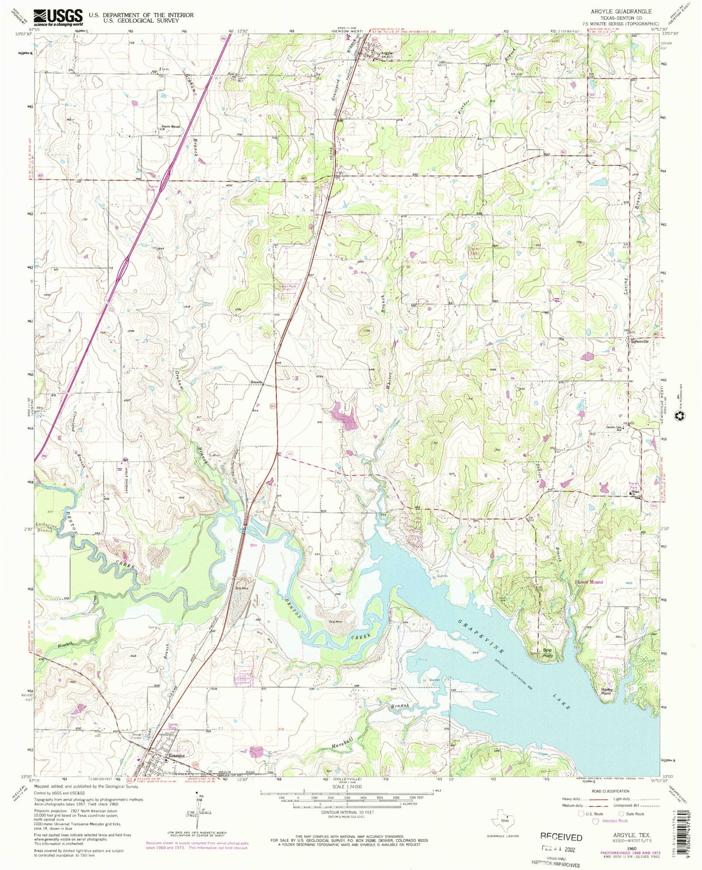
Classic USGS Argyle Texas 7.5'x7.5' Topo Map
Couldn't load pickup availability
Historical USGS topographic quad map of Argyle in the state of Texas. Typical map scale is 1:24,000, but may vary for certain years, if available. Print size: 24" x 27"
This quadrangle is in the following counties: Denton.
The map contains contour lines, roads, rivers, towns, and lakes. Printed on high-quality waterproof paper with UV fade-resistant inks, and shipped rolled.
Contains the following named places: Argyle, Bolo Point, Cade Branch, Catherine Branch, Cleveland Branch, Double Oak School, Elizabeth Creek, Graham Branch, Prairie Mound Church, Roanoke, Rocky Point, Sharps Branch, Shiloh Church, Whites Branch, Marshall Branch, Bartonville, Leroux Airport, Northwest Regional Airport, Corral City, Marshall Creek, Burger Lake Dam, Burger Lake, Trophy Club Golf Dam, Trophy Club Golf Lake, Ewing Lake Dam, Ewing Lake, Lakeview Elementary School, Northwest Alliance Academy, Roanoke Elementary School, Argyle Intermediate School, Denton Creek School, Argyle United Methodist Church, Tabernacle Baptist Church, Oak Hills Community Evangelical Free Church, Integrity Park, Marshall Creek Park, Knob Hills Trail, City of Argyle, City of Roanoke, Town of Bartonville, Town of Marshall Creek (historical), Town of Draper, Argyle Volunteer Fire District Station 511, Roanoke Fire Department, Flower Mound Fire Department Station 2, Argyle Volunteer Fire District Station 512, Argyle Post Office, Roanoke Post Office, Argyle Police Department, Roanoke Police Department, Denton County Constable's Office Precinct 4, Prairie Mound Cemetery