MyTopo
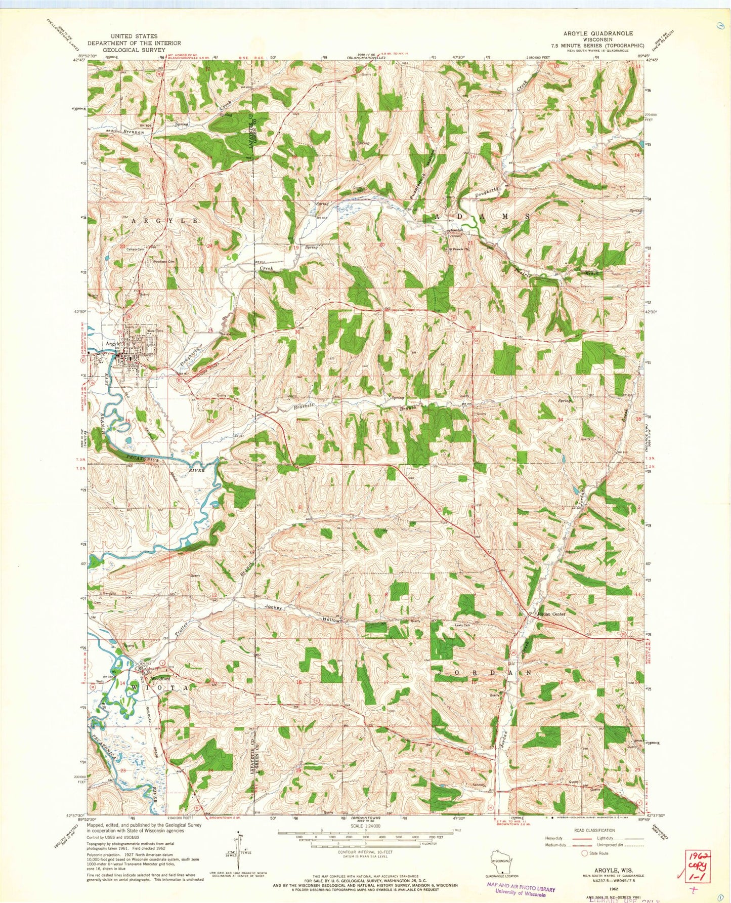
Classic USGS Argyle Wisconsin 7.5'x7.5' Topo Map
Couldn't load pickup availability
Historical USGS topographic quad map of Argyle in the state of Wisconsin. Map scale may vary for some years, but is generally around 1:24,000. Print size is approximately 24" x 27"
This quadrangle is in the following counties: Green, Lafayette.
The map contains contour lines, roads, rivers, towns, and lakes. Printed on high-quality waterproof paper with UV fade-resistant inks, and shipped rolled.
Contains the following named places: Alea Argyle Land Ethic Academy, Argyle, Argyle Adams Community Fire Department, Argyle Elementary School, Argyle Emergency Medical Services, Argyle Police Department, Argyle Post Office, Argyle Schools, Argyle Wastewater Treatment Facility, Big Valley Farm, Braezels Branch, Calvary Cemetery, Cherry Branch, Dougherty Creek, Jockey Hollow, Jordan Center, Lewis Cemetery, Prairie Brook, Puddledock Hollow, Saint Francis Church, Saint Joseph Catholic Church, Town of Adams, Town of Jordan, Trotter Branch, Village of Argyle, Willet, Woodford, Woodford Census Designated Place, Woodford Post Office, Woodford Volunteer Fire Department, Woodlawn Cemetery, ZIP Codes: 53504, 53599