MyTopo
Classic USGS Ariton Alabama 7.5'x7.5' Topo Map
Couldn't load pickup availability
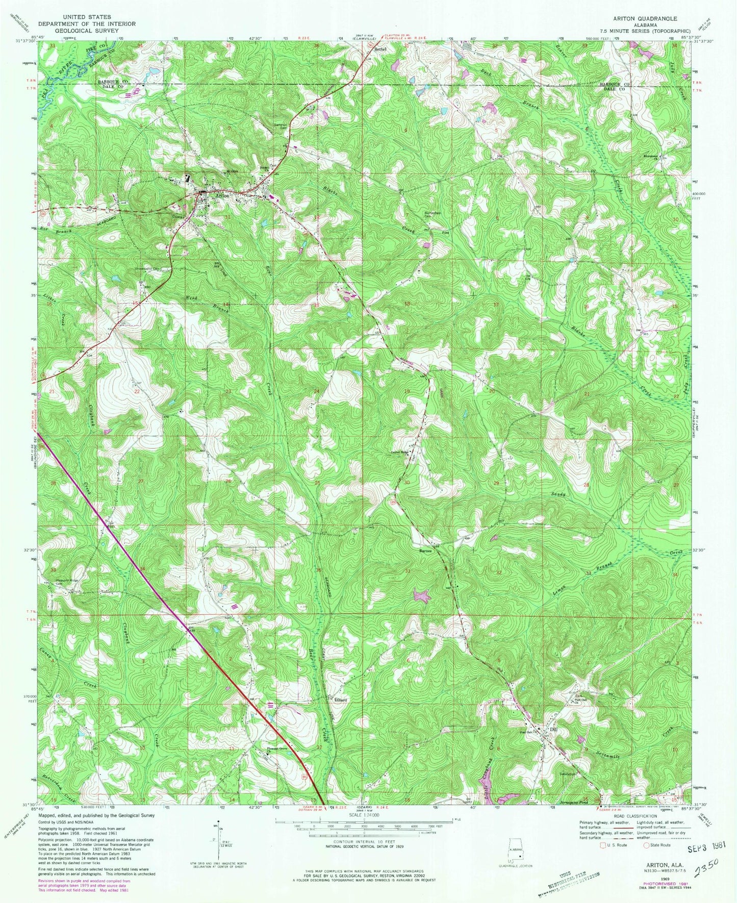
Historical USGS topographic quad map of Ariton in the state of Alabama. Map scale may vary for some years, but is generally around 1:24,000. Print size is approximately 24" x 27"
This quadrangle is in the following counties: Barbour, Dale, Pike.
The map contains contour lines, roads, rivers, towns, and lakes. Printed on high-quality waterproof paper with UV fade-resistant inks, and shipped rolled.
Contains the following named places: Ariton, Ariton Fire Rescue, Ariton High School, Ariton Police Department, Ariton Post Office, Ariton United Methodist Church, Barnes, Beasley Branch, Beaver Creek, Bethel Assembly of God Church, Bruces Mill Creek, Buck Branch, Caney Creek, Center Ridge Baptist Church, Center Ridge Cemetery, Dill, Dillard, Evergreen Church, Holy Faith Mission Full Gospel Church, Lemon Branch, Marvin Parker Lake Dam Number Two, Marvin Parker Lake Number Two, Mincheners Bridge, Mount Olive Church, Ozark Division, Pleasant Grove Baptist Church, Pleasant Ridge Cemetery, Post Oak Baptist Church, Post Oak Cemetery, Post Oak United Methodist Church, Powell School, Richardson Cemetery, Rocky Mount School, Sammon Cemetery, Shanghai School, Town of Ariton, Universalist Cemetery, W G Barnes Dam, W G Barnes Lake, Weed Branch, ZIP Code: 36311