MyTopo
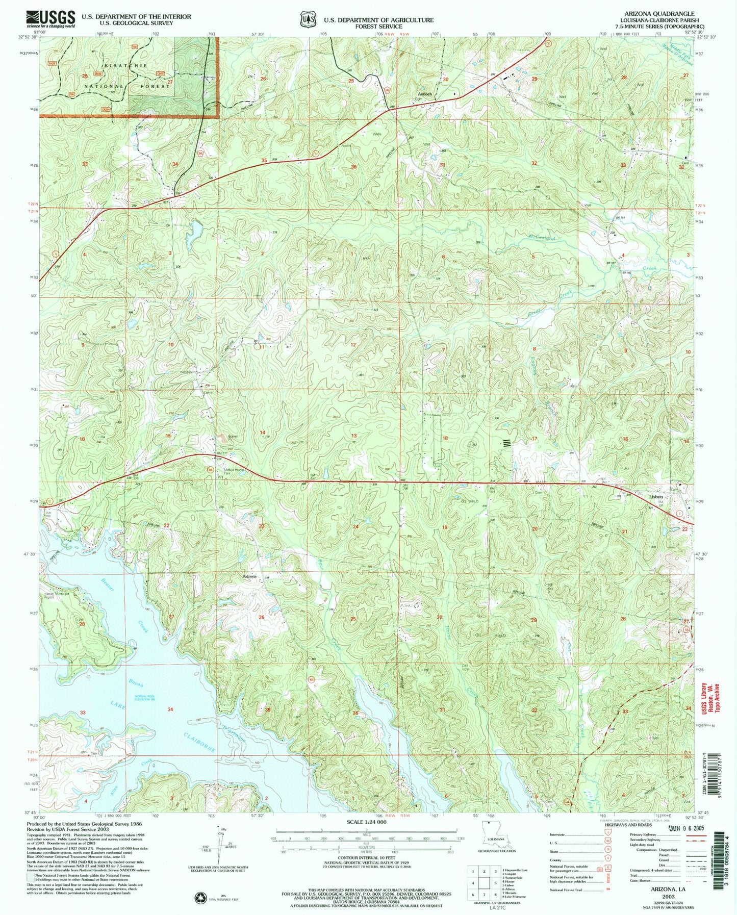
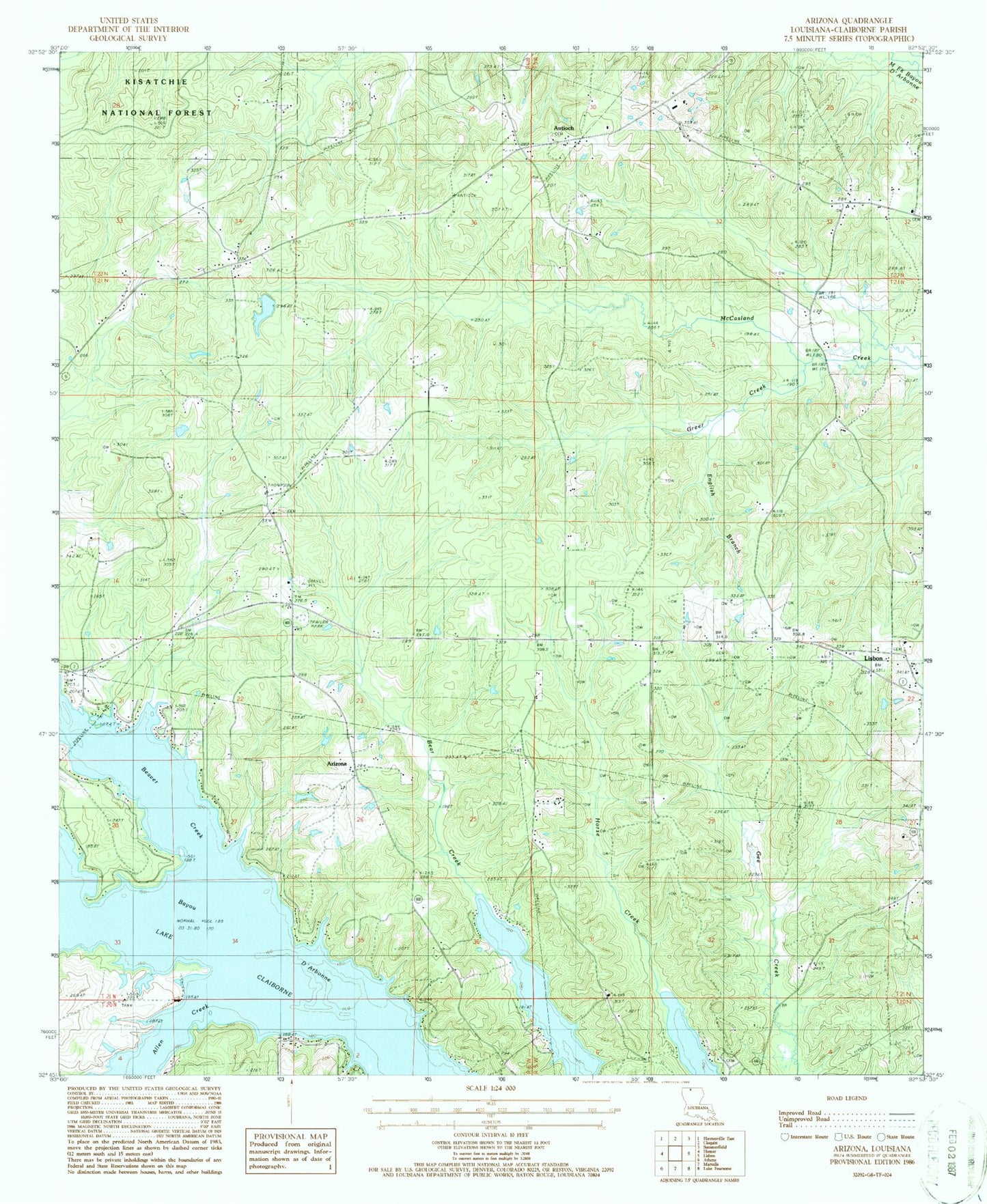
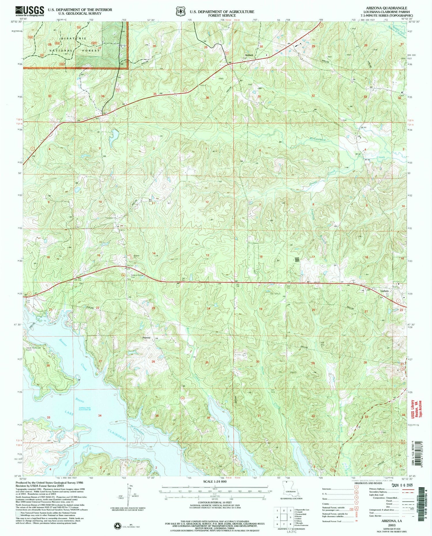
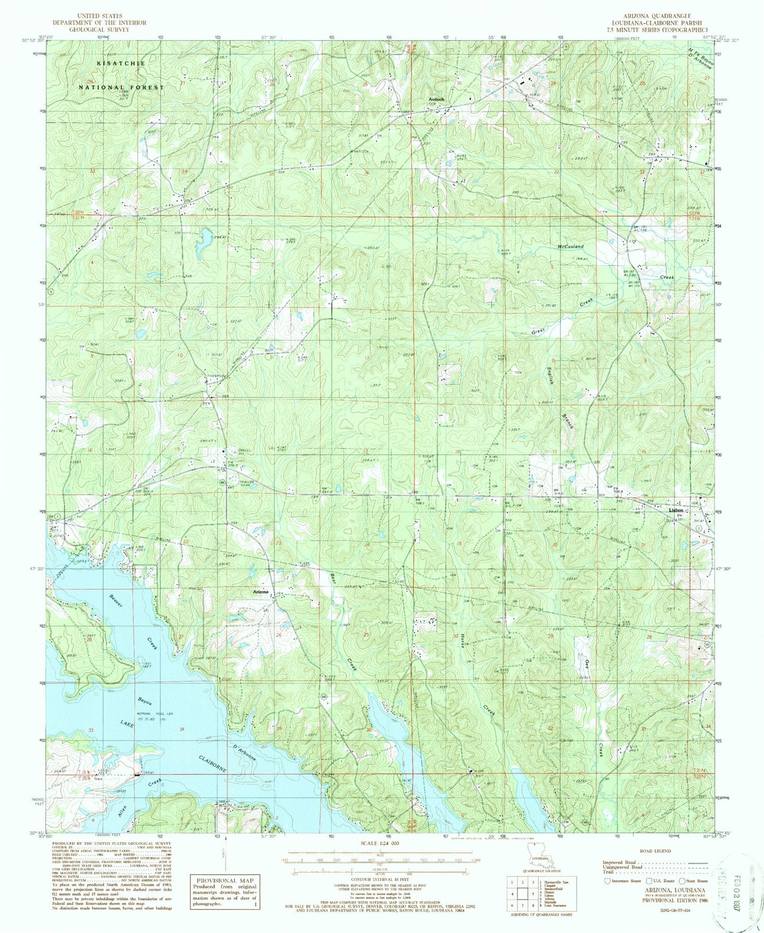
Classic USGS Arizona Louisiana 7.5'x7.5' Topo Map
Couldn't load pickup availability
Historical USGS topographic quad map of Arizona in the state of Louisiana. Typical map scale is 1:24,000, but may vary for certain years, if available. Print size: 24" x 27"
This quadrangle is in the following counties: Claiborne.
The map contains contour lines, roads, rivers, towns, and lakes. Printed on high-quality waterproof paper with UV fade-resistant inks, and shipped rolled.
Contains the following named places: Antioch Cemetery, Forest Grove Cemetery, Forest Grove School Gas Field, McCasland Creek Oil and Gas Field, Rocky Springs Cemetery, West Lisbon Oil and Gas Field, Antioch, Arizona, Aycock Cemetery, Beaver Creek, Center Springs Church, English Branch, Forest Grove School, Friendship Church, Green Creek, Liberty Hill Cemetery, Liberty Hill School, Rocky Springs Church, Salem School, White Cemetery, Arizona Methodist Church, Forest Grove, Lake Claiborne, Claiborne Parish, Antioch Post Office (historical), Parish Governing Authority District 8, Parish Governing Authority District 9, Claiborne Parish Fire District 6 Arizona Station, Claiborne Parish Fire District 6 Antioch Station