MyTopo
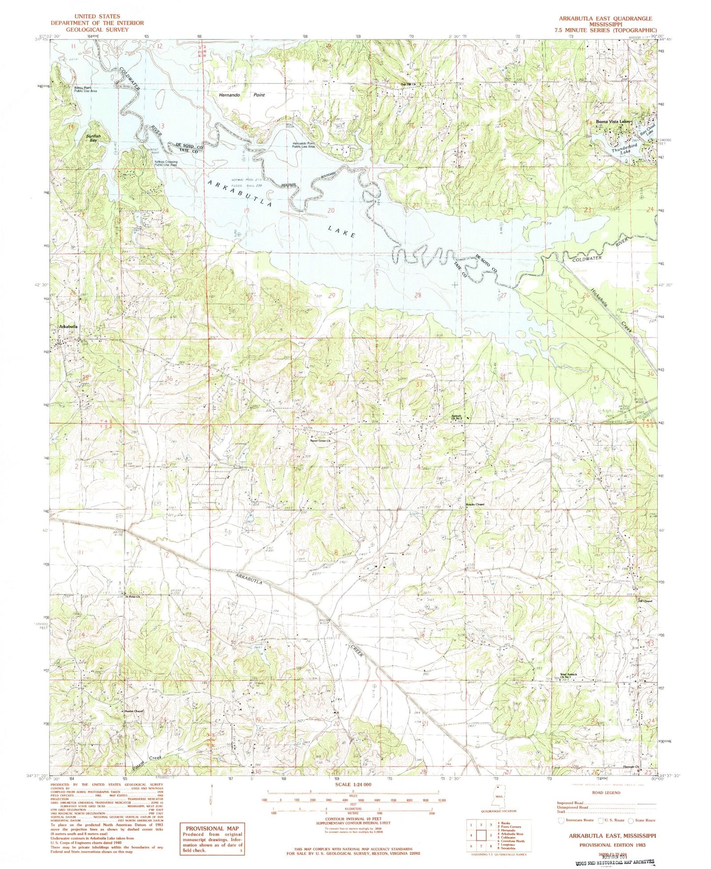
Classic USGS Arkabutla East Mississippi 7.5'x7.5' Topo Map
Couldn't load pickup availability
Historical USGS topographic quad map of Arkabutla East in the state of Mississippi. Typical map scale is 1:24,000, but may vary for certain years, if available. Print size: 24" x 27"
This quadrangle is in the following counties: DeSoto, Tate.
The map contains contour lines, roads, rivers, towns, and lakes. Printed on high-quality waterproof paper with UV fade-resistant inks, and shipped rolled.
Contains the following named places: Antioch Church Number 2, Arkabutla, Bayou Point, Brooks Chapel, Hill Chapel, Hunter Chapel, Saint Peter Church, Sunfish Bay, Sweet Grove Church, West Antioch Church Number 1, WNJC-FM (Senatobia), W P Veazey Junior Pond Dam, W P Veazey Junior Pond Dam, Hidden Valley Incorporated Lake Dam, Hidden Valley Incorporated Lake Dam, Doctor J Cash King Lake Dam, Haas-Rush Lake Dam, Bayou Point Public Use Area, Ebenezer Church, Eliphaz, Kelleys Crossing Public Use Area, Singleton Springs Cemetery, Murry (historical), Shelly (historical), Sunfish Bay Public Use Area, Arkabutla Lake, Hernando Point, Hickahala Creek, Oak Hill Church, Buena Vista Lakes Dam, Buena Vista Lakes Dam, Bluff (historical), Buena Vista Lakes, Hernando Point Public Use Area, Oak Hill School (historical), Rain Cloud Lake, Thunderbird Lake, Kelleys Crossing, Arkabutla Baptist Church, Hunters Chapel School (historical), Tatesville (historical), Tatumsville (historical), West Tate Elementary School, Ebenezer School (historical), Hammond School (historical), Hills School (historical), Saint Andrew School (historical), Sweet Grove School (historical), Veazley Grove School (historical), Arkabutla Post Office, Arkabutla Census Designated Place