MyTopo
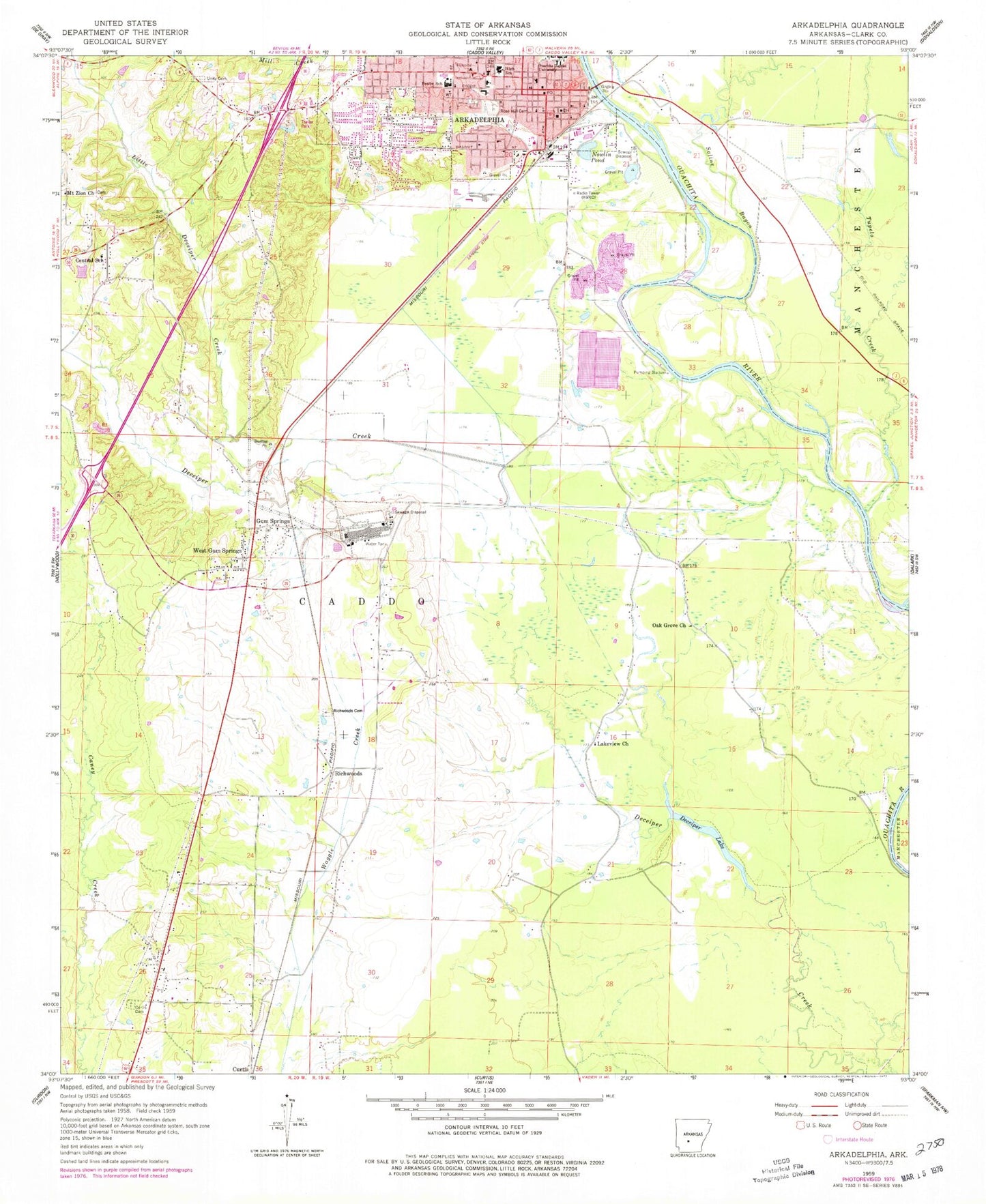
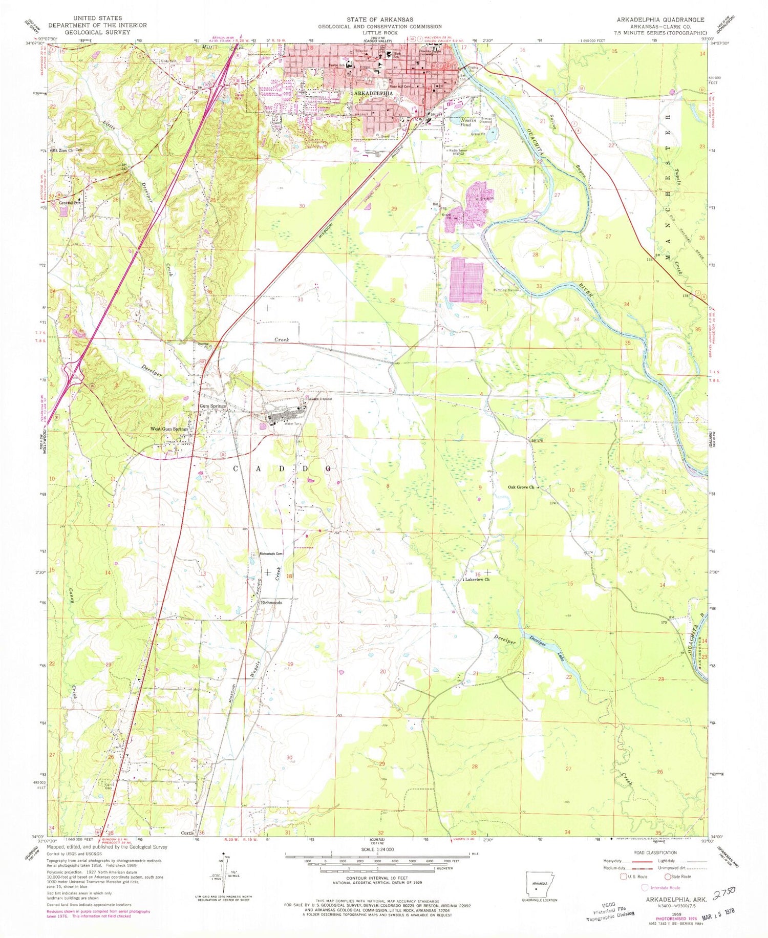
Classic USGS Arkadelphia Arkansas 7.5'x7.5' Topo Map
Couldn't load pickup availability
Historical USGS topographic quad map of Arkadelphia in the state of Arkansas. Map scale may vary for some years, but is generally around 1:24,000. Print size is approximately 24" x 27"
This quadrangle is in the following counties: Clark.
The map contains contour lines, roads, rivers, towns, and lakes. Printed on high-quality waterproof paper with UV fade-resistant inks, and shipped rolled.
Contains the following named places: Arkadelphia, Arkadelphia City Hall, Arkadelphia Fire Department Station 1, Arkadelphia Fire Station 2, Arkadelphia High School, Arkadelphia Police Department, Arkadelphia Post Office, Arkadelphia Wastewater Treatment Plant, Baptist Health Arkadelphia Hospital, Baptist Health Medical Center - Arkadelphia, Baring Cross Missionary Baptist Church, Berry Chapel, Central, Central Primary School, Central School, Church of Christ, Church of Christ Holiness, Church of the Nazarene, Clark County Courthouse, Clark County Fairgrounds, Clark County Health Center, Clark County Jail, Clark County Library, Clark County Memorial Hospital, Clark County Sheriff's Office, Concer Hall, Curtis Cemetery, Daleville, David Temple Church of God in Christ, Deceiper Lake, Dexter B Florence Memorial Field, Ebenezer Church of God in Christ, Faith Missionary Baptist Church, First Assembly of God Church, First Baptist Church, First Christian Church, First Presbyterian Church, First United Methodist Church, First United Pentecostal Church, Flennicken Memorial Students Center, Gennesaret Missionary Baptist Church, Goz Junior High School, Goza Middle School, Gum Springs, Gum Springs Baptist Church, Gum Springs Volunteer Fire Department, Interchange 73, J R Grant Memorial Administration Building, KDEL-FM (Arkadelphia), KVRC-AM (Arkadelphia), Lakeview Baptist Church, Little Deceiper Creek, Louisa E Perritt Primary School, Midway, Mitchell Hall, Mount Zion Baptist Church, New Life Church, Nowlin Pond, Oak Grove Church, Ozark Plateau, Park Hill Baptist Church, Peake Elementary School, Peake High School, Perritt Elementary School, Pine Plaza Shopping Center, Richwoods, Richwoods Baptist Church, Richwoods Cemetery, Rose Hill Cemetery, Saint Andrew United Methodist Church, Saint Marys Catholic Church, Saint Michaels Episcopal Church, Saint Paul African Methodist Episcopal Church, Saline Bayou, Second Baptist Church, Sturgis Field, Third Street Baptist Church, Town of Gum Springs, Tupelo Creek, Unity Cemetery, Walnut Street Missionary Baptist Church, West Gum Springs, ZIP Code: 71923