MyTopo
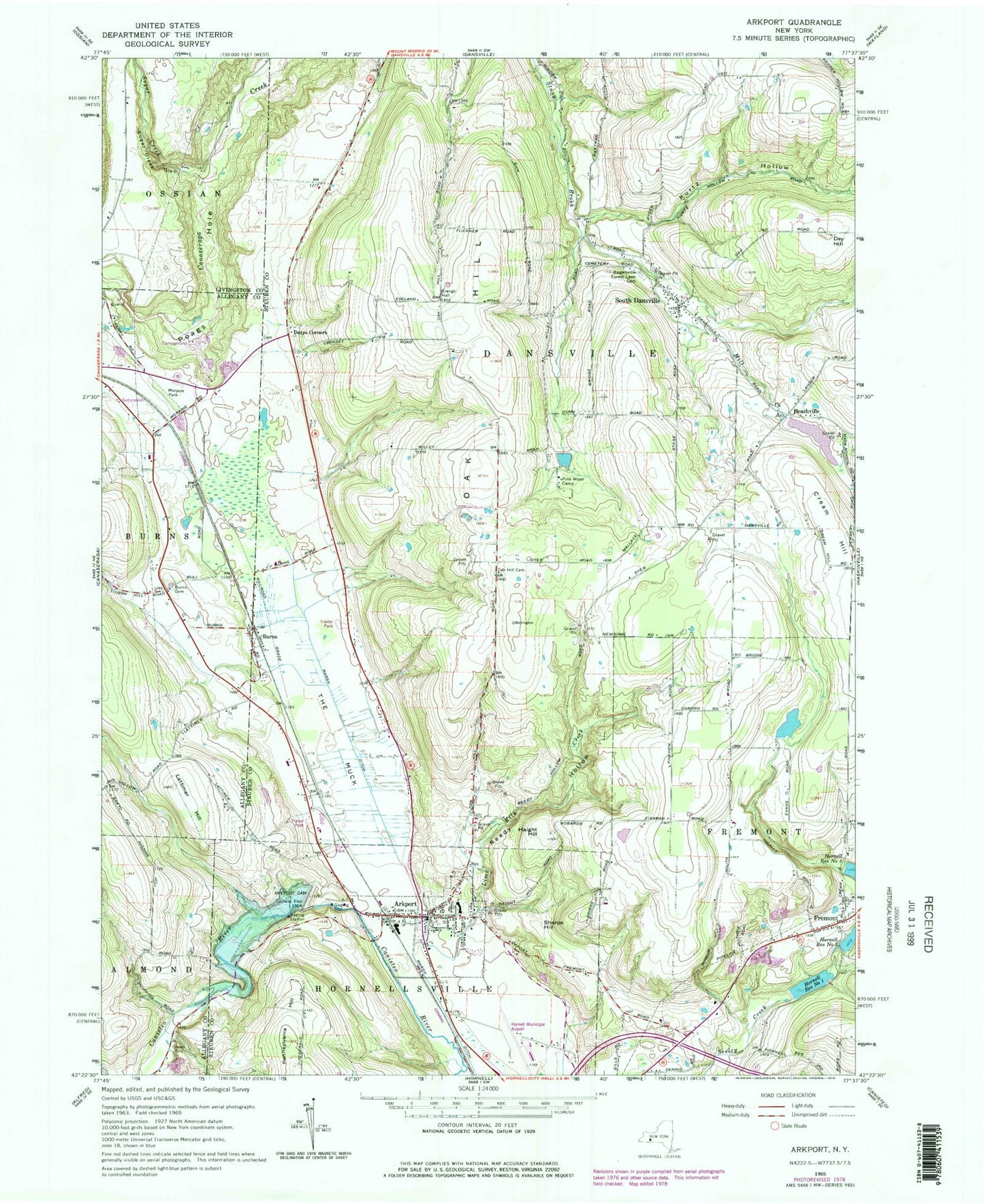
Classic USGS Arkport New York 7.5'x7.5' Topo Map
Couldn't load pickup availability
Historical USGS topographic quad map of Arkport in the state of New York. Map scale may vary for some years, but is generally around 1:24,000. Print size is approximately 24" x 27"
This quadrangle is in the following counties: Allegany, Livingston, Steuben.
The map contains contour lines, roads, rivers, towns, and lakes. Printed on high-quality waterproof paper with UV fade-resistant inks, and shipped rolled.
Contains the following named places: Arkport, Arkport Cemetery, Arkport Central School, Arkport Dam, Arkport Fire Department, Arkport Post Office, Arkport United Methodist Church, Beachville, Bishopville United Methodist Church, Blueberry Hill Farm, Burns, Burns Cemetery, Day Hill, Dotys Corners, Doty's Corners Cemetery, First Methodist Protestant Church, First Presbyterian Church, Fremont, Fremont Center Cemetery, Fremont Volunteer Fire Department 1, Haight Hill, Harding School, Hornell Church of Christ, Hornell Municipal Airport, Hornell Reservoir Number One, Hornell Reservoir Number Three, Jenkins Farm, Kurtz Hollow, Lattimer Hill, Lime Kiln Creek, Lismore Dairy, Marcus Farms, Meadows Mobile Home Park, Mill Creek, Moraine Park, Oak Hill Cemetery, Pennsylvania Hill, Pine Knoll Mobile Home Park, Pine Wood Camp, Poags Hole, Reedy Hollow, Rogersville Forest Lawn Cemetery, Sharps Hill, South Dansville, South Dansville United Methodist Church, South Dansville Volunteer Fire Company Station 1, Sugar Creek, Sugar Creek Glen, The Muck, Town of Dansville, Village of Arkport, ZIP Code: 14807