MyTopo
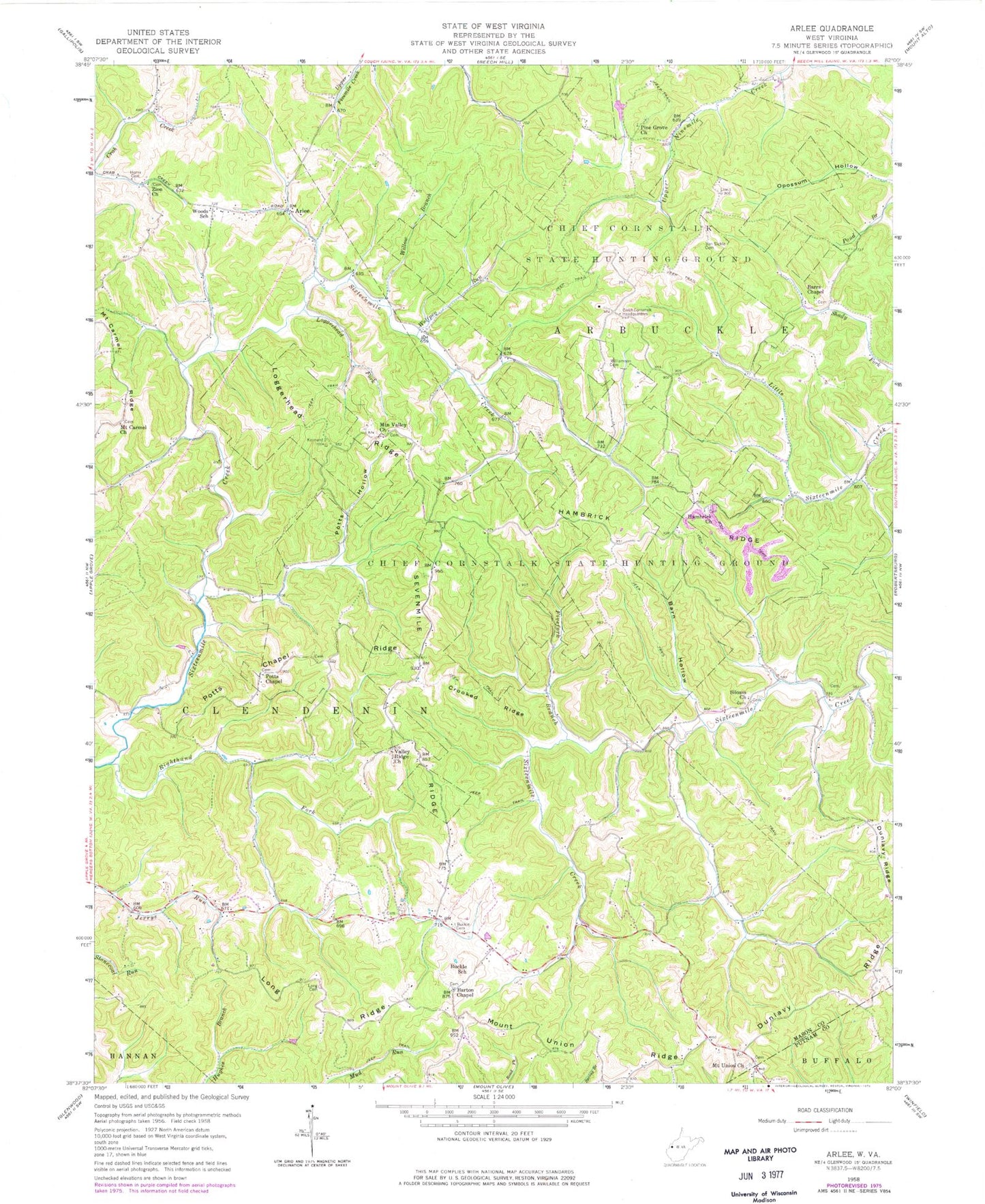
Classic USGS Arlee West Virginia 7.5'x7.5' Topo Map
Couldn't load pickup availability
Historical USGS topographic quad map of Arlee in the state of West Virginia. Typical map scale is 1:24,000, but may vary for certain years, if available. Print size: 24" x 27"
This quadrangle is in the following counties: Mason, Putnam.
The map contains contour lines, roads, rivers, towns, and lakes. Printed on high-quality waterproof paper with UV fade-resistant inks, and shipped rolled.
Contains the following named places: Buckle School (historical), Arlee, Barn Hollow, Barrs Chapel, Barton Chapel, Buckle Cemetery, Chief Cornstalk Headquarters, Chief Cornstalk Wildlife Management Area, Crooked Ridge, Dunlavy Ridge, Fivefork Branch, Hambrick Church, Hambrick Ridge, Henry Cemetery, Loggerhead Fork, Loggerhead Ridge, Long Cemetery, Long Ridge, Mount Carmel Church, Mount Union Church, Mount Union Ridge, Mountain Valley Church, Pine Grove Church, Potts Chapel, Potts Chapel Ridge, Potts Hollow, Righthand Fork Sixteenmile Creek, Sevenmile Ridge, Siloam Church, Valley Ridge Church, Van Sickle Cemetery, Williamson Cemetery, Willow Branch, Wolfpen Run, Woods School (historical), Zion Church, Righthand Fork, Mount Carmel Ridge, Balcott Spring, Balcott Spring, Charles Angles Spring, Condee (historical), Flaxton (historical), Hanes Spring, Madison Bowles Spring, Pondlick, Veranda (historical), Woyan Spring, Woyan Spring, Barton Chapel Cemetery, Hambrick Cemetery, Mount Carmel Cemetery, Mount Union Cemetery, Mountain Valley Cemetery, Pine Grove Cemetery, Potts Chapel Cemetery, Siloam Cemetery, Zion Cemetery, Arbuckle District, Clendenin District