
MyTopo
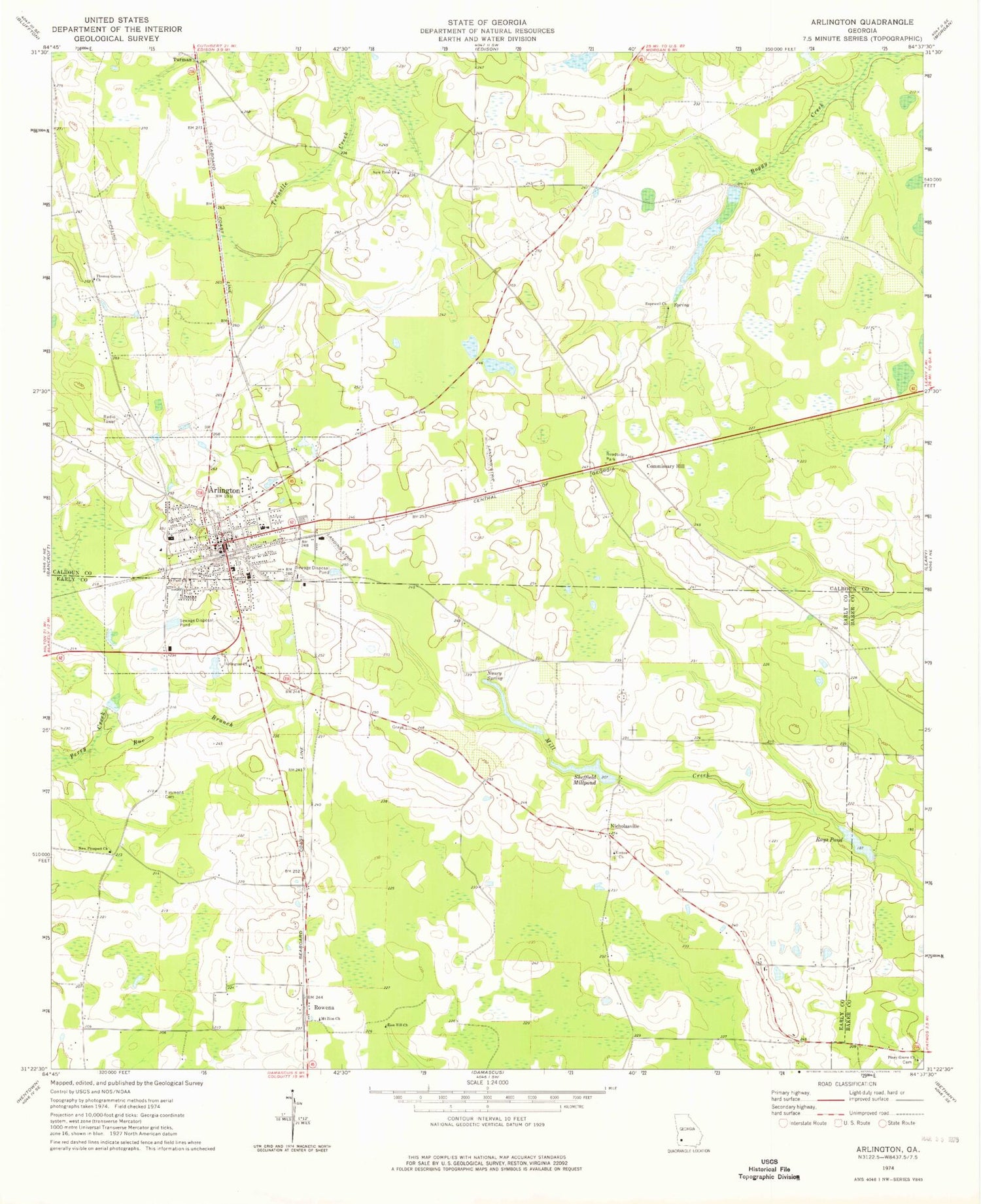
Classic USGS Arlington Georgia 7.5'x7.5' Topo Map
Couldn't load pickup availability
Historical USGS topographic quad map of Arlington in the state of Georgia. Map scale may vary for some years, but is generally around 1:24,000. Print size is approximately 24" x 27"
This quadrangle is in the following counties: Baker, Calhoun, Early.
The map contains contour lines, roads, rivers, towns, and lakes. Printed on high-quality waterproof paper with UV fade-resistant inks, and shipped rolled.
Contains the following named places: Andrews Airport, Arlington, Arlington Baptist Church, Arlington Church, Arlington Division, Arlington Elementary School, Arlington Methodist Episcopal Church, Arlington Police Department, Arlington Post Office, Calhoun County Elementary School, Calhoun Memorial Hospital, City of Arlington, Commissary Hill, Covington Mill, Early County Fire Department Arlington Station, Gessemane Baptist Church, Harpe Cemetery, Hillside Church, Hopewell Church, Jones Spur, Jordans Airport, Kiokee Church, Mount Zion Church, Nancy Spring, New Point Church, New Prospect Church, Nicholasville, Piney Grove Church, Rays Pond, Rowena, Rue Branch, Saint Paul Church, Sheffield Millpond, Sheffield Millpond Dam, Thomas Grove Church, Timmons Cemetery, Zion Hill Church, ZIP Code: 39813


