MyTopo
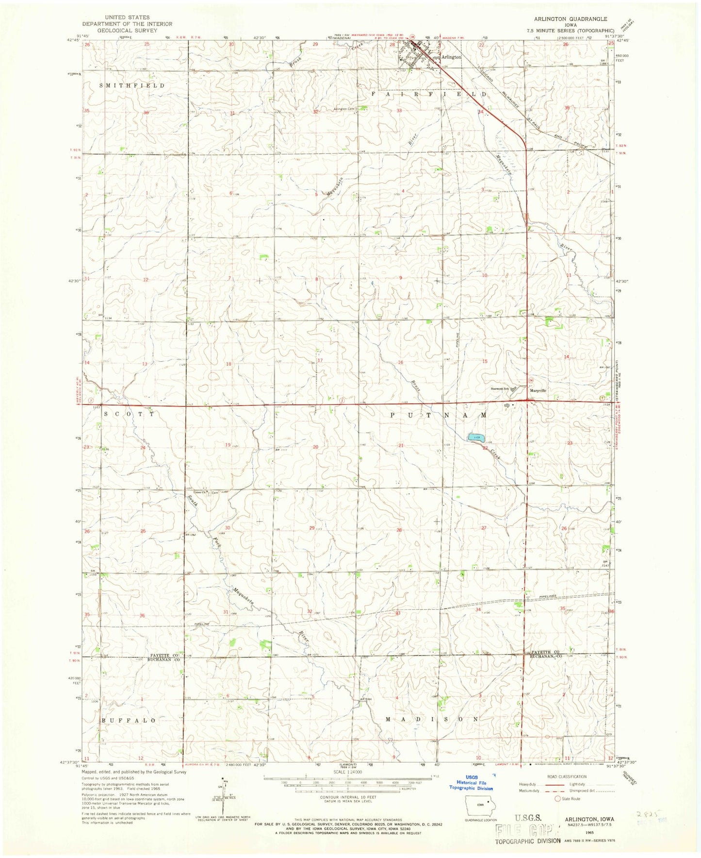
Classic USGS Arlington Iowa 7.5'x7.5' Topo Map
Couldn't load pickup availability
Historical USGS topographic quad map of Arlington in the state of Iowa. Map scale may vary for some years, but is generally around 1:24,000. Print size is approximately 24" x 27"
This quadrangle is in the following counties: Buchanan, Fayette.
The map contains contour lines, roads, rivers, towns, and lakes. Printed on high-quality waterproof paper with UV fade-resistant inks, and shipped rolled.
Contains the following named places: Arlington, Arlington Area Ambulance, Arlington Cemetery, Arlington Post Office, Arlington Public Library, Arlington Volunteer Fire Department, Castle House, Church of Christ, City of Arlington, Independent District of Center School, Lake District School, Maryville, Mercy Clinic - Arlington, Putnam Post Office, Saint John Lutheran Church, Starmont Elementary School, Starmont High School, Starmont Middle School, Summit District School, Township of Putnam, Union Cemetery, Union Church, United Methodist Church, Wheeland District School, ZIP Code: 50606