MyTopo
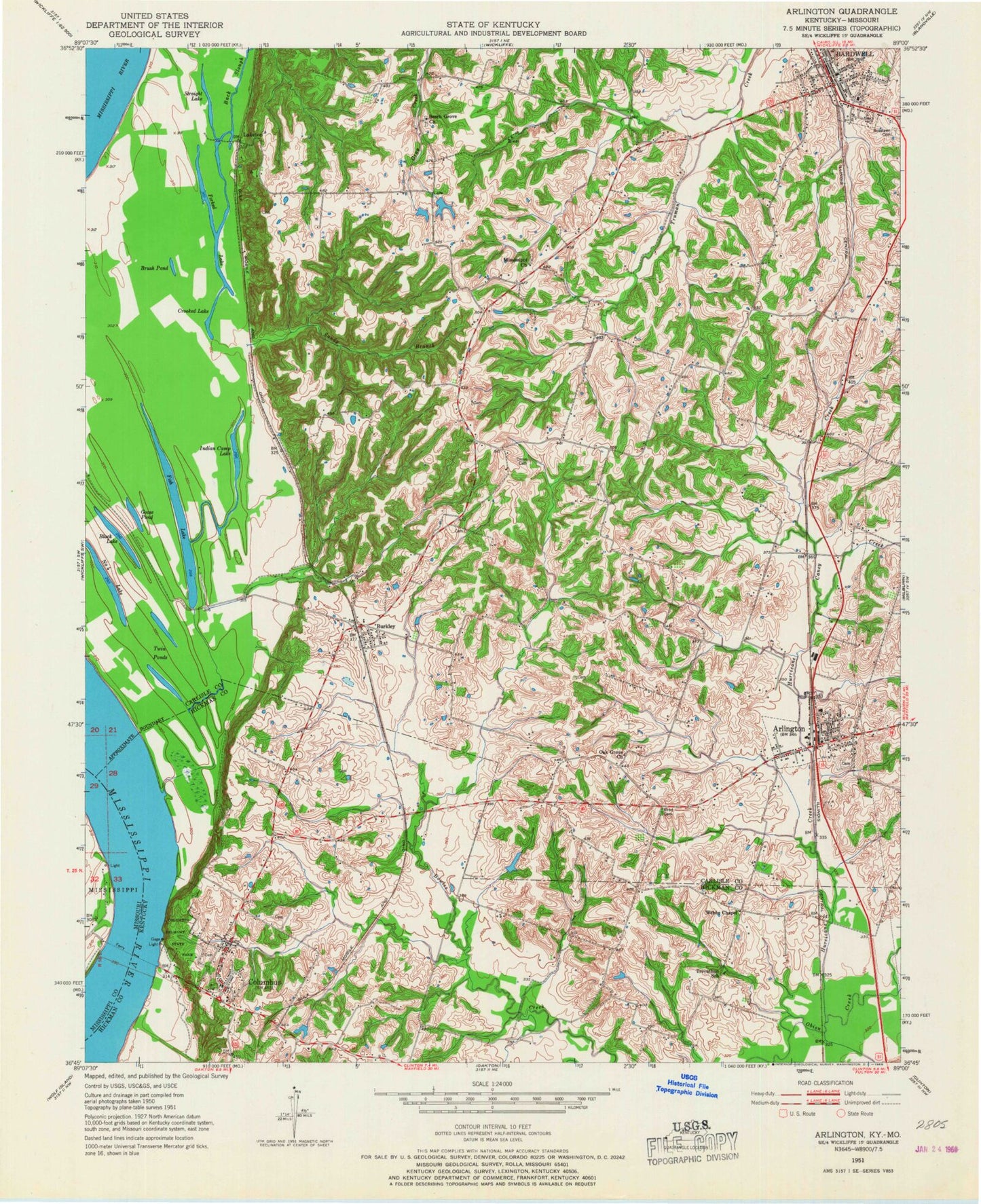
Classic USGS Arlington Kentucky 7.5'x7.5' Topo Map
Couldn't load pickup availability
Historical USGS topographic quad map of Arlington in the states of Kentucky, Missouri. Map scale may vary for some years, but is generally around 1:24,000. Print size is approximately 24" x 27"
This quadrangle is in the following counties: Carlisle, Hickman, Mississippi.
The map contains contour lines, roads, rivers, towns, and lakes. Printed on high-quality waterproof paper with UV fade-resistant inks, and shipped rolled.
Contains the following named places: Allen Cemetery, Allred Cemetery, Arlington, Arlington Cemetery, Arlington Fire Department / City Hall, Arlington Post Office, Back Slough, Bardwell, Bardwell Division, Bardwell Fire Department, Bardwell Police Department, Bardwell Post Office, Beech Grove, Beech Grove Church, Belmont Landing, Belmont Revetment, Berkley, Berkley Fire Department, Black Lake, Brush Pond, Caddle Creek, Campbell Cemetery, Caney Creek, Carlisle County Ambulance Service, Carlisle County Rural Rescue and Fire, City of Arlington, City of Bardwell, City of Columbus, Columbus, Columbus Confederate Cemetery, Columbus Fire Department, Columbus Post Office, Columbus-Belmont State Park, Crooked Lake, Dicus Cemetery, Fish Lake, Forked Lake, Geveden, Goose Pond, Hurricane Creek, Indian Camp Lake, Laketon, Long Creek, Mississippi, Mississippi Cemetery, Number 4 Lake, Oak Grove School, Rogers Cemetery, Roselawn Cemetery, Sandy Branch, Straight Slough, Taylor Cemetery, Twin Pond, WDKA-TV (Paducah), Webbs Chapel, Zook Cemetery, ZIP Codes: 42021, 42032