MyTopo
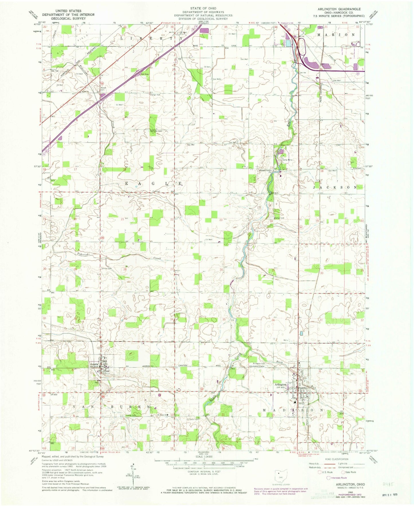
Classic USGS Arlington Ohio 7.5'x7.5' Topo Map
Couldn't load pickup availability
Historical USGS topographic quad map of Arlington in the state of Ohio. Map scale may vary for some years, but is generally around 1:24,000. Print size is approximately 24" x 27"
This quadrangle is in the following counties: Hancock.
The map contains contour lines, roads, rivers, towns, and lakes. Printed on high-quality waterproof paper with UV fade-resistant inks, and shipped rolled.
Contains the following named places: Alge Airport, Appleseed Joint Ambulance District, Arlington, Arlington Branch Library, Arlington Cemetery, Arlington Elementary School, Arlington High School, Arlington Post Office, Arlington United Methodist Church, Arlington Volunteer Fire Department, Beagle, Beagle Post Office, Bishop Cemetery, Bishop School, Boehm Dairy Farm, Brinkman Turkey Farms, Buck Run, Camp Berry, Eagle Center Church, Ellis Cemetery, Ferrell Airport, Good Hope Lutheran Church, Hartman Cemetery, Jenera, Jenera Post Office, Jenera Volunteer Fire Department, Keller Cemetery, Line Cemetery, Lucas School, Martinstown, Plain View Dairy, Powell Cemetery, Saint Pauls Cemetery, Saint Pauls Church, Salem Church, Schaller Airport, Sycamore Springs Golf Course, Township of Eagle, Trinity Cemetery, Trinity Evangelical Lutheran Church, Trinity Lutheran School, Village of Arlington, Village of Jenera, ZIP Code: 45814