
MyTopo
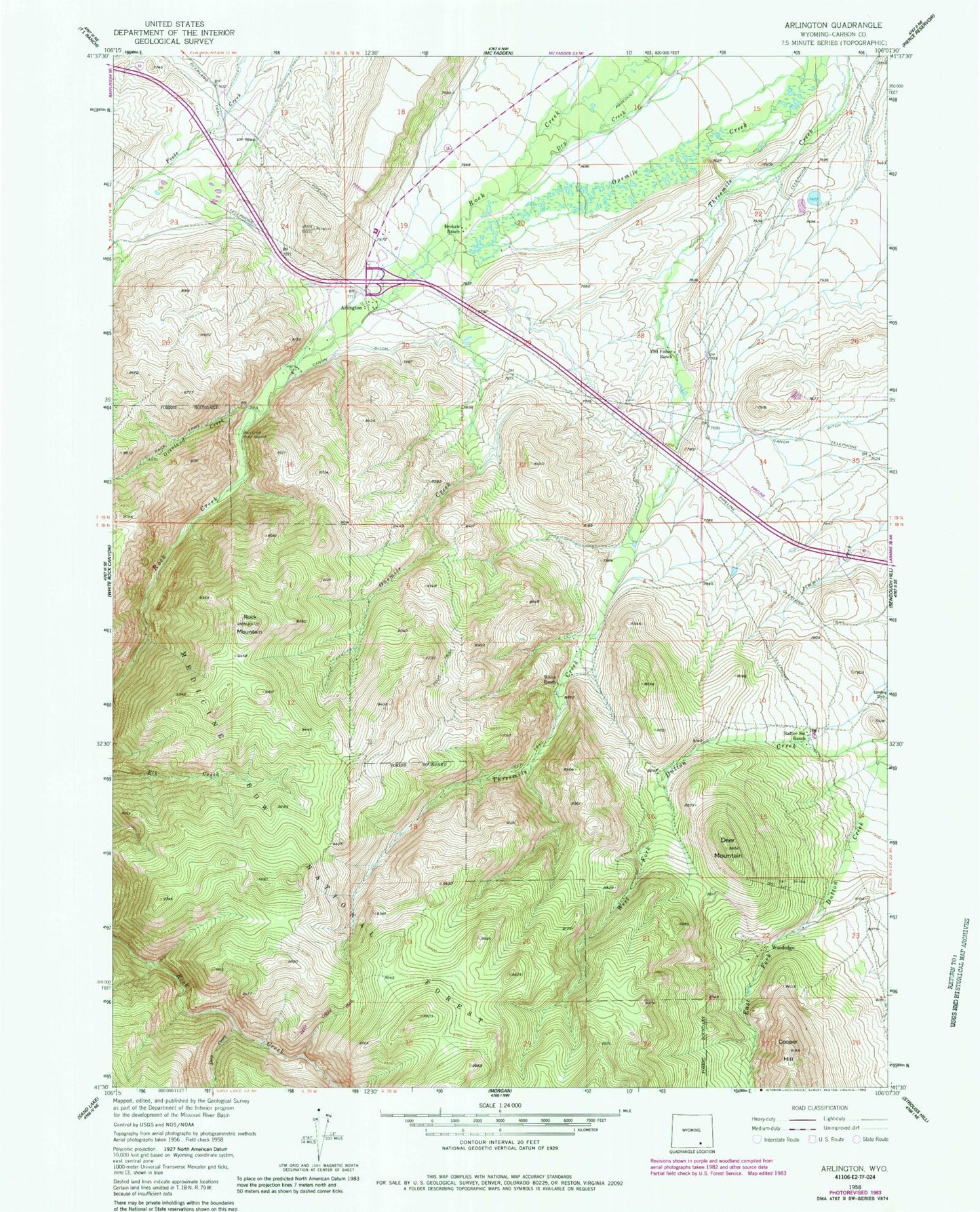
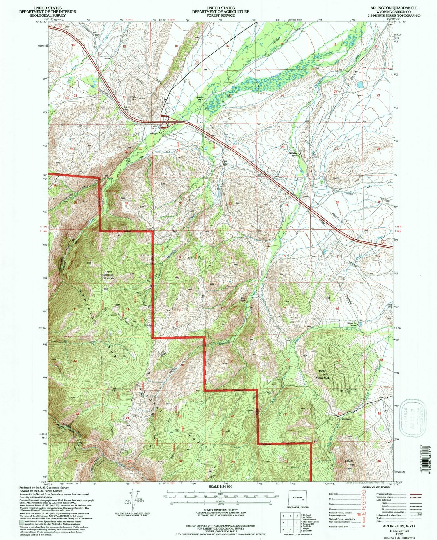
Classic USGS Arlington Wyoming 7.5'x7.5' Topo Map
Couldn't load pickup availability
Historical USGS topographic quad map of Arlington in the state of Wyoming. Typical map scale is 1:24,000, but may vary for certain years, if available. Print size: 24" x 27"
This quadrangle is in the following counties: Carbon.
The map contains contour lines, roads, rivers, towns, and lakes. Printed on high-quality waterproof paper with UV fade-resistant inks, and shipped rolled.
Contains the following named places: Brokaw Ranch, Canon Ditch, Deep Creek, Deer Mountain, Old Fisher Ranch, Overland Creek, Rafter Six Ranch, Rock Creek Picnic Ground, Rock Mountain, West Fork Dutton Creek, White Ranch, Woodedge, Arlington, Waterloo Prospects, Cottontail Mine, Rock Creek Mine, Copper King Mine, Arlington Census Designated Place