MyTopo
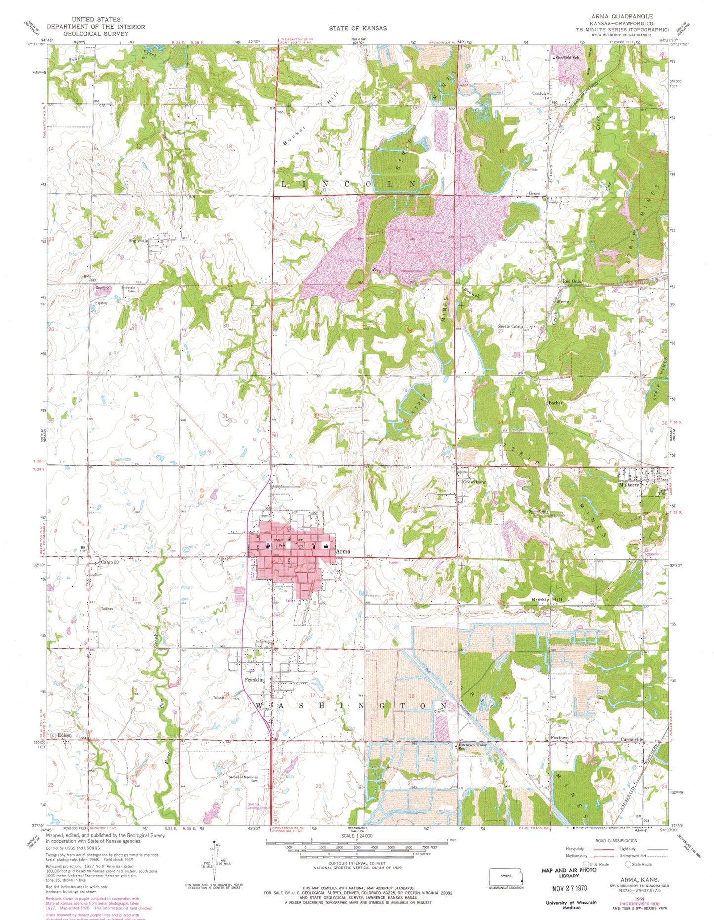
Classic USGS Arma Kansas 7.5'x7.5' Topo Map
Couldn't load pickup availability
Historical USGS topographic quad map of Arma in the state of Kansas. Map scale may vary for some years, but is generally around 1:24,000. Print size is approximately 24" x 27"
This quadrangle is in the following counties: Crawford.
The map contains contour lines, roads, rivers, towns, and lakes. Printed on high-quality waterproof paper with UV fade-resistant inks, and shipped rolled.
Contains the following named places: Adams School, Arma, Arma City Fire Department / Crawford County Fire District 2, Arma City Hall, Arma City Library, Arma Community Center, Arma Fire Department, Arma Police Department, Arma Post Office, Arma United Methodist Church, Arma Wastewater Treatment Plant, Barber, Bone Creek Reservoir, Breezy Hill, Breezy Hill School, Bunker Hill, City of Arma, Coalvale, County Farm Cemetery, Crawford County Emergency Medical Services Station 2, Crawford County Fire District 2, Croweburg, Croweburg Census Designated Place, Curranville, Curranville School, Dry Branch, Edison, Englevale, Englevale Cemetery, First Southern Missionary Baptist Church, Fox Town, Foxtown Union School, Franklin, Franklin Census Designated Place, Franklin Community Center & Heritage Museum, Franklin Community Park, Franklin Sidewalk, Galichia Airport, Garden of Memories Cemetery, Gross, Hadley School, Howe Station, Keplinger School, Mertz, Mulberry Limestone Quarry, Mulberry United Presbyterian Church, Mulberry Wastewater Plant, New Life Baptist Church, Northeast Elementary / Junior High School, Northeast High School, Northeast Junior High School, Polk, Polk School, Red Onion, Saint Joseph Catholic Church, Scotts Camp, Sheffield School, Smilie Cemetery, Township of Lincoln, Township of Washington, Youvan Airport, ZIP Codes: 66712, 66735, 66756