MyTopo
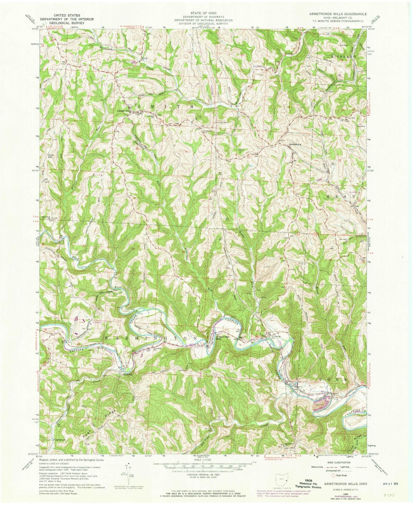
Classic USGS Armstrongs Mills Ohio 7.5'x7.5' Topo Map
Couldn't load pickup availability
Historical USGS topographic quad map of Armstrongs Mills in the state of Ohio. Typical map scale is 1:24,000, but may vary for certain years, if available. Print size: 24" x 27"
This quadrangle is in the following counties: Belmont.
The map contains contour lines, roads, rivers, towns, and lakes. Printed on high-quality waterproof paper with UV fade-resistant inks, and shipped rolled.
Contains the following named places: Anderson Run, Armstrongs Cemetery, Bend Fork, Bend Fork Church, Bethel Church, Concord Church, Dover Church, Grandview Christian Church, Rocky Fork, Scatterday Cemetery, Cool Hill, Centerville Elementary School, Dorsey (historical), Becket (historical), Pea Vine Creek, Centerville, Kelsey (historical), Crabapple, Alledonia, Armstrongs Mills, Jacobsburg, Joy Fork, Millers Run, Moore Run, Crabapple Creek, Piney Creek, Nacco Slurry Refuse Disposal Dam, Nacco Slurry Refuse Impoundment, Township of Smith, Township of Washington, Bend Fork Cemetery, Centerville Cemetery, Dover Cemetery, Grandview Cemetery, Jacobsburg Cemetery, Perkins Cemetery, Kelsey Post Office (historical), Dorsey Post Office (historical), Jacobsburg Post Office, Alledonia Post Office, Armstrongs Mills Post Office, Smith Township Volunteer Fire Company, Hogsink, Powhatan Number 6 Mine