MyTopo
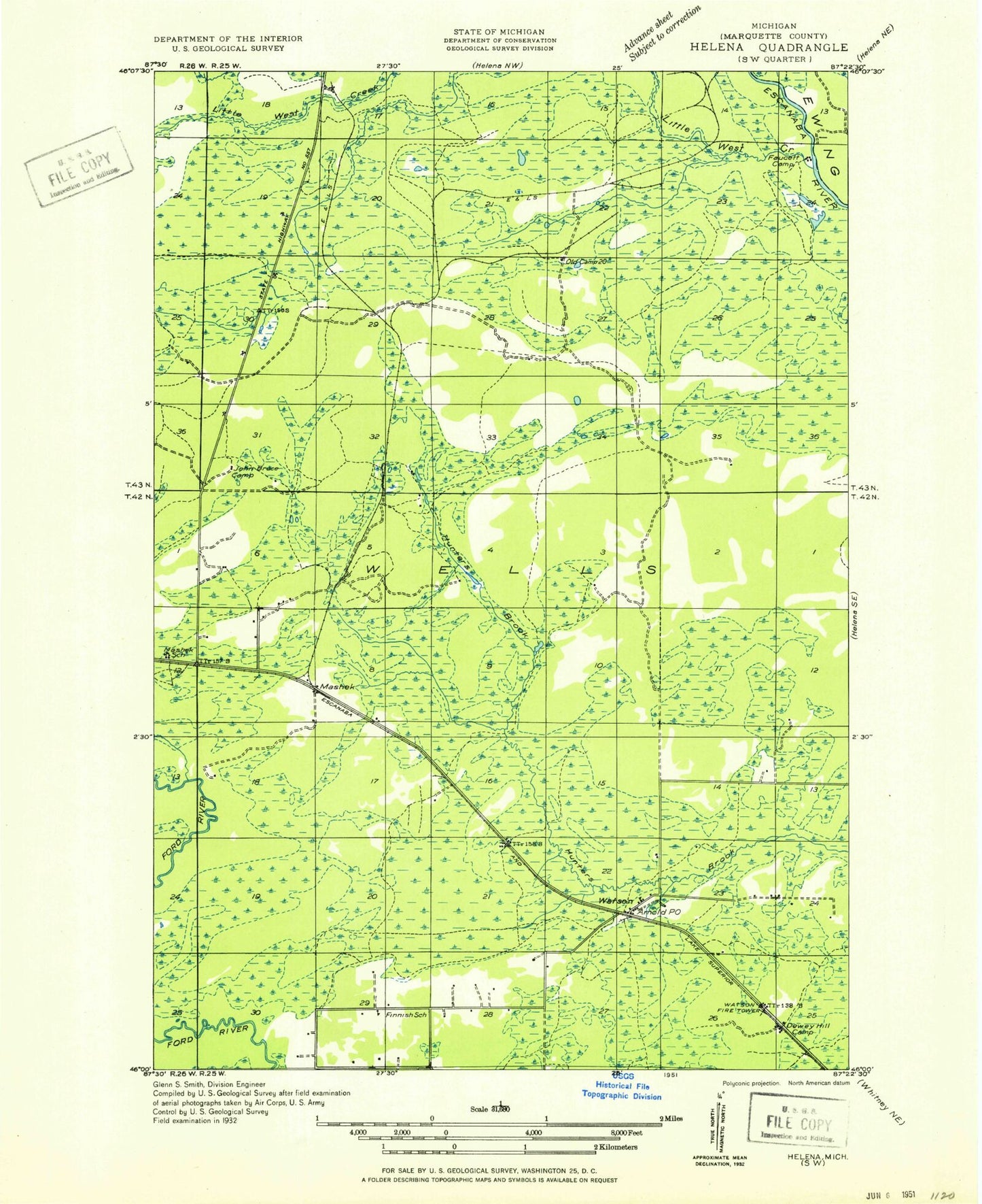
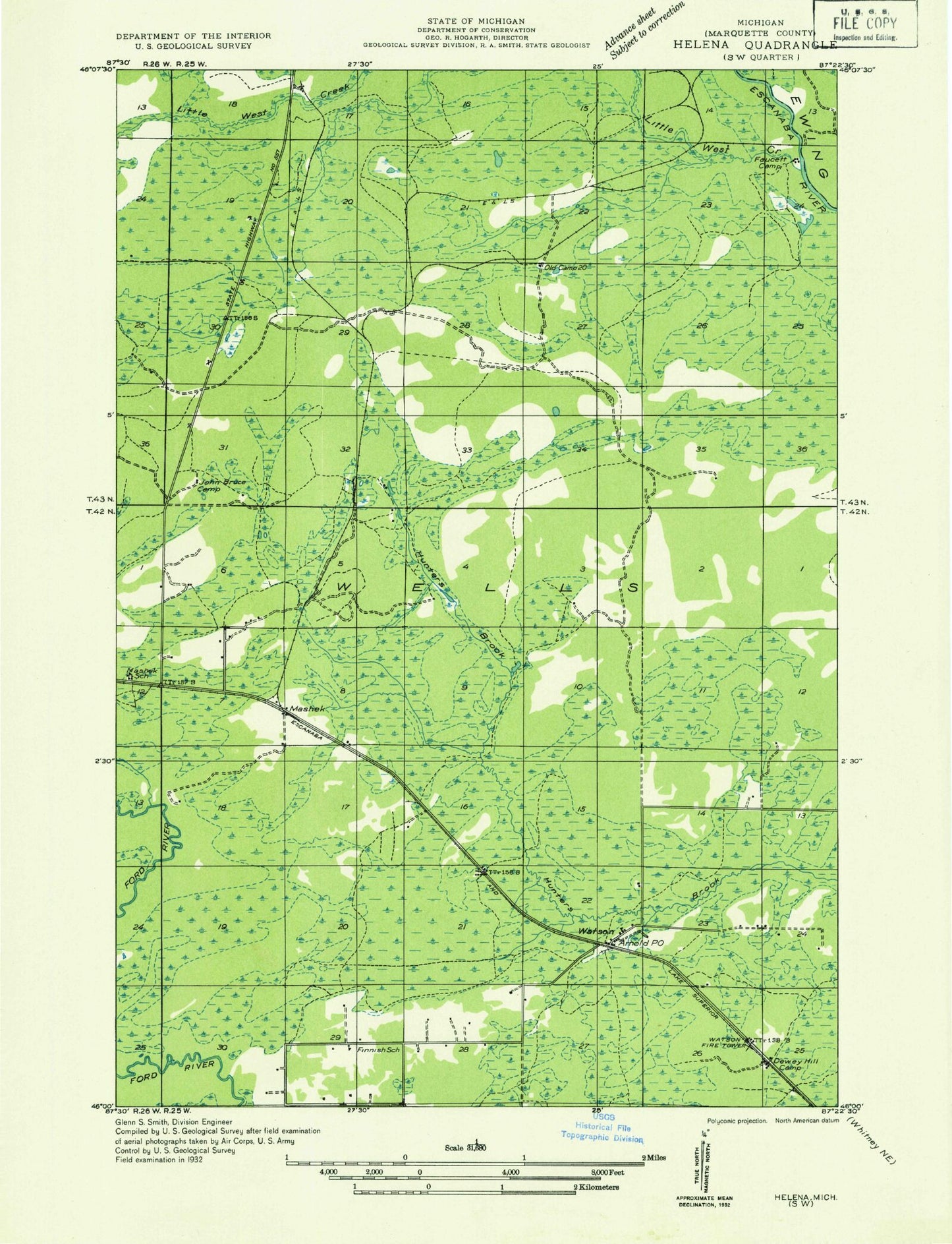
Classic USGS Arnold Michigan 7.5'x7.5' Topo Map
Regular price
$16.95
Regular price
Sale price
$16.95
Unit price
per
Couldn't load pickup availability
Historical USGS topographic quad map of Arnold in the state of Michigan. Map scale may vary for some years, but is generally around 1:24,000. Print size is approximately 24" x 27"
This quadrangle is in the following counties: Marquette.
The map contains contour lines, roads, rivers, towns, and lakes. Printed on high-quality waterproof paper with UV fade-resistant inks, and shipped rolled.
Contains the following named places: Arnold, Arnold Lookout Tower, Arnold Post Office, Arnold Station, Elie Creek, Forest Home Cemetery, Lindsey Creek, Little West Branch Escanaba River, Mashek, Township of Wells, Watson, Wells Township School, Wells Township Volunteer Fire Department, ZIP Code: 49819