MyTopo
Classic USGS Arpan Butte Wyoming 7.5'x7.5' Topo Map
Regular price
$16.95
Regular price
Sale price
$16.95
Unit price
per
Couldn't load pickup availability
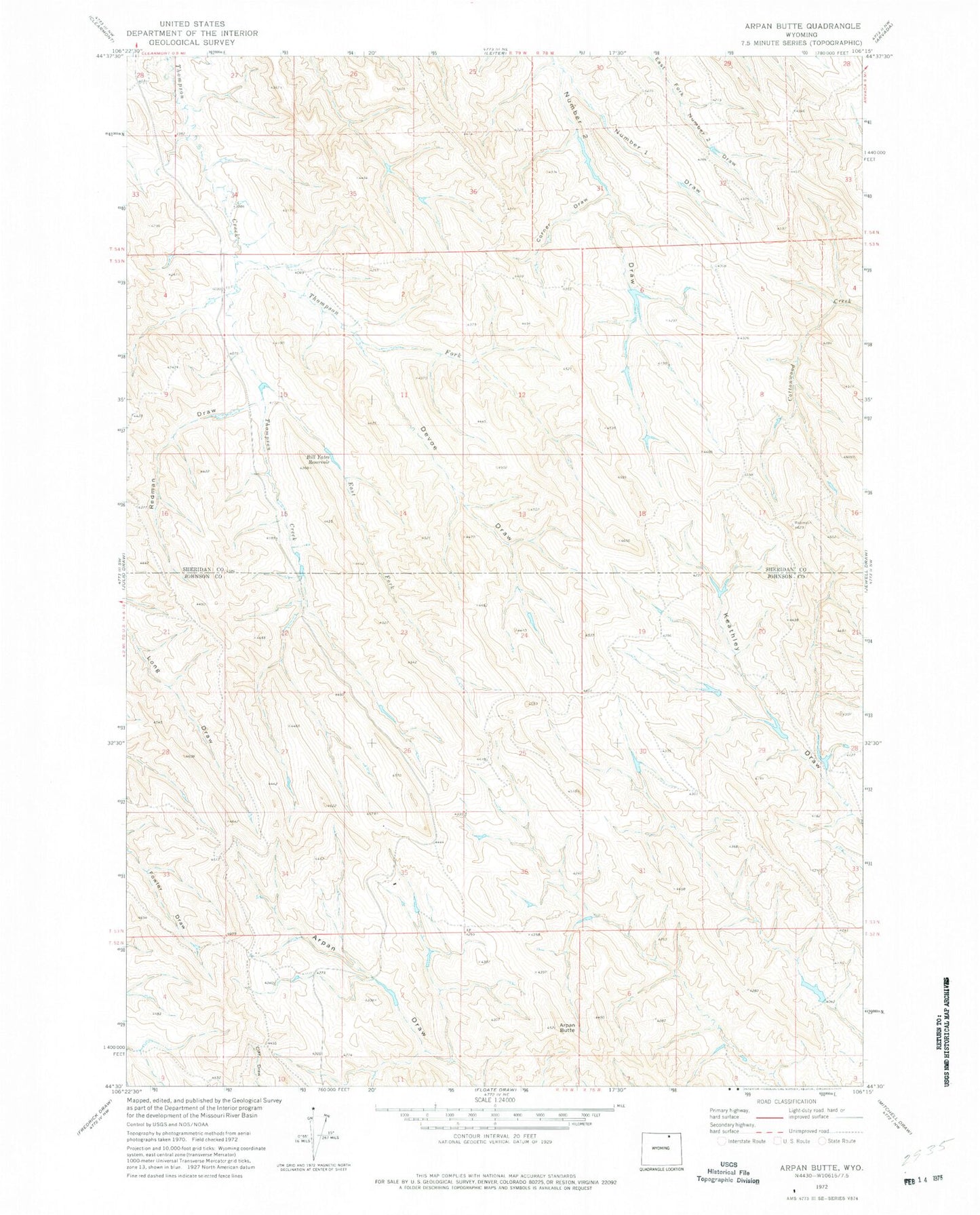
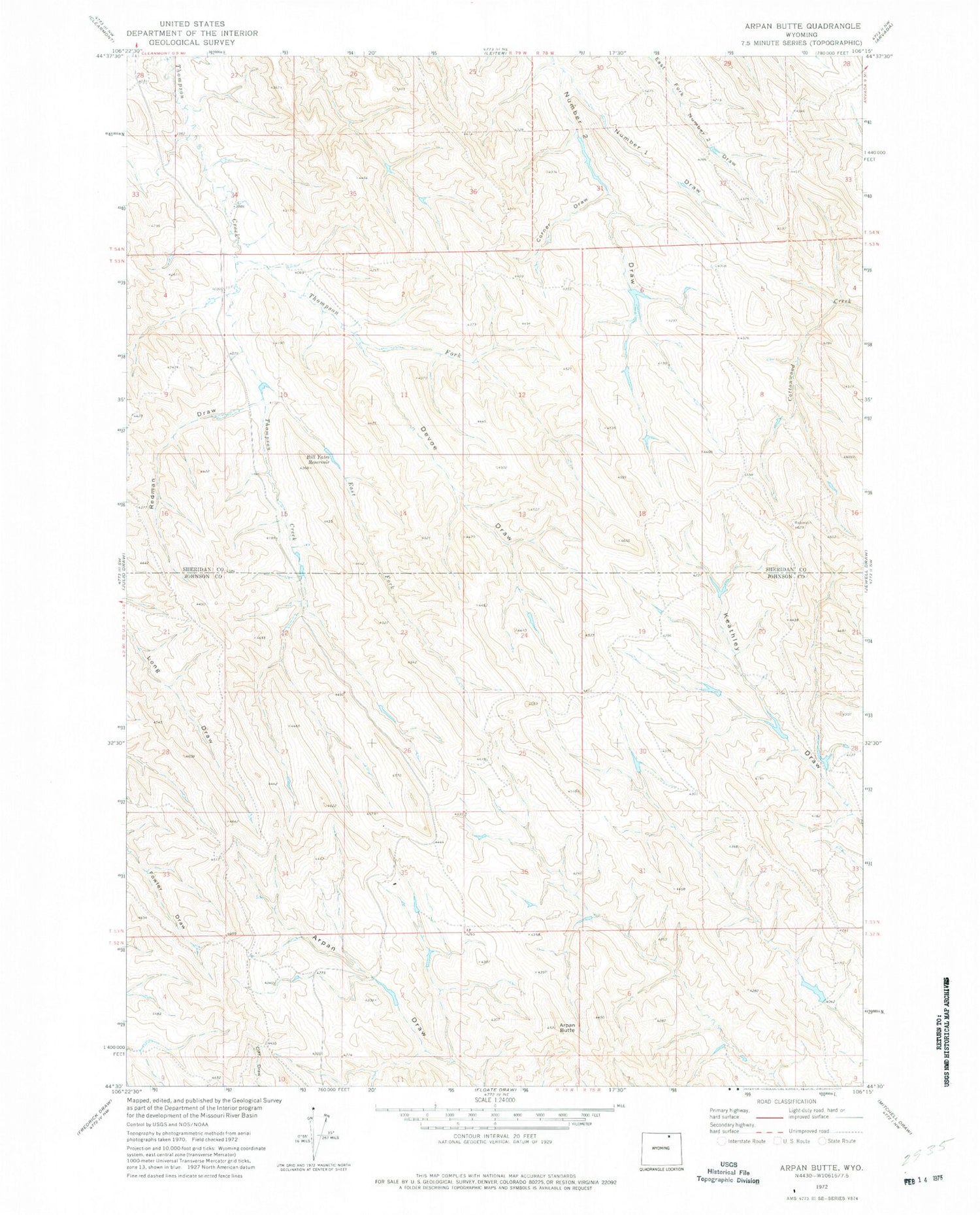
Historical USGS topographic quad map of Arpan Butte in the state of Wyoming. Map scale may vary for some years, but is generally around 1:24,000. Print size is approximately 24" x 27"
This quadrangle is in the following counties: Johnson, Sheridan.
The map contains contour lines, roads, rivers, towns, and lakes. Printed on high-quality waterproof paper with UV fade-resistant inks, and shipped rolled.
Contains the following named places: Arpan Butte, Auzqui Number 2 Dam, Auzqui Reservoir Number 2, Ben Dam, Ben Reservoir, Bill Yates Reservoir, Corner Draw, Devoe Draw, East Fork Thompson Creek, Green Cabin Number 3 Dam, Number 1 Draw, Redman Draw, Republican Dam, Republican Reservoir, Thompson Fork