MyTopo
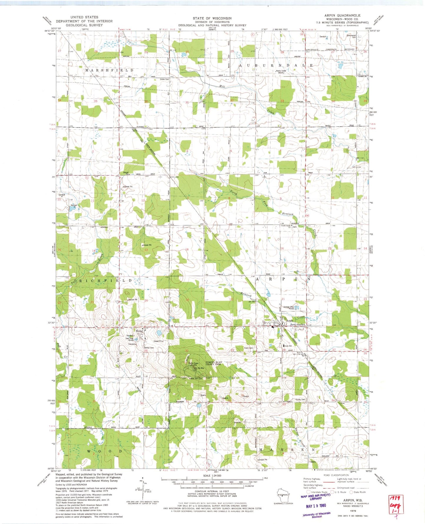
Classic USGS Arpin Wisconsin 7.5'x7.5' Topo Map
Couldn't load pickup availability
Historical USGS topographic quad map of Arpin in the state of Wisconsin. Map scale may vary for some years, but is generally around 1:24,000. Print size is approximately 24" x 27"
This quadrangle is in the following counties: Wood.
The map contains contour lines, roads, rivers, towns, and lakes. Printed on high-quality waterproof paper with UV fade-resistant inks, and shipped rolled.
Contains the following named places: Arpin, Arpin Cemetery, Arpin Post Office, Arpin School, Arpin Volunteer Fire Department, Berryland Farm, Bethel, Bethel Cemetery, Bethel Junior Academy, Emmanuel Lutheran Cemetery, Greenwood Cemetery, Indian Bill Cemetery, John Na - Wee Cemetery, Kandy Kane Park, Maple Grove School, Mill Creek Grove School, North Arpin Church, North Arpin School, Powers Bluff County Park, Powers Bluff Maple Woods State Natural Area, Shady Nook School, Slidre Cemetery, Town of Arpin, Town of Marshfield, Village of Arpin, WLBL-AM (Auburndale), Woodland Echo School, ZIP Code: 54410