MyTopo
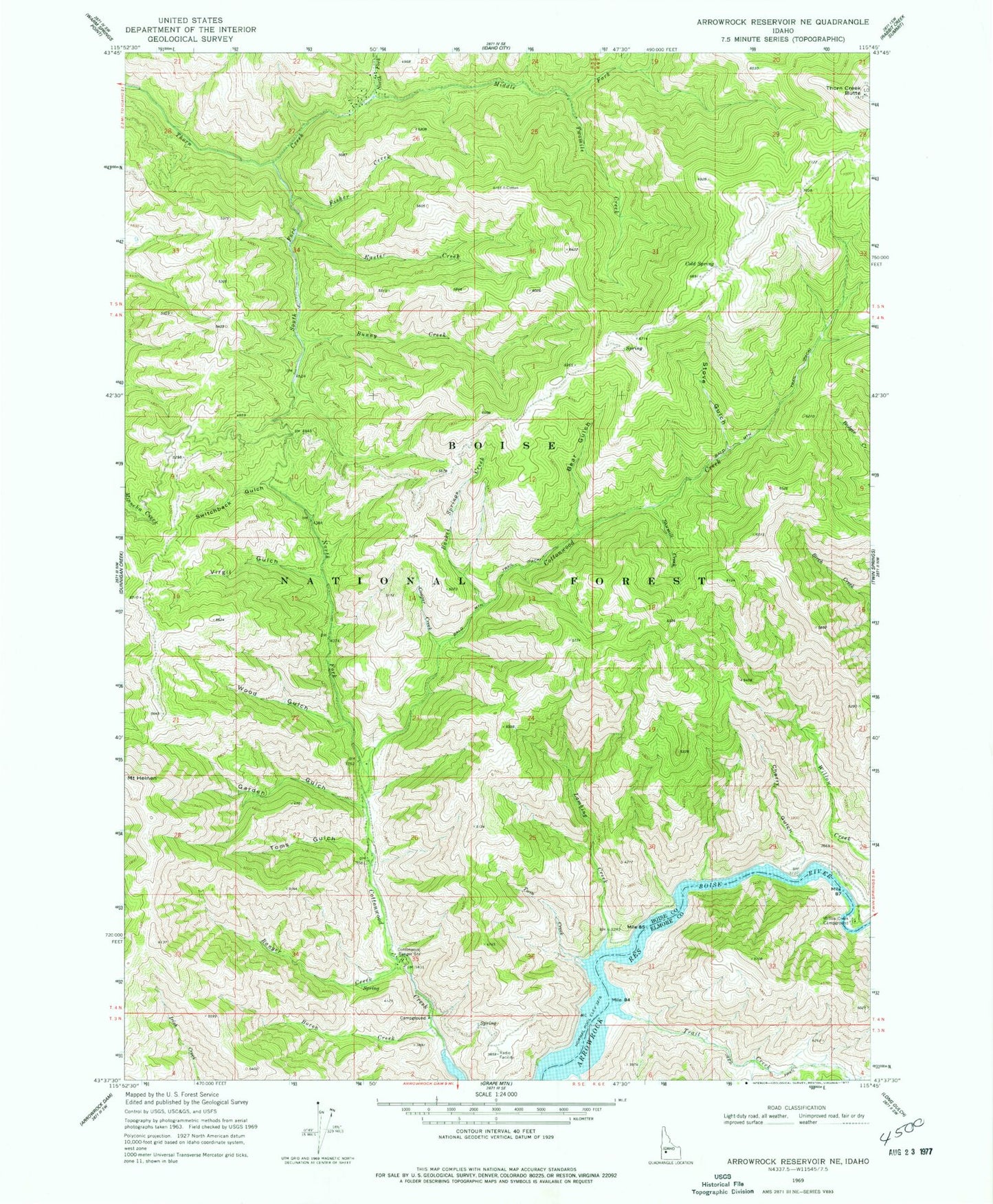
Classic USGS Arrowrock Reservoir NE Idaho 7.5'x7.5' Topo Map
Couldn't load pickup availability
Historical USGS topographic quad map of Arrowrock Reservoir NE in the state of Idaho. Typical map scale is 1:24,000, but may vary for certain years, if available. Print size: 24" x 27"
This quadrangle is in the following counties: Boise, Elmore.
The map contains contour lines, roads, rivers, towns, and lakes. Printed on high-quality waterproof paper with UV fade-resistant inks, and shipped rolled.
Contains the following named places: Ranger Creek, Basket Springs Creek, Bear Gulch, Boren Creek, Bunny Creek, Cherry Gulch, Cottonwood Ranger Station, Cougar Creek, Easter Creek, Fisher Creek, Garden Gulch, Mount Heinen, Lambing Creek, Middle Fork Thorn Creek, Nellies Last Chance, North Fork Cottonwood Creek, North Fork Thorn Creek, Sawmill Creek, South Fork Thorn Creek, Stove Gulch, Switchback Gulch, Thorn Creek Butte, Toms Gulch, Trail Creek, Twin Creek, Twomile Creek, Virgil Gulch, Willow Creek, Willow Creek Campground, Wood Gulch, Cottonwood Campground