MyTopo
Classic USGS Arroyo Del Agua New Mexico 7.5'x7.5' Topo Map
Couldn't load pickup availability
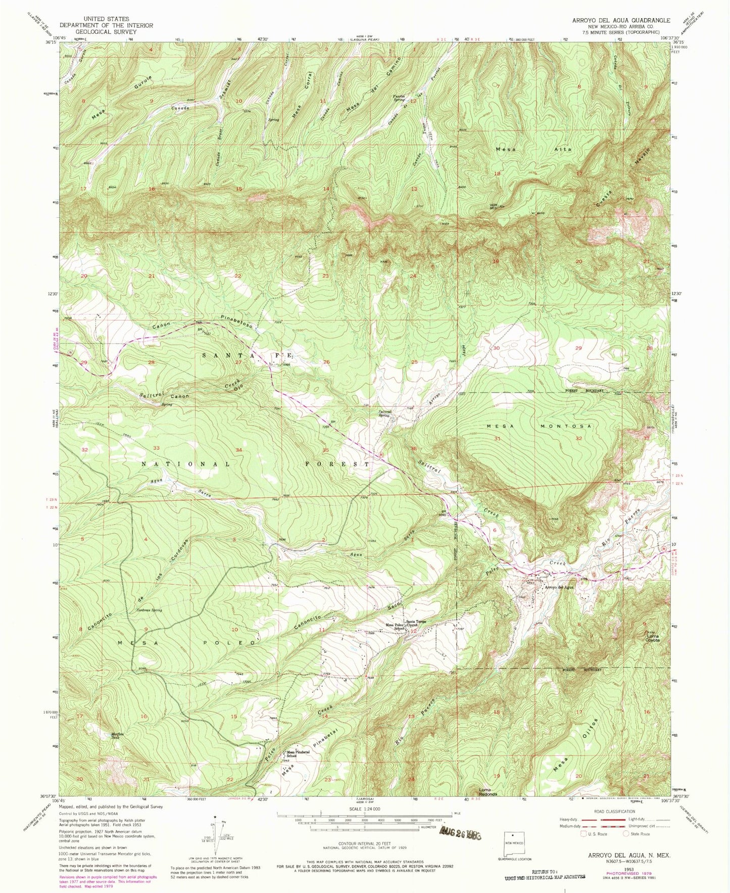
Historical USGS topographic quad map of Arroyo Del Agua in the state of New Mexico. Map scale may vary for some years, but is generally around 1:24,000. Print size is approximately 24" x 27"
This quadrangle is in the following counties: Rio Arriba.
The map contains contour lines, roads, rivers, towns, and lakes. Printed on high-quality waterproof paper with UV fade-resistant inks, and shipped rolled.
Contains the following named places: Agua Sarca, Arroyo del Agua, Arroyo Jaspe, Canada Brazo, Canada Spring, Canada Tusas, Canon Ojo, Canon Pinabetoso, Canoncito de los Cordovas, Canoncito Seco, Casey Spring, Cordovas Spring, Coyote Ranger District, Coyote Ranger Station, Cuesta Navajo, Dead Horse Spring, Escondido Spring, Fuertes Spring, Gurule Spring, Jaramillo-Montoya, Jaspe Trick Tank, Jose Miguel Creek, La Cueba Tank, Lino Creek, Lino Spring, Loma Coyote, Mesa Alta, Mesa Alta Wildlife Trick Tank, Mesa Corral, Mesa del Camino, Mesa Montosa, Mesa Ojitos, Mesa Pinabetal School, Mesa Poleo, Mesa Poleo School, Morfins Tank, Navajo Tank, Navajo Trick Tank, Ojitos Spring, Ojo Corral, Poleo Creek, Resurrection, Salazar Tank, Salitral Corral, Salitral Creek, Salitral Spring, Sandy Deer Spring, Santa Teresa, Santa Teresa Church, Sarca Spring, South Salitral Trick Tank, Upper Potrero Spring, West Trick Tank, ZIP Code: 87012