MyTopo
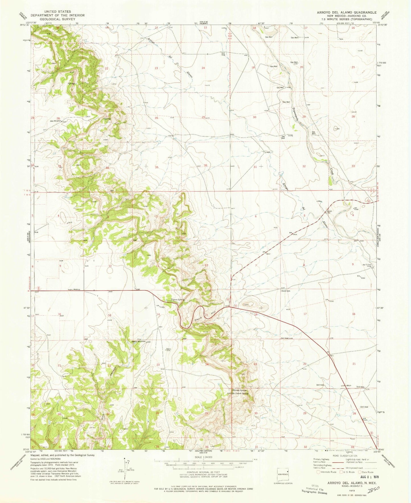
Classic USGS Arroyo Del Alamo New Mexico 7.5'x7.5' Topo Map
Couldn't load pickup availability
Historical USGS topographic quad map of Arroyo Del Alamo in the state of New Mexico. Map scale may vary for some years, but is generally around 1:24,000. Print size is approximately 24" x 27"
This quadrangle is in the following counties: Harding.
The map contains contour lines, roads, rivers, towns, and lakes. Printed on high-quality waterproof paper with UV fade-resistant inks, and shipped rolled.
Contains the following named places: Amerigas Number Sixteen Mitchell, Amerigas Number Twenty Mitchell, Amoco Number One State FM, Arbuckle, Bar T Cross Camp, Brown, Carbonic Number Five Mitchell, Carbonic Number Seven Mitchell, Carbonic Number Thirteen Mitchell, Carbonic Number Three Mitchell, Cedros Windmills, CO 2 Well, David Cemetery, David Hill, Harding County, Jake Windmill, McIntosh Spring, Parras Spring, Shrum, Tejano Spring, Waldron, ZIP Code: 87733