MyTopo
Classic USGS Arroyo Hondo New Mexico 7.5'x7.5' Topo Map
Couldn't load pickup availability
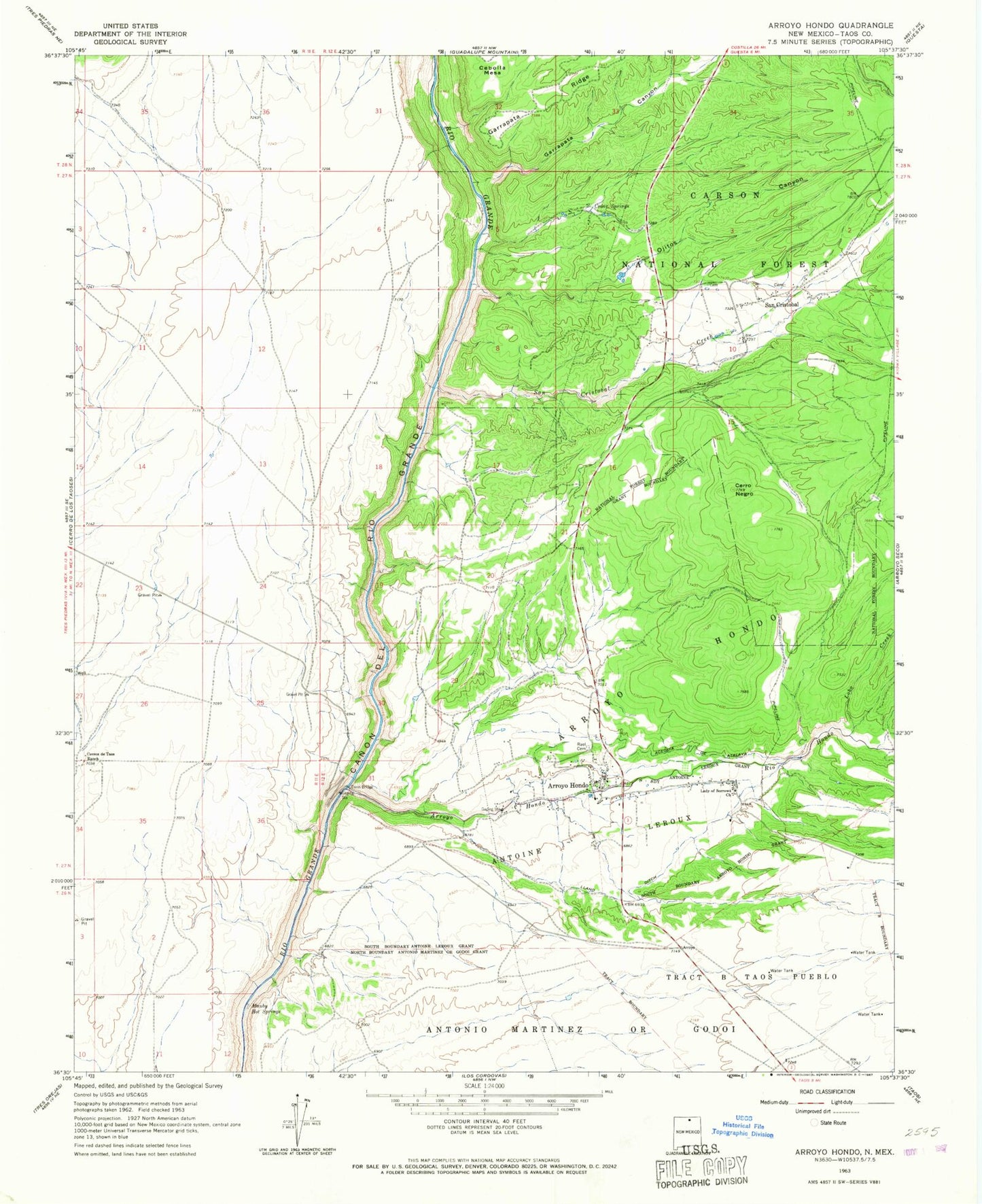
Historical USGS topographic quad map of Arroyo Hondo in the state of New Mexico. Typical map scale is 1:24,000, but may vary for certain years, if available. Print size: 24" x 27"
This quadrangle is in the following counties: Taos.
The map contains contour lines, roads, rivers, towns, and lakes. Printed on high-quality waterproof paper with UV fade-resistant inks, and shipped rolled.
Contains the following named places: New Buffalo Area, Arroyo Hondo, Acequia de Atalaya, Arroyo Hondo, Cedar Springs, Cerro Negro, Cerros de Taos Ranch, Garrapata Canyon, Lady of Sorrows Church, Llano Ditch, Lobo Creek, Manby Hot Springs, Ojitos Canyon, Rael Cemetery, Rio Hondo, San Cristobal, Rio Grande Wild River, Parish School, Van Bruggen Reservoir Dam, Horse Thief Shorty Rapid, Canoncito, South Water Well, House Water Well, Arroyo Hondo, San Cristobal Creek, Dunn Bridge, Taos County, Arroyo Hondo Elementary School, Turley Mill and Distillery Site, Arroyo Hondo Post Office, San Cristobal Post Office, Arroyo Hondo Census Designated Place, San Cristobal Census Designated Place, Hondo Seco Fire and Rescue Station 1