MyTopo
Classic USGS Arroyo Landavaso New Mexico 7.5'x7.5' Topo Map
Couldn't load pickup availability
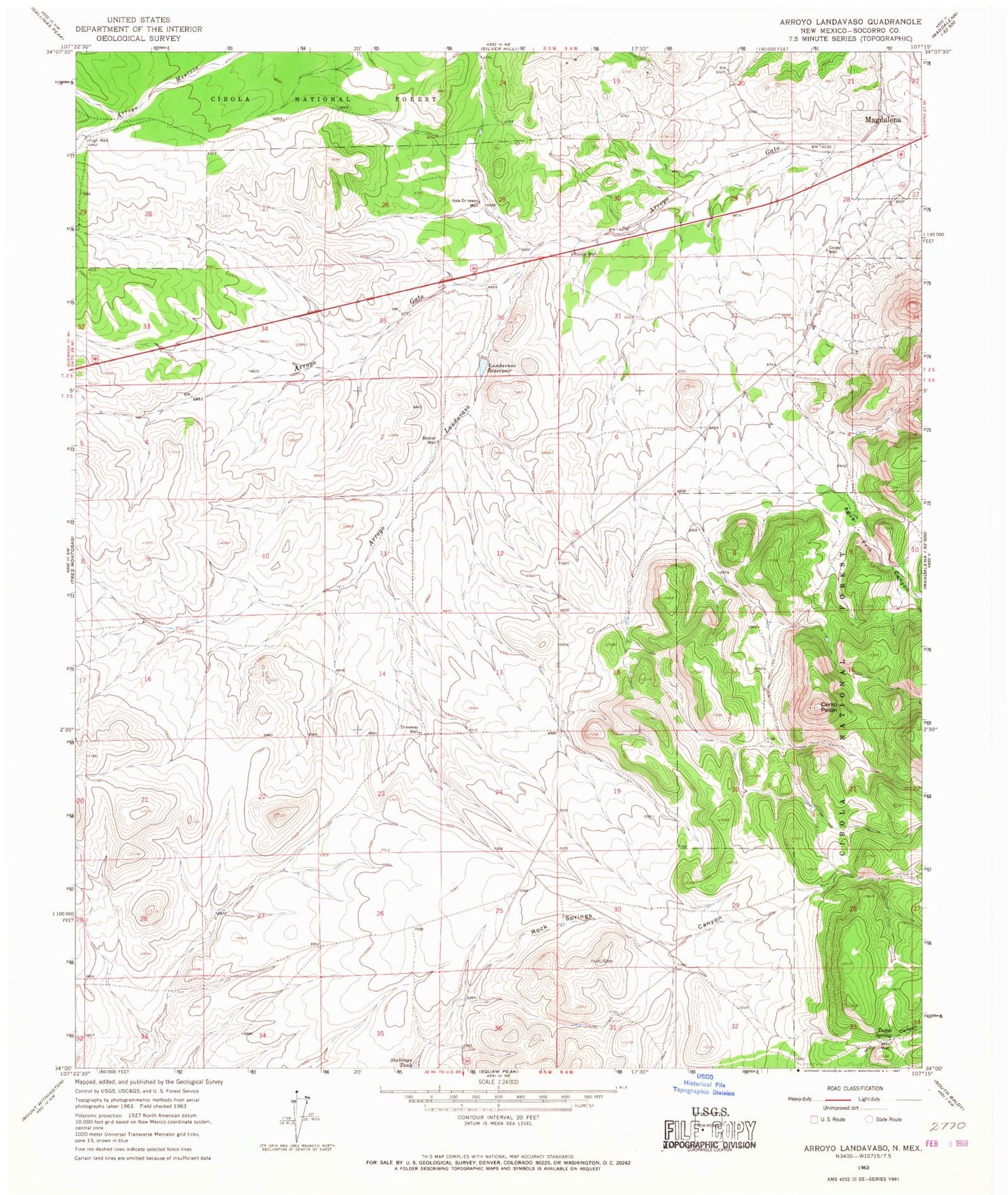
Historical USGS topographic quad map of Arroyo Landavaso in the state of New Mexico. Map scale may vary for some years, but is generally around 1:24,000. Print size is approximately 24" x 27"
This quadrangle is in the following counties: Socorro.
The map contains contour lines, roads, rivers, towns, and lakes. Printed on high-quality waterproof paper with UV fade-resistant inks, and shipped rolled.
Contains the following named places: Agua Frio Canyon, Arroyo Landavaso, Boxcar Well, Cerro Pelon, Driveway Well, Earth Tank Number One, Earth Tank Number Two, Easy Tank, Gosey Well, Hale Driveway Well, Hale Tank, High Well, Landavaso Reservoir, Magdalena Airport, Magdalena Division, North Tank, Number Five Tank, Number Four Tank, Number One Tank, Number Three Tank, Number Two Tank, Palome Tank, Rabbe Well, Rancho Magdalena Airport, SW Hale Tank, Texas Spring, Texas Well, Wet Weather Spring, Woodbury Ranch