MyTopo
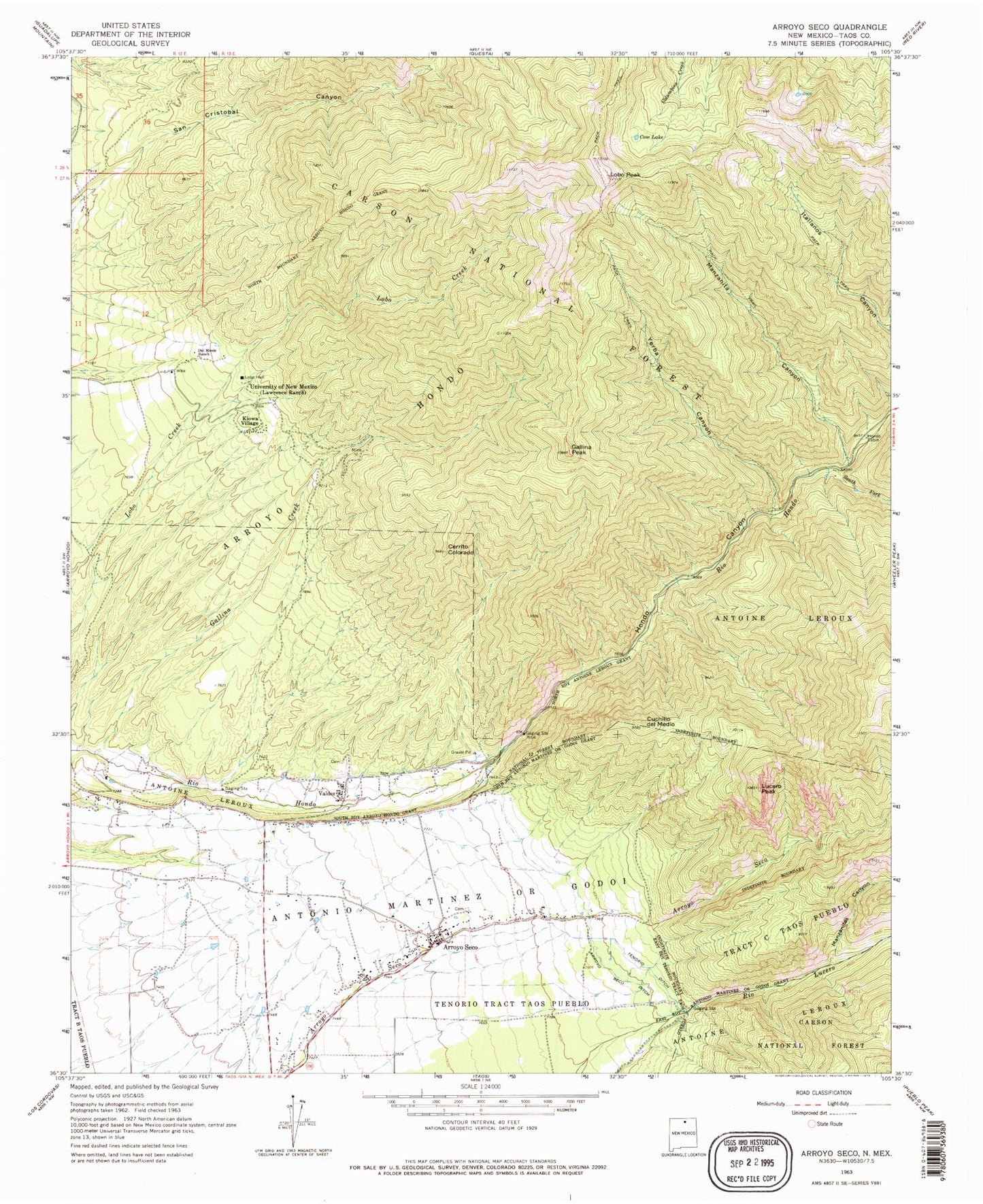
Classic USGS Arroyo Seco New Mexico 7.5'x7.5' Topo Map
Couldn't load pickup availability
Historical USGS topographic quad map of Arroyo Seco in the state of New Mexico. Typical map scale is 1:24,000, but may vary for certain years, if available. Print size: 24" x 27"
This quadrangle is in the following counties: Taos.
The map contains contour lines, roads, rivers, towns, and lakes. Printed on high-quality waterproof paper with UV fade-resistant inks, and shipped rolled.
Contains the following named places: Lobo Hall, Lawrence Ranch, Lobo (historical), Valley Bible Baptist Church, Antoine Leroux, Arroyo Hondo Grant, Arroyo Seco Ditch, Cerrito Colorado, Cow Lake, Cuchillo del Medio, Del Monte Ranch, Gallina Creek, Gallina Peak, Hondo Cabin, Hondo Canyon, Kiowa Village, Lobo Peak, Lucero Peak, Manzanita Canyon, Manzanitas Canyon, San Cristobal Canyon, South Fork Rio Hondo, Tenorio Ditch, University of New Mexico, Valdez, Yerba Canyon, Watson School, Portico Prospect, Iowa Group, South Fork Mine, Hondo Forest Service Facility, Cuchillo De Medio Campground, Lower Hondo Campground, Vuicich, Arroyo Seco, Canoncito, D H Lawrence Ranch University of New Mexico Historical Marker, Arroyo Seco Elementary School, Columbine Hondo Wilderness Study Area, Valdez Post Office, Arroyo Seco Post Office, Lobo Post Office (historical), Perra Peak, Arroyo Hondo Division, Arroyo Seco Census Designated Place