MyTopo
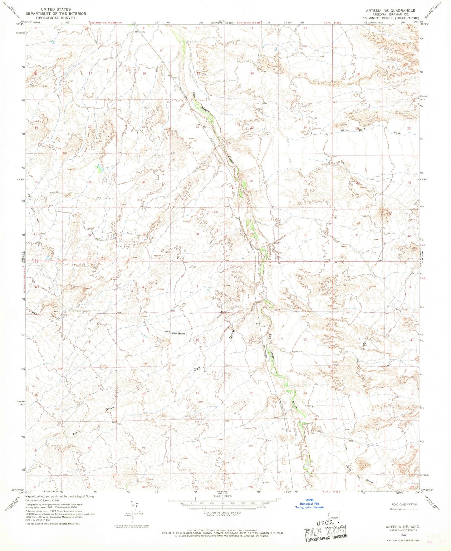
Classic USGS Artesia NE Arizona 7.5'x7.5' Topo Map
Regular price
$16.95
Regular price
Sale price
$16.95
Unit price
per
Couldn't load pickup availability
Historical USGS topographic quad map of Artesia NE in the state of Arizona. Map scale may vary for some years, but is generally around 1:24,000. Print size is approximately 24" x 27"
This quadrangle is in the following counties: Graham.
The map contains contour lines, roads, rivers, towns, and lakes. Printed on high-quality waterproof paper with UV fade-resistant inks, and shipped rolled.
Contains the following named places: Cove Detention Dam, Cove Draw, Goat Well Drop Structure Dam, Halfway Detention Dam, Oak Draw, Olson Well, Rock House, Safford Division, Slick Rock Wash, ZIP Code: 85551