MyTopo
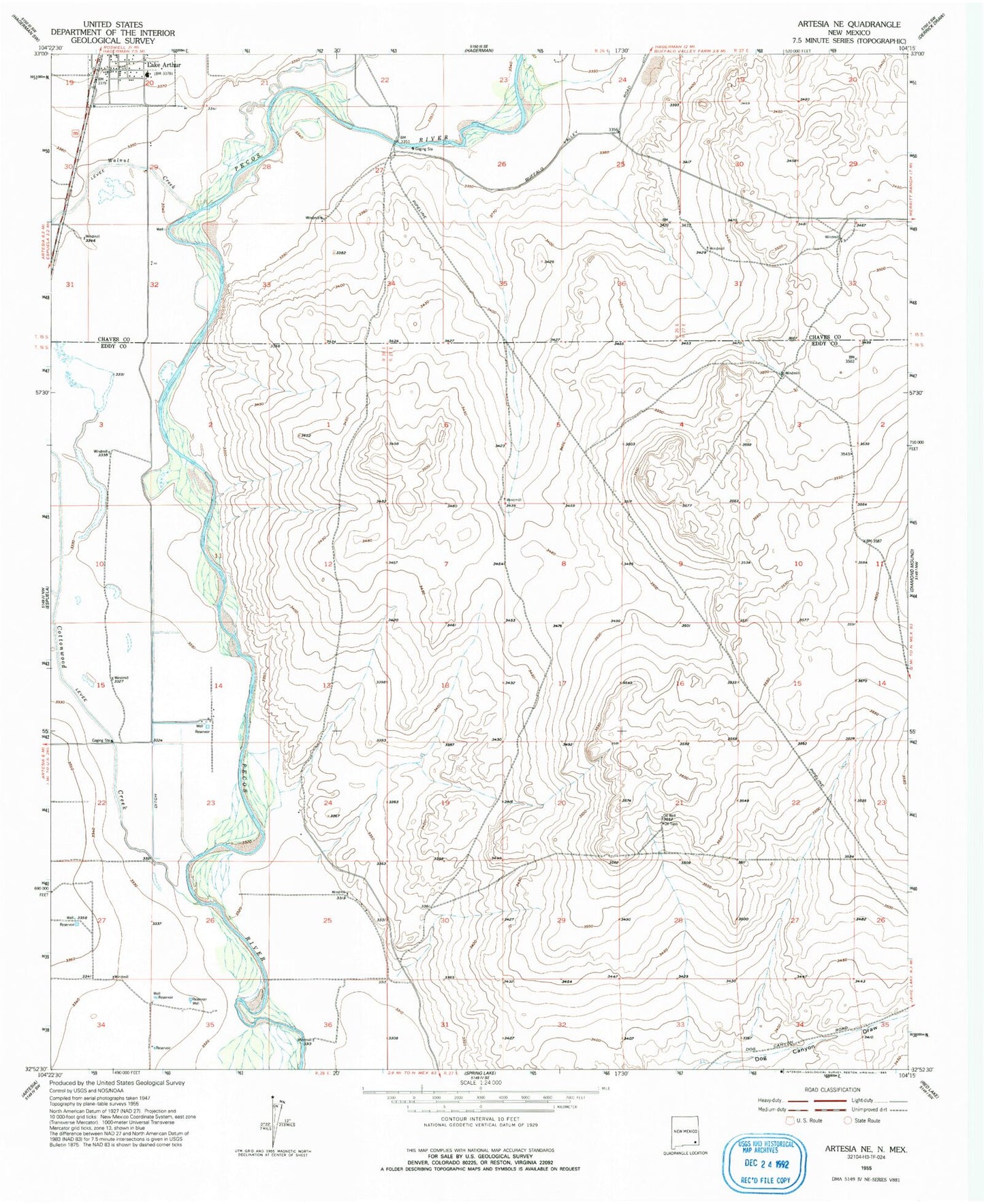
Classic USGS Artesia NE New Mexico 7.5'x7.5' Topo Map
Couldn't load pickup availability
Historical USGS topographic quad map of Artesia NE in the state of New Mexico. Map scale may vary for some years, but is generally around 1:24,000. Print size is approximately 24" x 27"
This quadrangle is in the following counties: Chaves, Eddy.
The map contains contour lines, roads, rivers, towns, and lakes. Printed on high-quality waterproof paper with UV fade-resistant inks, and shipped rolled.
Contains the following named places: 05346 Water Well, 05347 Water Well, 05348 Water Well, 05349 Water Well, 05350 Water Well, 05351 Water Well, 06124 Water Well, 06126 Water Well, 10348 Water Well, 10349 Water Well, 10354 Water Well, 10913 Water Well, 10914 Water Well, 10915 Water Well, 10917 Water Well, 10918 Water Well, 10919 Water Well, 12827 Water Well, 12885 Water Well, 12886 Water Well, 12887 Water Well, 13590 Water Well, 13593 Water Well, Cottonwood Creek, First Baptist Church, Lake Arthur, Lake Arthur Educational Museum, Lake Arthur Elementary School, Lake Arthur High School, Lake Arthur Middle School, Lake Arthur Post Office, Lake Arthur Volunteer Fire Department Main Station, Lake Arthur Volunteer Fire Department The Mills, Town of Lake Arthur, Walnut Creek