MyTopo
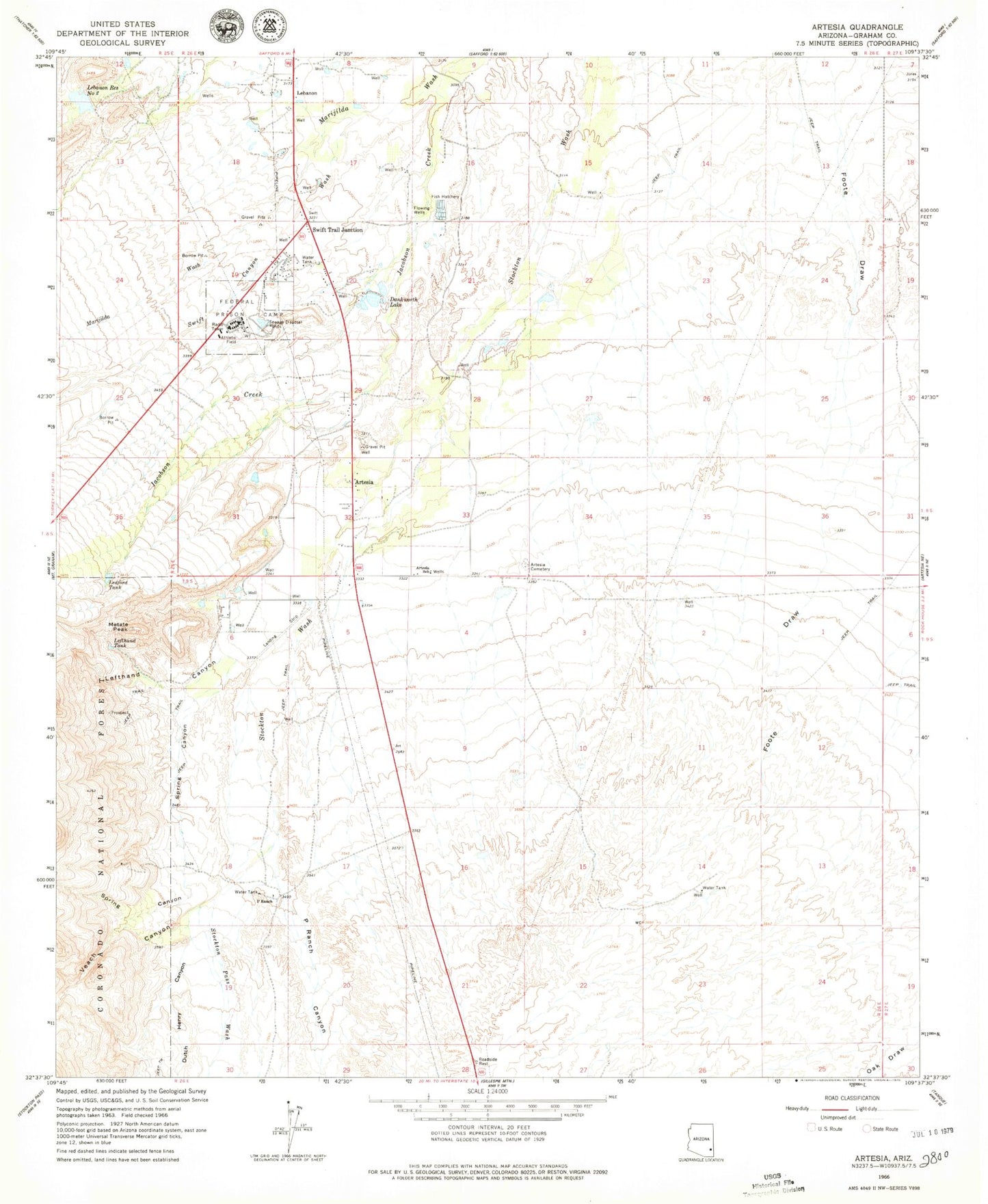
Classic USGS Artesia Arizona 7.5'x7.5' Topo Map
Couldn't load pickup availability
Historical USGS topographic quad map of Artesia in the state of Arizona. Map scale may vary for some years, but is generally around 1:24,000. Print size is approximately 24" x 27"
This quadrangle is in the following counties: Graham.
The map contains contour lines, roads, rivers, towns, and lakes. Printed on high-quality waterproof paper with UV fade-resistant inks, and shipped rolled.
Contains the following named places: Artesia, Artesia Cemetery, Artesia School, Dankworth Pond, Dankworth Pond State Park, Dutch Henry Canyon, Federal Correctional Institution Safford, Jacobson Creek, Lebanon, Lebanon Reservoir Number Two, Lebanon Reservoir Number Two Dam, Ledford Tank, Lefthand Canyon, Lefthand Tank, Metate Peak, P Ranch, P Ranch Canyon, Spring Canyon, Stockton Pass Wash, Swift Canyon Wash, Swift Trail Junction, Swift Trail Junction Census Designated Place, Veach Canyon