MyTopo
Classic USGS Artesian Draw Wyoming 7.5'x7.5' Topo Map
Regular price
$16.95
Regular price
Sale price
$16.95
Unit price
per
Couldn't load pickup availability
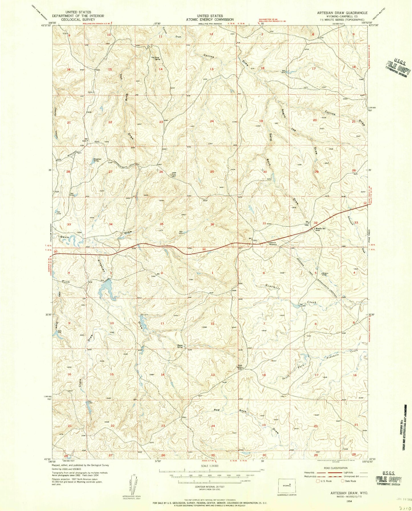
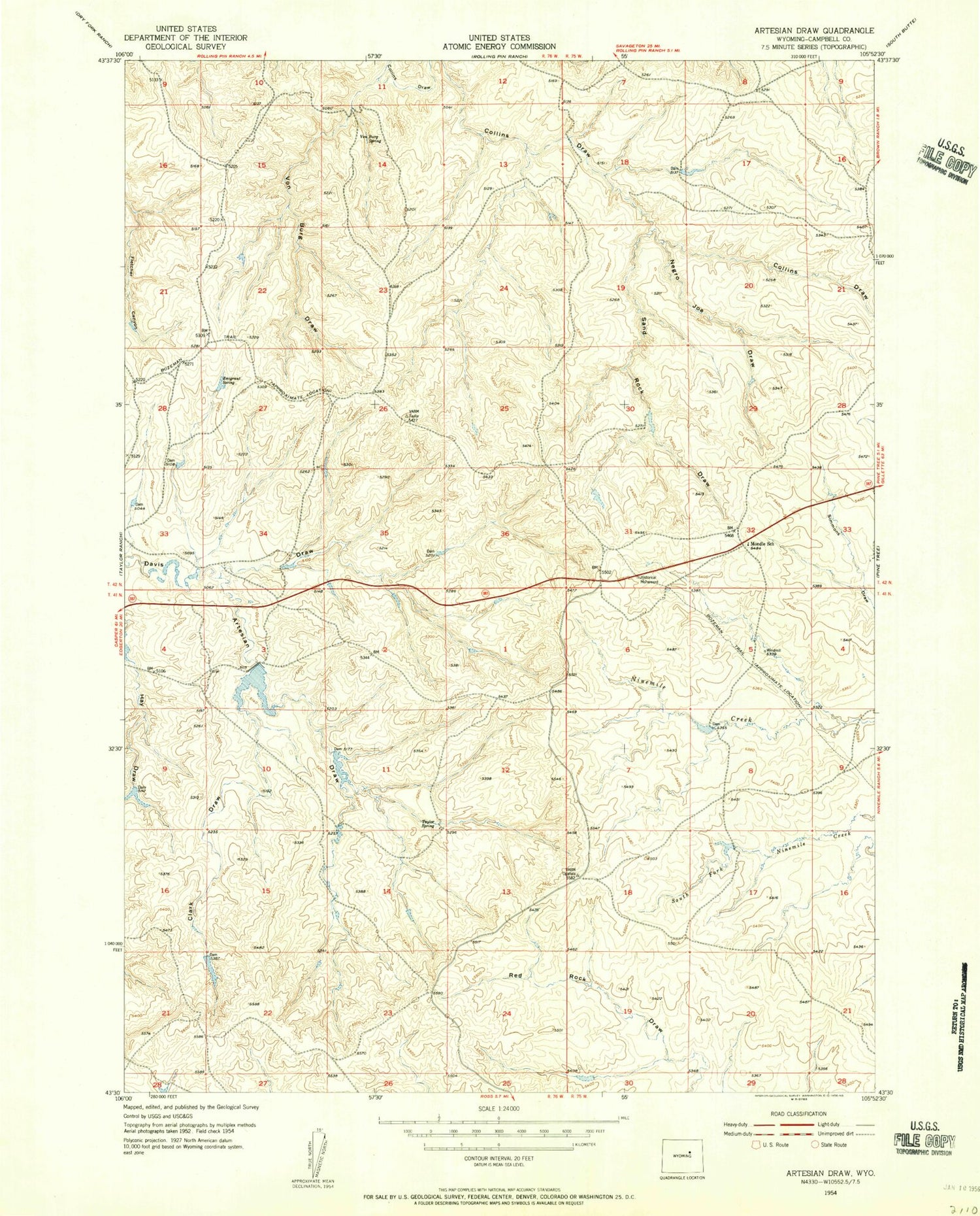
Historical USGS topographic quad map of Artesian Draw in the state of Wyoming. Map scale may vary for some years, but is generally around 1:24,000. Print size is approximately 24" x 27"
This quadrangle is in the following counties: Campbell.
The map contains contour lines, roads, rivers, towns, and lakes. Printed on high-quality waterproof paper with UV fade-resistant inks, and shipped rolled.
Contains the following named places: Artesian Draw, Clark Draw, Emigrant Spring, Kerr McGee Mine, Mondle School, Negro Joe Draw, Sand Rock Draw, Taylor Spring, Von Burg Draw, Von Burg Spring