MyTopo
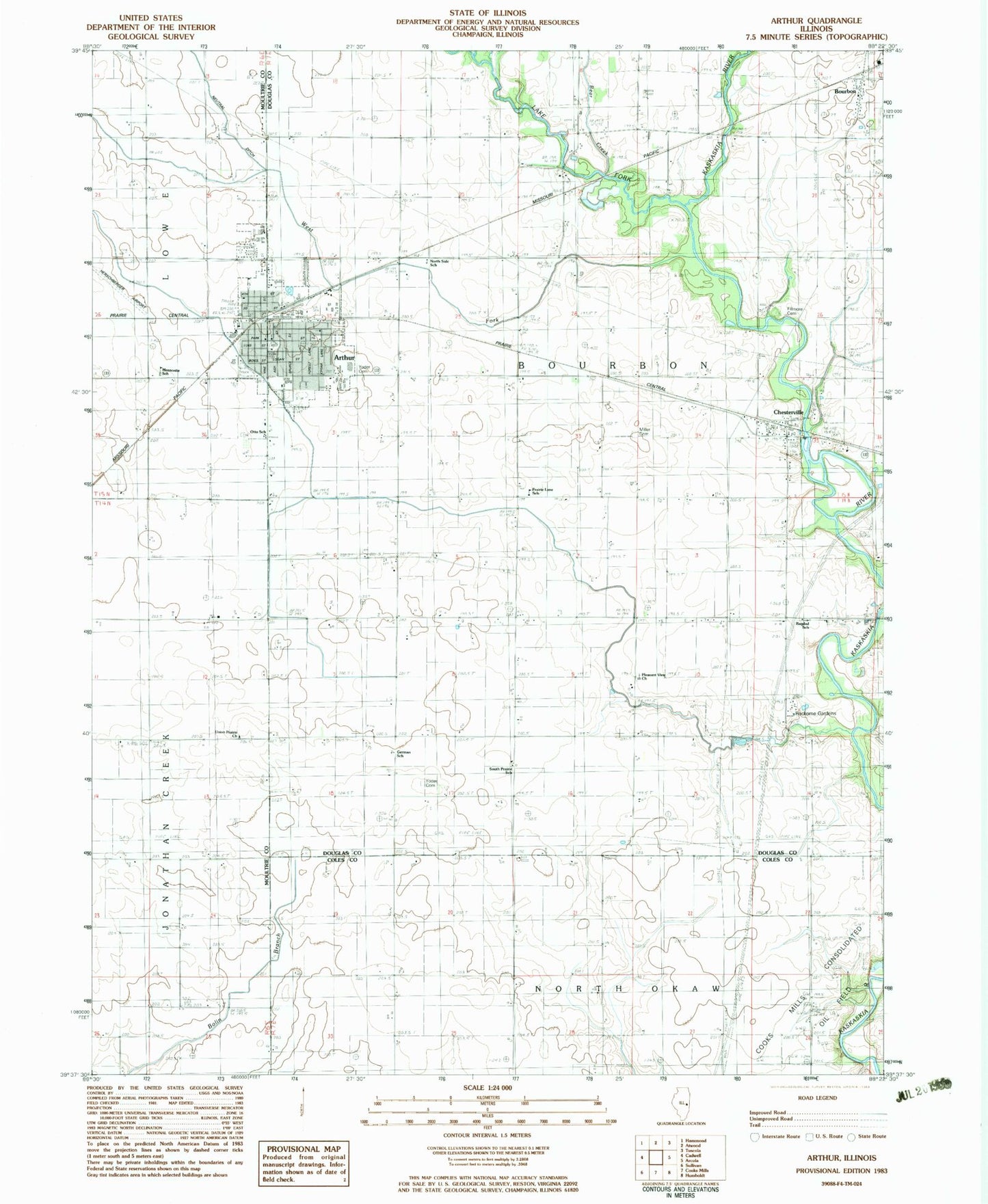
Classic USGS Arthur Illinois 7.5'x7.5' Topo Map
Couldn't load pickup availability
Historical USGS topographic quad map of Arthur in the state of Illinois. Map scale may vary for some years, but is generally around 1:24,000. Print size is approximately 24" x 27"
This quadrangle is in the following counties: Coles, Douglas, Moultrie.
The map contains contour lines, roads, rivers, towns, and lakes. Printed on high-quality waterproof paper with UV fade-resistant inks, and shipped rolled.
Contains the following named places: Arthur, Arthur Ambulance Service, Arthur Church of Christ, Arthur Elementary School, Arthur Fire Department, Arthur Mennonite Church, Arthur Police Department, Arthur Post Office, Arthur Public Library, Arthur Senior High School, Arthur Town Hall, Arthur United Methodist Church, Bagdad School, Bear Creek, Bolinger School, Bourbon, Bourbon Post Office, Chesterville, Chesterville Post Office, Chesterville School, Columbia School, Cooks Mills Consolidated Oil Field, De Hart School, East Prairie School, Fillmore, Fillmore Cemetery, First Apostolic Church, First Baptist Church, German School, Lake Fork, Lake Fork Special Ditch, Larry D Herschberger Airport, Liberty School, Lilly School, McDonald School, Mennonite School, Miller Cemetery, North Side School, Otto School, Pleasant View Church, Prairie Lane School, Reeder School, Rockome Gardens, Shady Crest Orchard, Shaw School, South Prairie School, Township of Bourbon, Union Prairie Church, Village of Arthur, Vine Street Christian Church, West Fork Kaskaskia River, West Prairie School, Yoder Cemetery, Yoder School, ZIP Code: 61911