
MyTopo
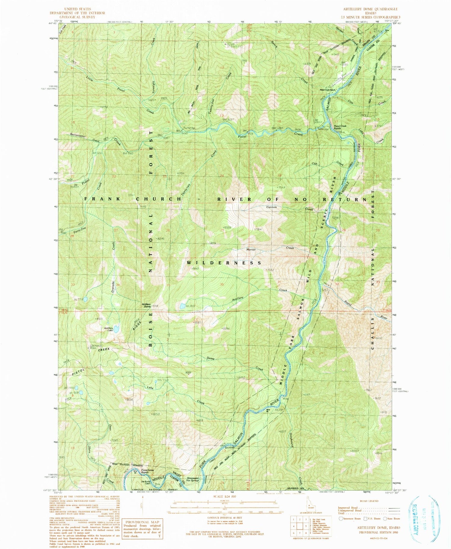
Classic USGS Artillery Dome Idaho 7.5'x7.5' Topo Map
Couldn't load pickup availability
Historical USGS topographic quad map of Artillery Dome in the state of Idaho. Typical map scale is 1:24,000, but may vary for certain years, if available. Print size: 24" x 27"
This quadrangle is in the following counties: Custer, Valley.
The map contains contour lines, roads, rivers, towns, and lakes. Printed on high-quality waterproof paper with UV fade-resistant inks, and shipped rolled.
Contains the following named places: Artillery Creek, Artillery Dome, Artillery Lake, Beansnapper Creek, Cannon Creek, Cap Creek, Cow Creek, Dome Creek, Foresight Creek, Forty-five Creek, Garden Creek, Grenade Creek, Greyhound Creek, Lake Creek, Lake Creek, Little Pistol Creek, Middle Fork Guard Station, Mortar Creek, Pistol Creek, Pistol Creek Ridge, Ranch Creek, Rapid River, Sheepeater Hot Springs, Soldier Creek, Thirty-two Creek, Twenty-five Creek, Big Snag Campsite, Dolly Lake Campsite, Quick Stop Campsite, Pistol Creek Campground, Pistol Creek Rapids, Pistol Creek Ranch, Oakie Point Campsite, Greyhound Creek Campsite, Dome House Campsite, Fire Island Campsite, Lake Creek Campsite, Jons Camp Campsite, Joe Bump Cabin, Sheepeater Hot Springs Campground, Mule Creek, Pistol Creek Ranch Landing Strip (historical), Powerhouse Rapids


