
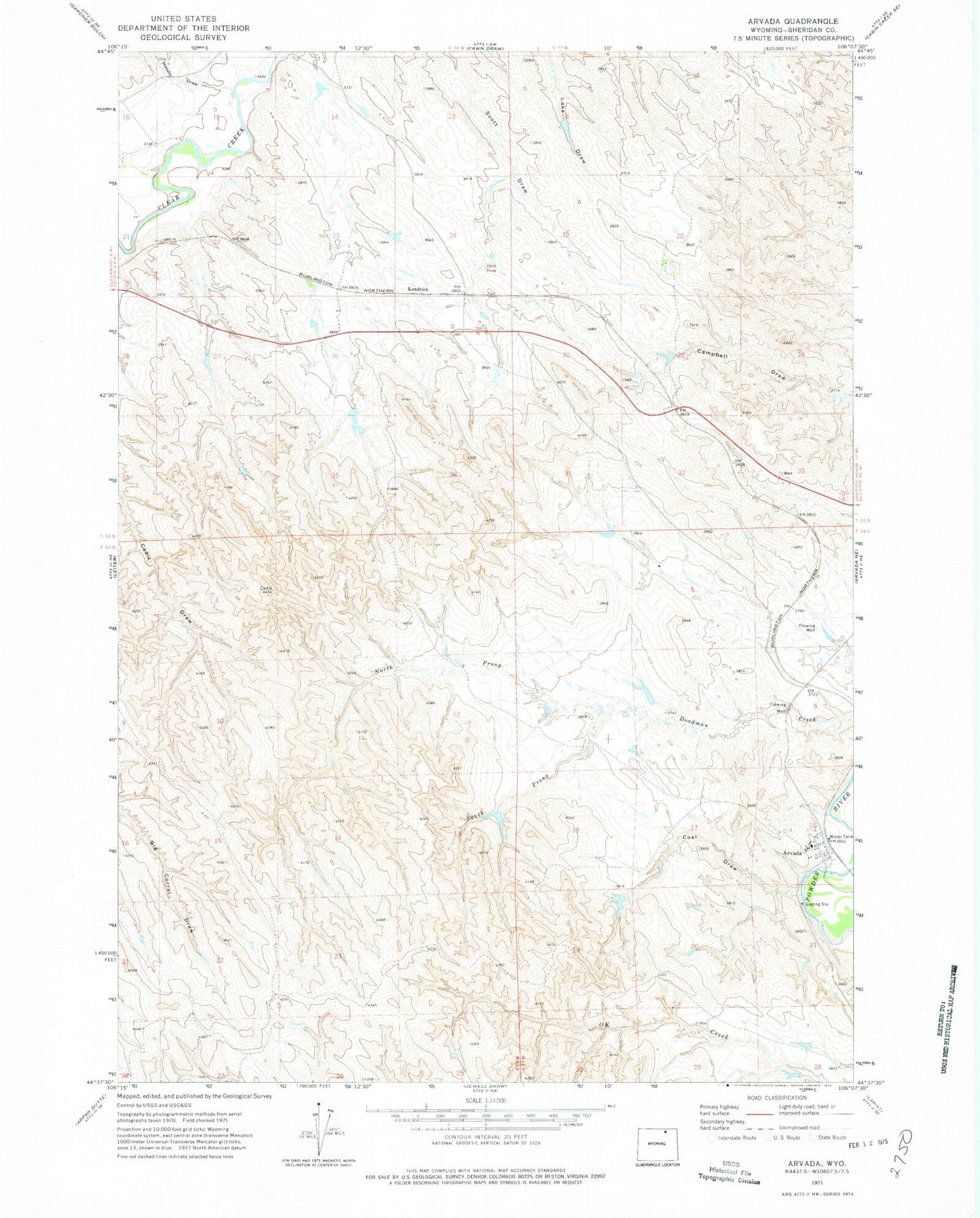
MyTopo
Classic USGS Arvada Wyoming 7.5'x7.5' Topo Map
Couldn't load pickup availability
Historical USGS topographic quad map of Arvada in the state of Wyoming. Map scale may vary for some years, but is generally around 1:24,000. Print size is approximately 24" x 27"
This quadrangle is in the following counties: Sheridan.
The map contains contour lines, roads, rivers, towns, and lakes. Printed on high-quality waterproof paper with UV fade-resistant inks, and shipped rolled.
Contains the following named places: Arvada, Arvada Census Designated Place, Arvada Coal Mine, Arvada Post Office, Arvada School, Clearmont Fire District, Coal Draw, Hando Draw, Kendrick, North Prong Deadman Creek, Puffball Dam, Puffball Reservoir, South Prong Deadman Creek, Sweat Mine, Weller Dam, Weller Reservoir, Whitman Mine, Wild Horse Creek, Wyoming Smokeless Mine


