MyTopo
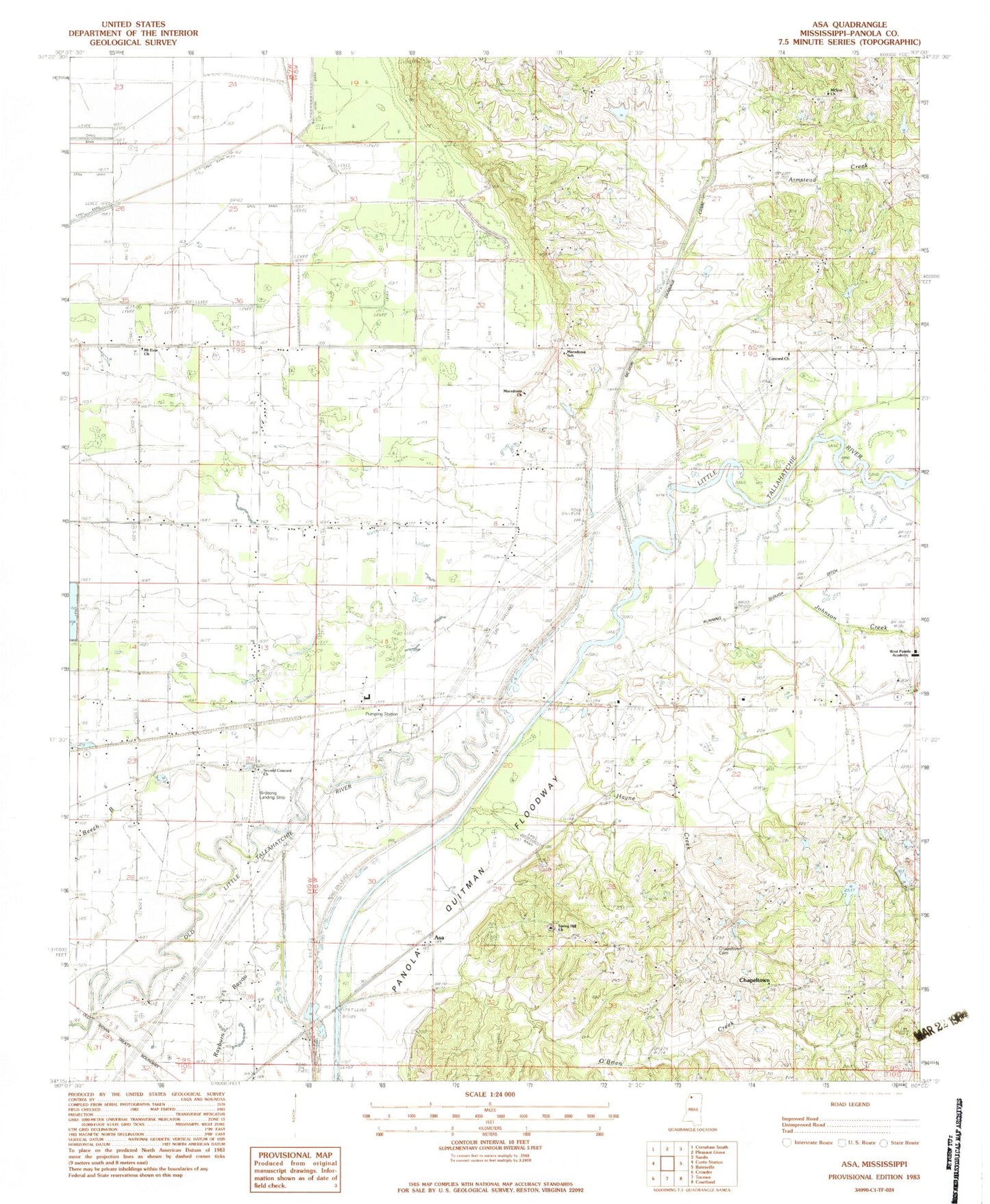
Classic USGS Asa Mississippi 7.5'x7.5' Topo Map
Couldn't load pickup availability
Historical USGS topographic quad map of Asa in the state of Mississippi. Map scale may vary for some years, but is generally around 1:24,000. Print size is approximately 24" x 27"
This quadrangle is in the following counties: Panola.
The map contains contour lines, roads, rivers, towns, and lakes. Printed on high-quality waterproof paper with UV fade-resistant inks, and shipped rolled.
Contains the following named places: Armstead Creek, Asa, Birdsong Landing Strip, Caldwell School, Carrier Landing Field, Chapeltown, Chapeltown Cemetery, Concord Church, Concord School, Corn Cobb Church, Hayne Creek, Haynes Mill, Little Tallahatchie River, Lower Tallahatchie Y-10-37 Dam, Macedonia Church, Macedonia School, McIvor Cemetery, McIvor Church, Mount Evia Church, Nelsons Bluff, O'Brien Creek, Porters Bridge, Porters Ferry School, Running Slough Ditch, Second Concord Church, Spring Hill Church, Squirrel Bridge, Swango Chapel, Swango Church, The Round Hole, Wesley Church, West Panola Academy, Westside School