
MyTopo
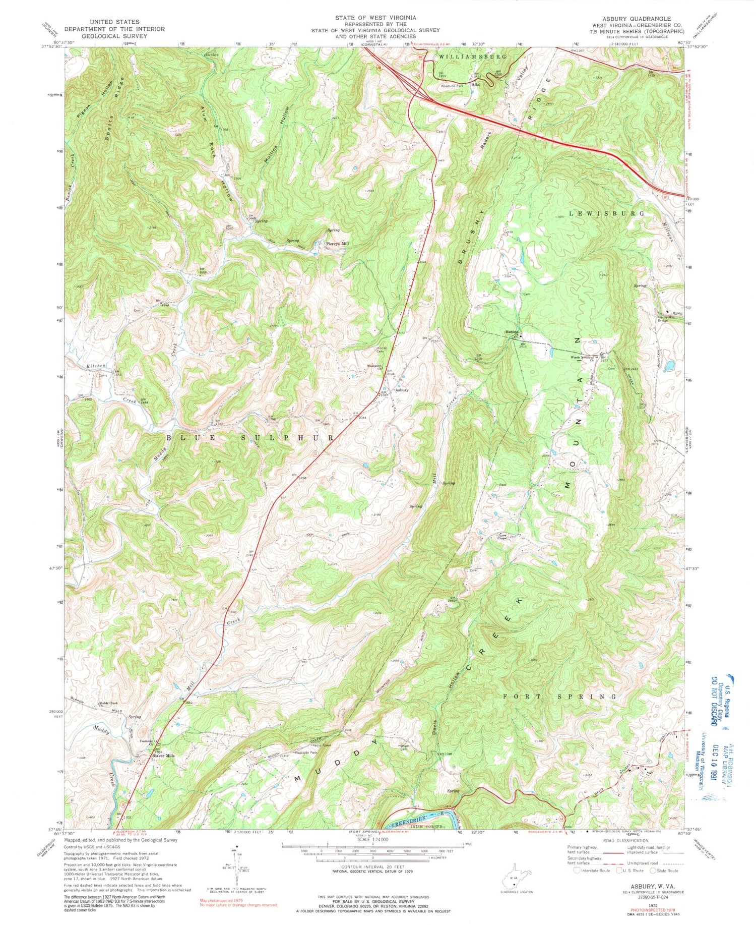
Classic USGS Asbury West Virginia 7.5'x7.5' Topo Map
Couldn't load pickup availability
Historical USGS topographic quad map of Asbury in the state of West Virginia. Map scale may vary for some years, but is generally around 1:24,000. Print size is approximately 24" x 27"
This quadrangle is in the following counties: Greenbrier.
The map contains contour lines, roads, rivers, towns, and lakes. Printed on high-quality waterproof paper with UV fade-resistant inks, and shipped rolled.
Contains the following named places: Alta, Alum Rock Hollow, Alum Run, Asbury, Asbury Methodist Church Cemetery, Asbury Post Office, Baker School, Big Spring, Blaker Mills, Brushy Ridge School, Curry School, David Nash Spring, Davis - Stuart School, Davis Hollow, Davis Spring, Davis Stuart School, Dye Spring, Early Spring, Fairview School, Feamster Memorial Freewill Baptist Church, Fearnster School, Fleshman Spring, Fry School, Fuller Spring, George School, Hanger Cemetery, Hanger School, Harrah Cemetery, Harvey Spring, Hawver School, Herns Mill Bridge, Highland Baptist Church, Hillview School, Janes Chapel, Jim Fleshman Spring, Kitchen Creek, Kramer School, McQueen School, Mill Creek, Morlunda Farms Spring, Mount Zion Church, Muddy Creek Church, Muddy Creek Mountain, Mullins Hollow, North House Museum, Persinger School, Piercy Spring, Piercys Cave Spring, Piercys Mill, Pigeon Hollow, Pine Grove School, Raders Valley, Renick Creek, Reynolds Spring, Rich Hollow School, Seep Spring, Spotts Ridge, Tucker Bridge, West Point Baptist Church, Woods Memorial Church, WRON-FM (Ronceverte), ZIP Code: 24916


