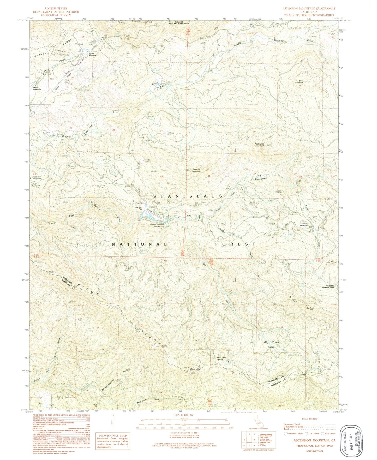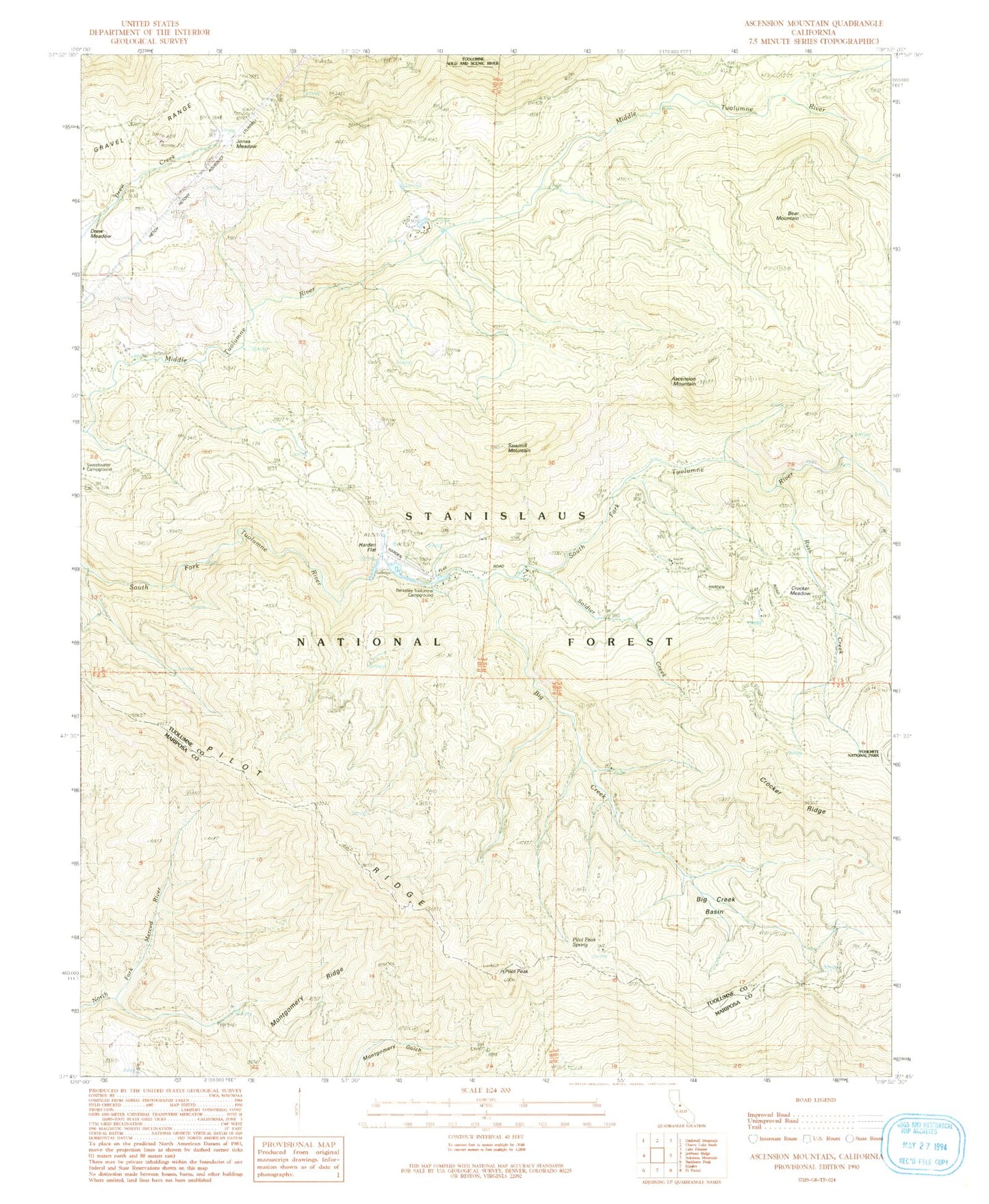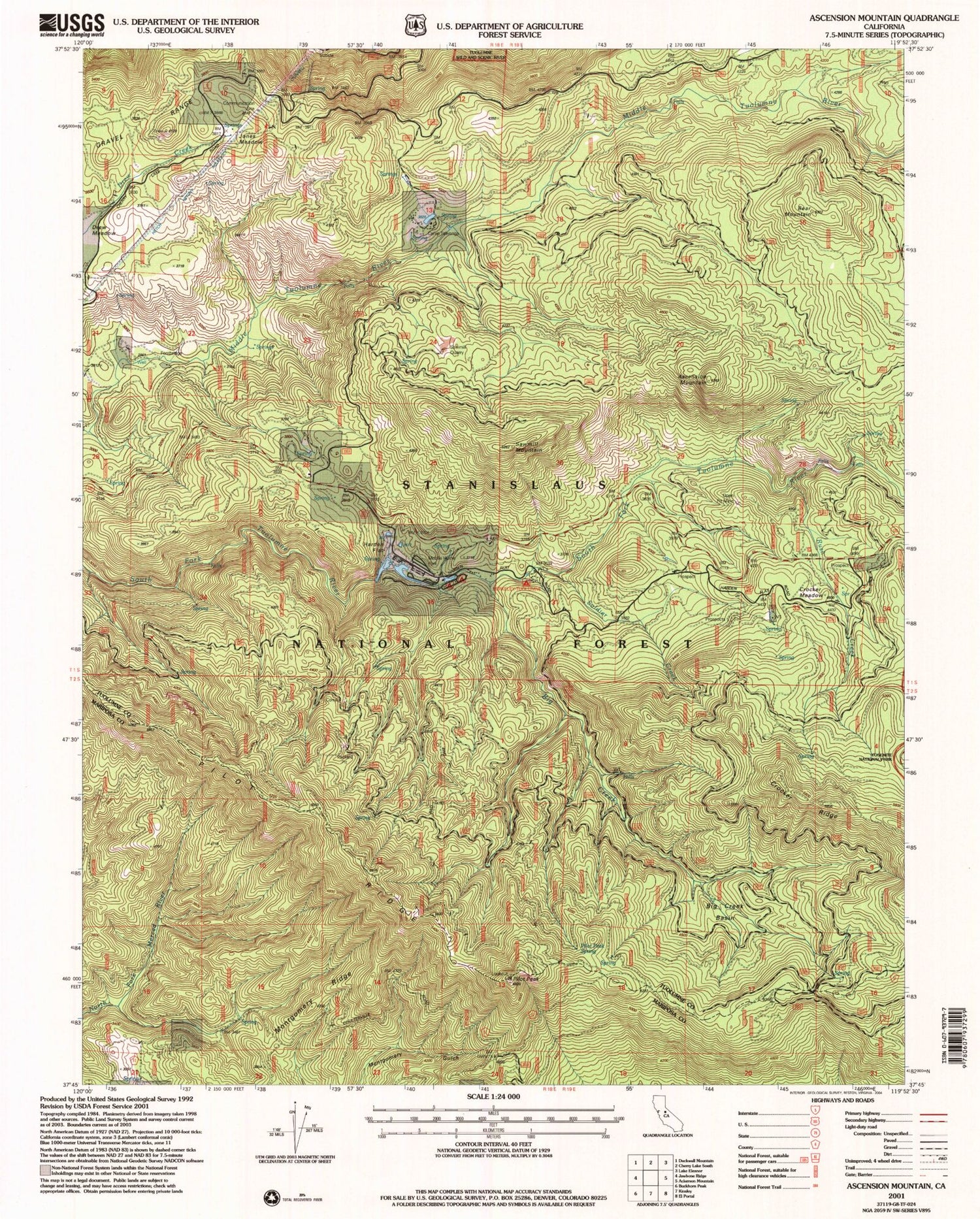

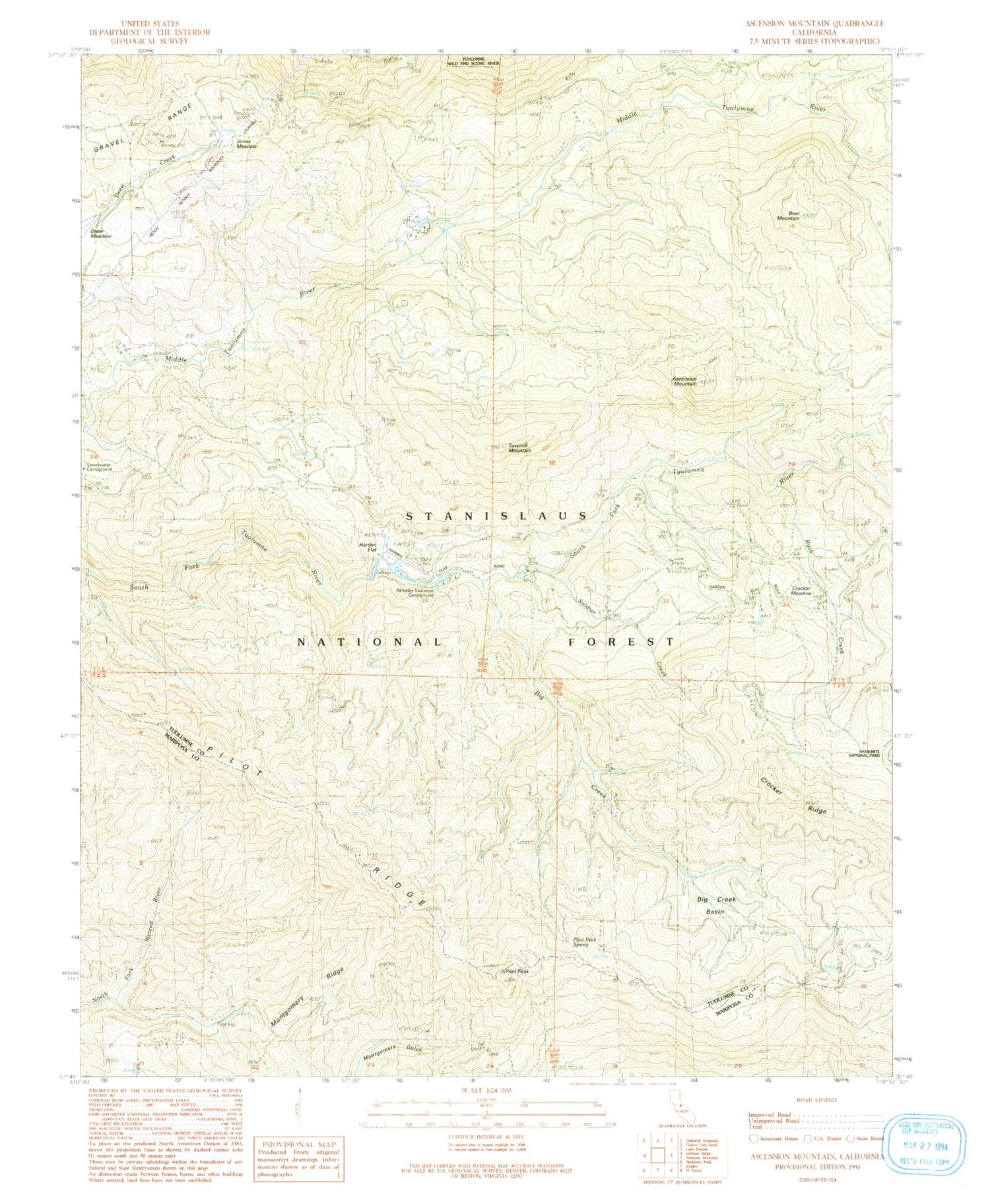
MyTopo
Classic USGS Ascension Mountain California 7.5'x7.5' Topo Map
Couldn't load pickup availability
Historical USGS topographic quad map of Ascension Mountain in the state of California. Typical map scale is 1:24,000, but may vary for certain years, if available. Print size: 24" x 27"
This quadrangle is in the following counties: Mariposa, Tuolumne.
The map contains contour lines, roads, rivers, towns, and lakes. Printed on high-quality waterproof paper with UV fade-resistant inks, and shipped rolled.
Contains the following named places: Pilot Peak, Sequoia, Harden Ranch, Crocker Meadow, Pilot Peak Spring, Jones Meadow, Berkeley-Tuolumne Campground, Ackerson Creek, Bear Mountain, Big Creek, Big Creek Basin, Columbia Camp (historical), Five Star Mine (historical), Gravel Range, Harden Flat, Montgomery Ridge, Rush Creek (historical), Rush Creek, Sawmill Mountain, Pilot Ridge, Soldier Creek, Sunset Camp (historical), Tuolumne Camp (historical), Camp Towenga, Spinning Wheel Forest Service Facility, Yosemite Lakes Park Campground, Goat Camp, Ascension Mountain, Pilot Peak, Sequoia, Harden Ranch, Crocker Meadow, Pilot Peak Spring, Jones Meadow, Berkeley-Tuolumne Campground, Ackerson Creek, Bear Mountain, Big Creek, Big Creek Basin, Columbia Camp (historical), Five Star Mine (historical), Gravel Range, Harden Flat, Montgomery Ridge, Rush Creek (historical), Rush Creek, Sawmill Mountain, Pilot Ridge, Soldier Creek, Sunset Camp (historical), Tuolumne Camp (historical), Camp Towenga, Spinning Wheel Forest Service Facility, Yosemite Lakes Park Campground, Goat Camp, Ascension Mountain