MyTopo
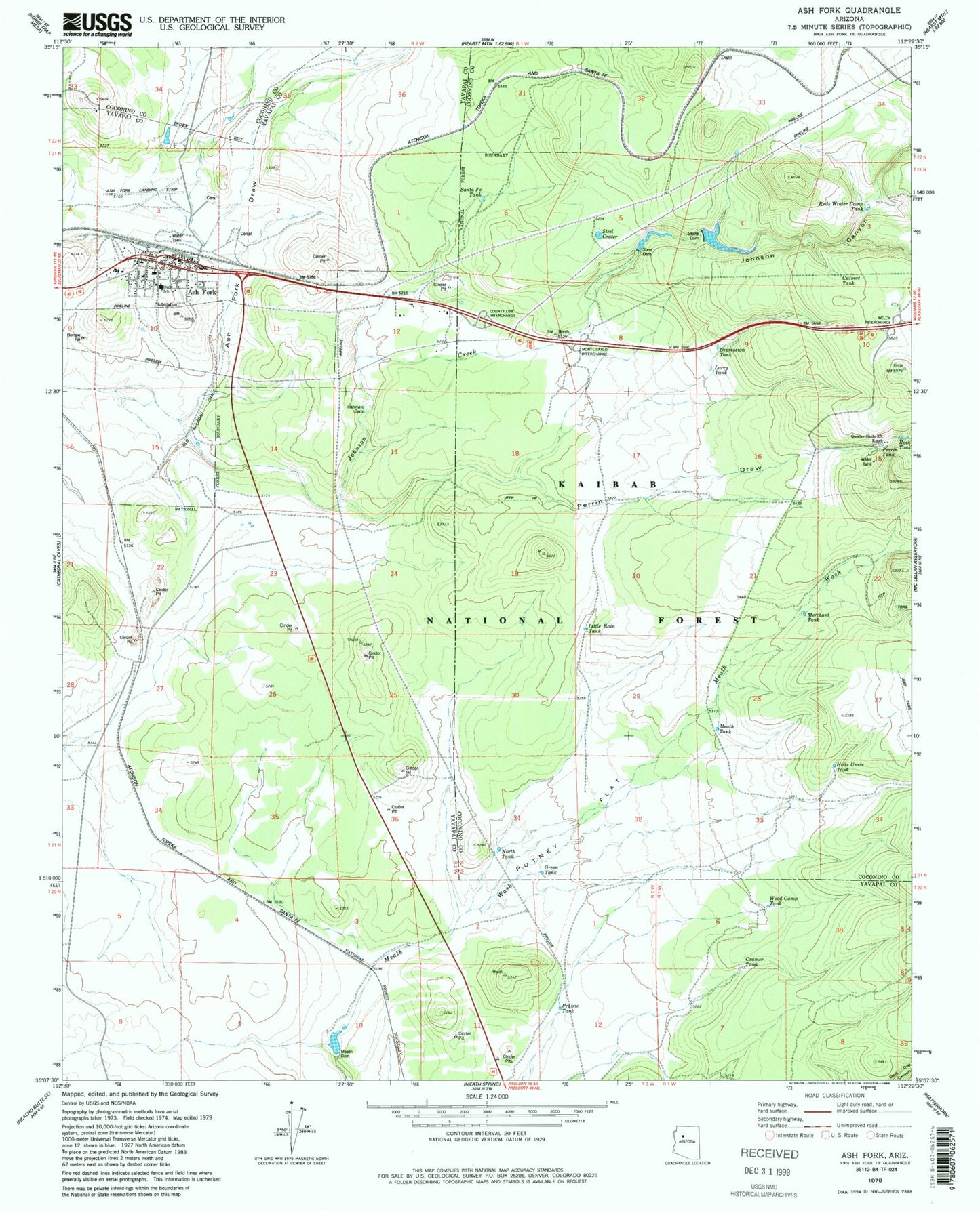
Classic USGS Ash Fork Arizona 7.5'x7.5' Topo Map
Couldn't load pickup availability
Historical USGS topographic quad map of Ash Fork in the state of Arizona. Map scale may vary for some years, but is generally around 1:24,000. Print size is approximately 24" x 27"
This quadrangle is in the following counties: Coconino, Yavapai.
The map contains contour lines, roads, rivers, towns, and lakes. Printed on high-quality waterproof paper with UV fade-resistant inks, and shipped rolled.
Contains the following named places: Antelope Tank, Arizona Highway Maintenance Yard, Ash Fork, Ash Fork Cemetery, Ash Fork Census Designated Place, Ash Fork Elementary School, Ash Fork Fire Station, Ash Fork High School, Ash Fork Landing Strip, Ash Fork Middle School, Ash Fork Post Office, Ash Fork Public Library, Ash Fork Railroad Station, Ash Fork Santa Fe Railroad Company Water Tank, Ash Fork Substation, Bridge Tank, Cramer Tank, Cruice Railroad Station, Cruice Siding, Culvert Tank, Daze, Daze Railroad Station, Depression Tank, First Southern Baptist Church, Green Tank, Hat Ranch, Hells Uncle Tank, Irishman Dam, Johnson Canyon, Johnson Creek, Larry Tank, Little Rain Tank, Little Tank, Masonry Number Two Reservoir, Meath Dam, Meath Tank, Merchant Tank, North Tank, Perrin Draw, Perrin Tank, Prairie Tank, Putney Flat, Quarter Circle X X Ranch, Rock Tank, Rods Winter Camp Tank, Santa Fe Tank, Steel Crater, Steel Dam, Steel Dam Reservoir, Stone Dam, Wood Camp Tank