MyTopo
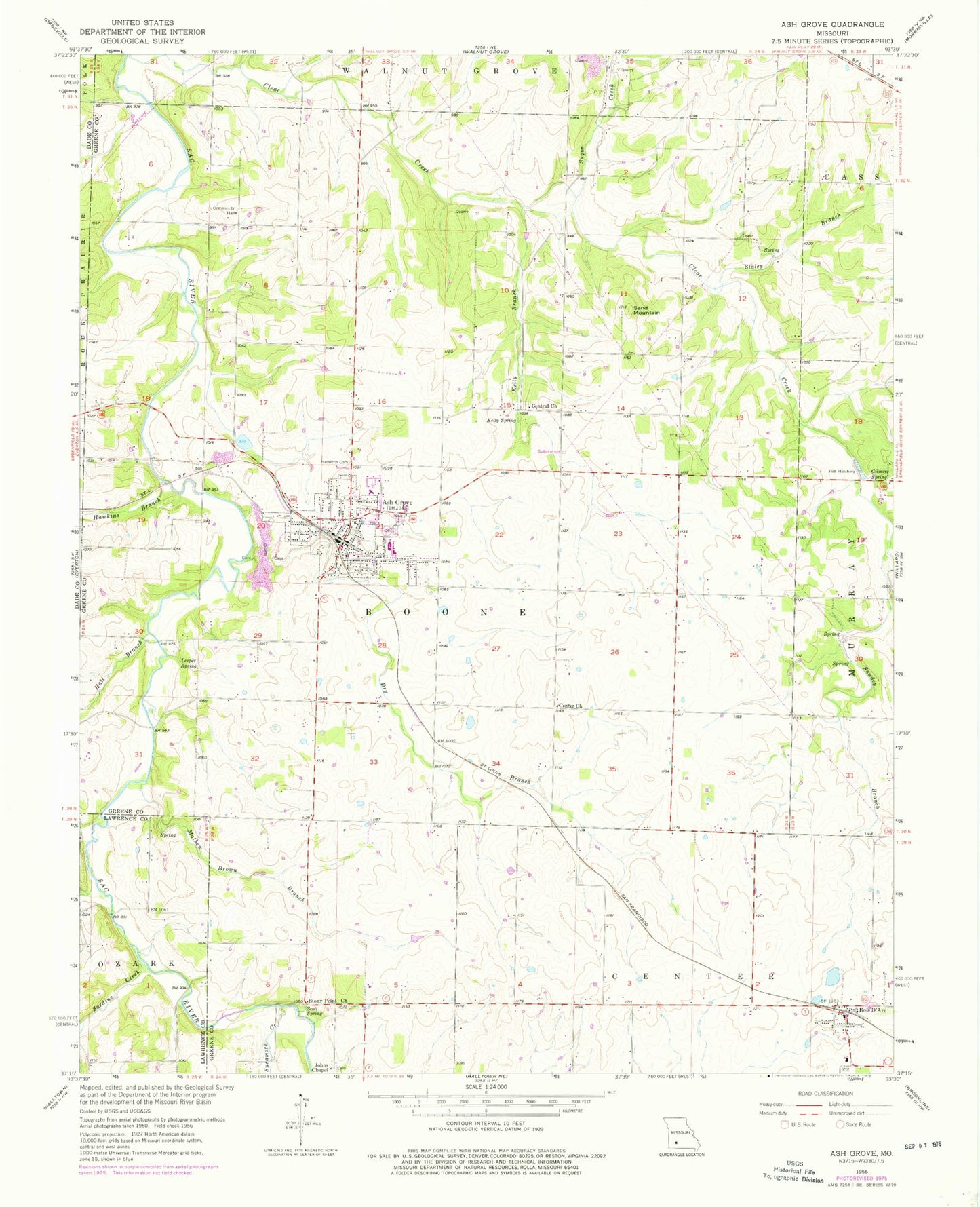
Classic USGS Ash Grove Missouri 7.5'x7.5' Topo Map
Couldn't load pickup availability
Historical USGS topographic quad map of Ash Grove in the state of Missouri. Typical map scale is 1:24,000, but may vary for certain years, if available. Print size: 24" x 27"
This quadrangle is in the following counties: Dade, Greene, Lawrence.
The map contains contour lines, roads, rivers, towns, and lakes. Printed on high-quality waterproof paper with UV fade-resistant inks, and shipped rolled.
Contains the following named places: Ash Grove, Center Church, Dry Branch, Gentral Church, Gilmore Spring, Hall Branch, Hamilton Cemetery, Hawkins Branch, Johns Chapel, Kelly Branch, Kelly Spring, Leeper Spring, Mathew Brown Branch, Province Branch, Sand Mountain, Sardine Creek, Sawdey Branch, Scott Spring, Staley Branch, Stony Point Church, Sugar Creek, Sycamore Creek, New Site School (historical), Leeper School (historical), Center Hill Church (historical), Stony Point School (historical), Harold School (historical), Central Church, Kelly School (historical), Coleman School (historical), Center School (historical), Pleasant Hope School (historical), Fairview School (historical), Bois D'Arc, Township of Boone Number 1, Township of Boone Number 2, City of Ash Grove, Ash Grove Fire Protection District, Bois D Arc Fire Protection District Station 1, Johns Chapel Cemetery, Ash Grove Police Department, Ash Grove Post Office, Bois D'Arc Post Office