MyTopo
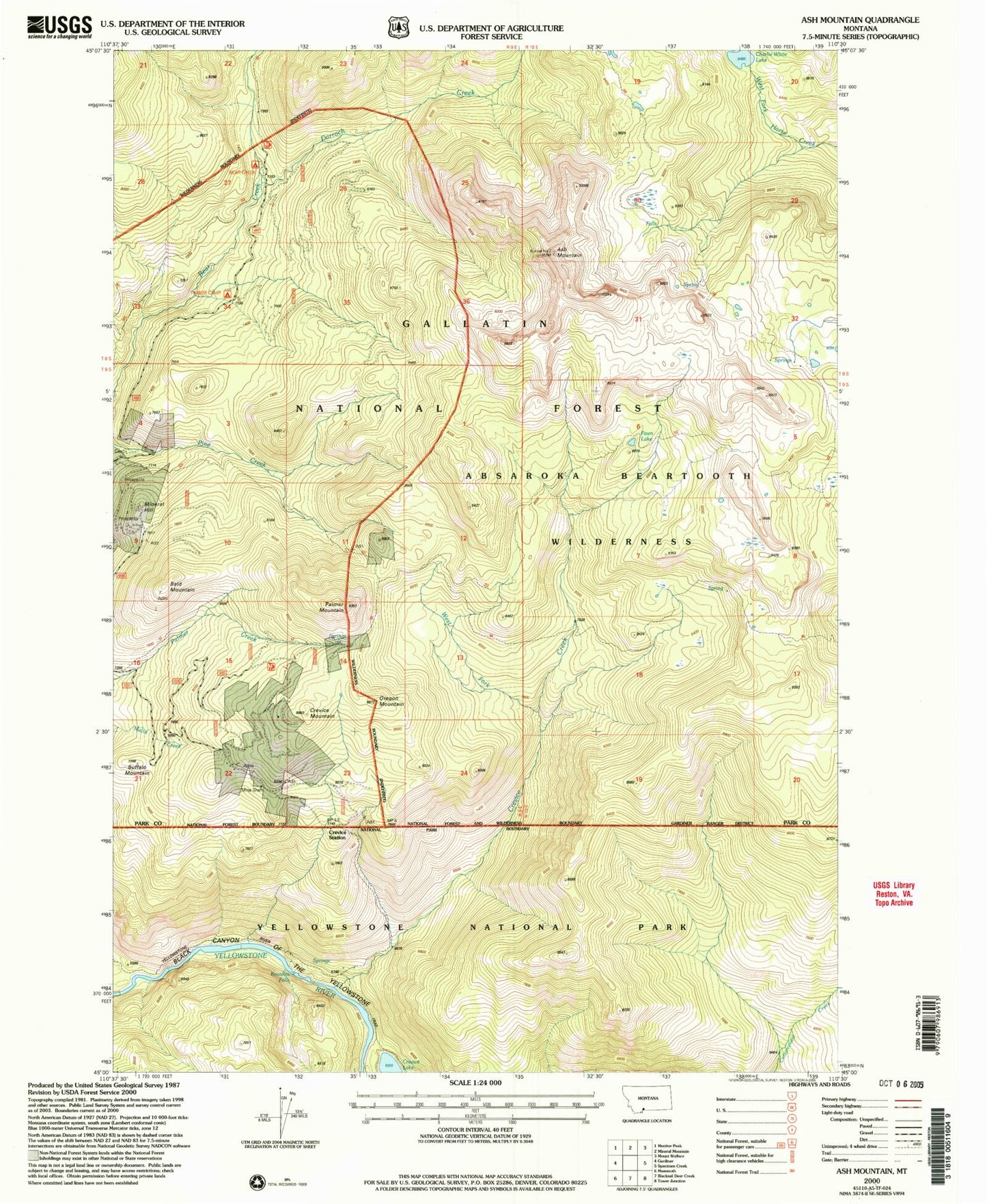
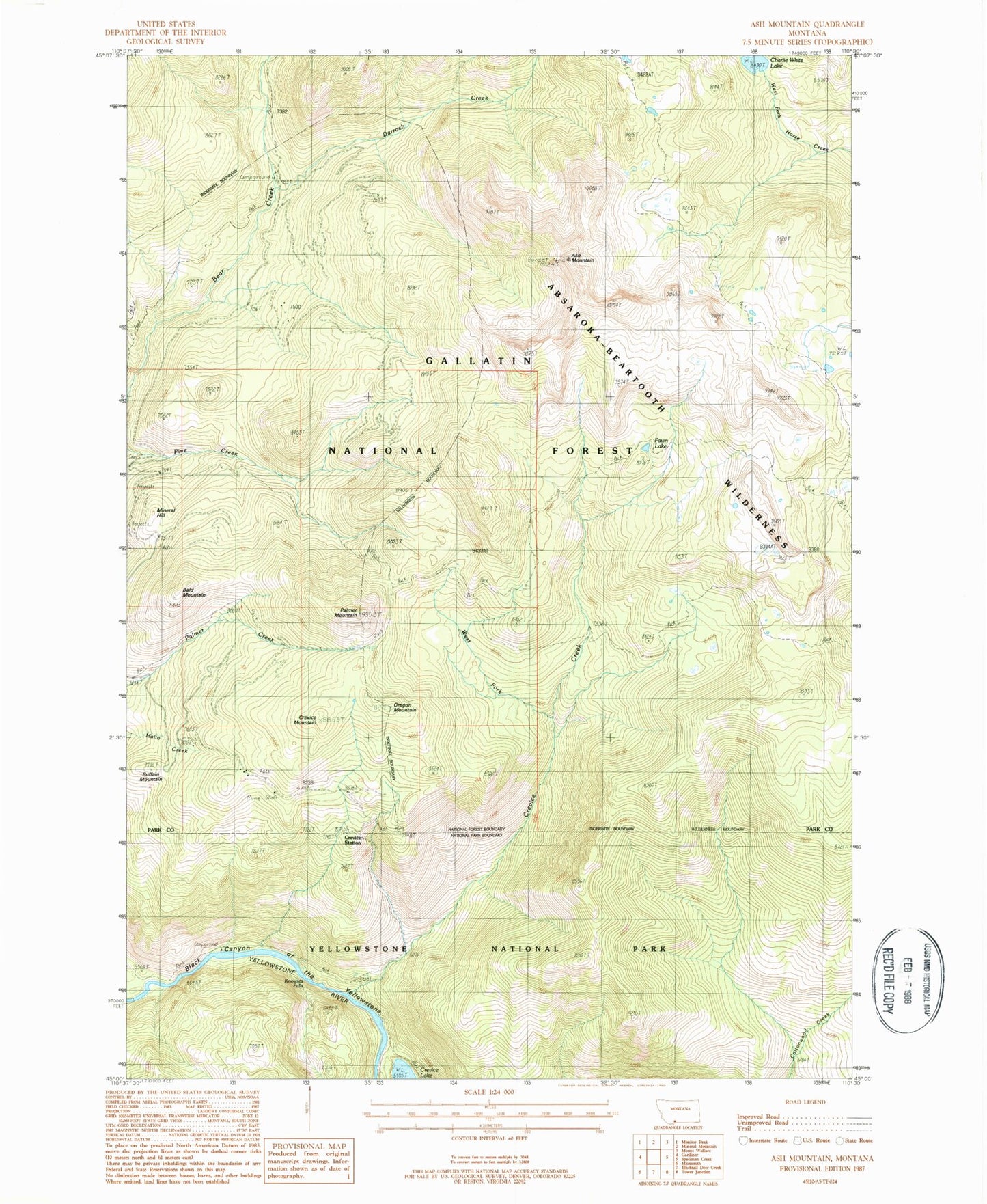
Classic USGS Ash Mountain Montana 7.5'x7.5' Topo Map
Couldn't load pickup availability
Historical USGS topographic quad map of Ash Mountain in the state of Montana. Typical map scale is 1:24,000, but may vary for certain years, if available. Print size: 24" x 27"
This quadrangle is in the following counties: Park.
The map contains contour lines, roads, rivers, towns, and lakes. Printed on high-quality waterproof paper with UV fade-resistant inks, and shipped rolled.
Contains the following named places: Ash Mountain, Ash Mountain Trail, Bald Mountain, Charlie White Lake, Crevice Mountain, Darroch Creek, Fawn Lake, Jardine-Hellroaring Trail, Oregon Mountain, Palmer Mountain, West Fork Crevice Creek, Crevice Creek, Crevice Lake, Crevice Station, Knowles Falls, Buffalo Mountain, Mineral Hill, Spotted Horse Mine, Yale-McGinty Mine, Vindicator Mine, First Chance/Lower Mine, Clark Mine, Rio Grande Mine, Sin Nombre Mine, Topeka Mine, NW Section 22 Mine, Columbia Mine, Watson Mine, Snowshoe Mine, Pratt Mine, Tower Grove Mine, Vista Mine, Conrad Mine, Homestead Mine, First Chance Mine, SE Section 14 Mine, NW Section 14 Mine, McCauley South Mine, Bonanza/Kentuck Mine, Granite Mine, Guest Tunnel Mine, Summit Mine, Medona Mine, B S Tunnel Mine, Conrad 6 Mine, M Tunnel Mine, J Tunnel Mine, Conrad Incline Mine, Conrad 3 Mine, Conrad 2 Mine, Vista 3 Mine, Bald Mountain Mine, Pop Incline Mine, Jones Cabin Mine, Helldorado Mine, Kennebeck Mine, Little Bonanza Mine, Medona North Mine, Jupiter Mine, Emma Mine, George Mine, Empire State Mine, Jardine Cemetery, Crevasse Post Office (historical), Yellowstone National Park Division, Jardine Census Designated Place