MyTopo
Classic USGS Ash Mountain New Mexico 7.5'x7.5' Topo Map
Regular price
$16.95
Regular price
Sale price
$16.95
Unit price
per
Couldn't load pickup availability
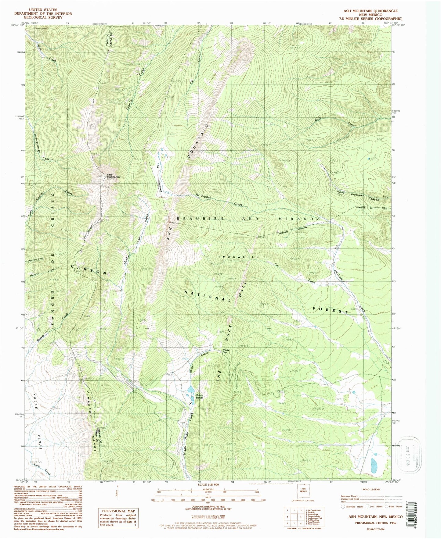
Historical USGS topographic quad map of Ash Mountain in the state of New Mexico. Typical map scale is 1:24,000, but may vary for certain years, if available. Print size: 24" x 27"
This quadrangle is in the following counties: Colfax, Taos.
The map contains contour lines, roads, rivers, towns, and lakes. Printed on high-quality waterproof paper with UV fade-resistant inks, and shipped rolled.
Contains the following named places: Cimarron Campground, Clayton Corral, Little Costilla Peak, McCrystal Place, Shuree Creek, Shuree Lodge, The Rock Wall, Windy Gap, Ash Mountain, Shuree Picnic Area, Shuree, Elk Meadows, Shuree Ponds, Can Creek