MyTopo
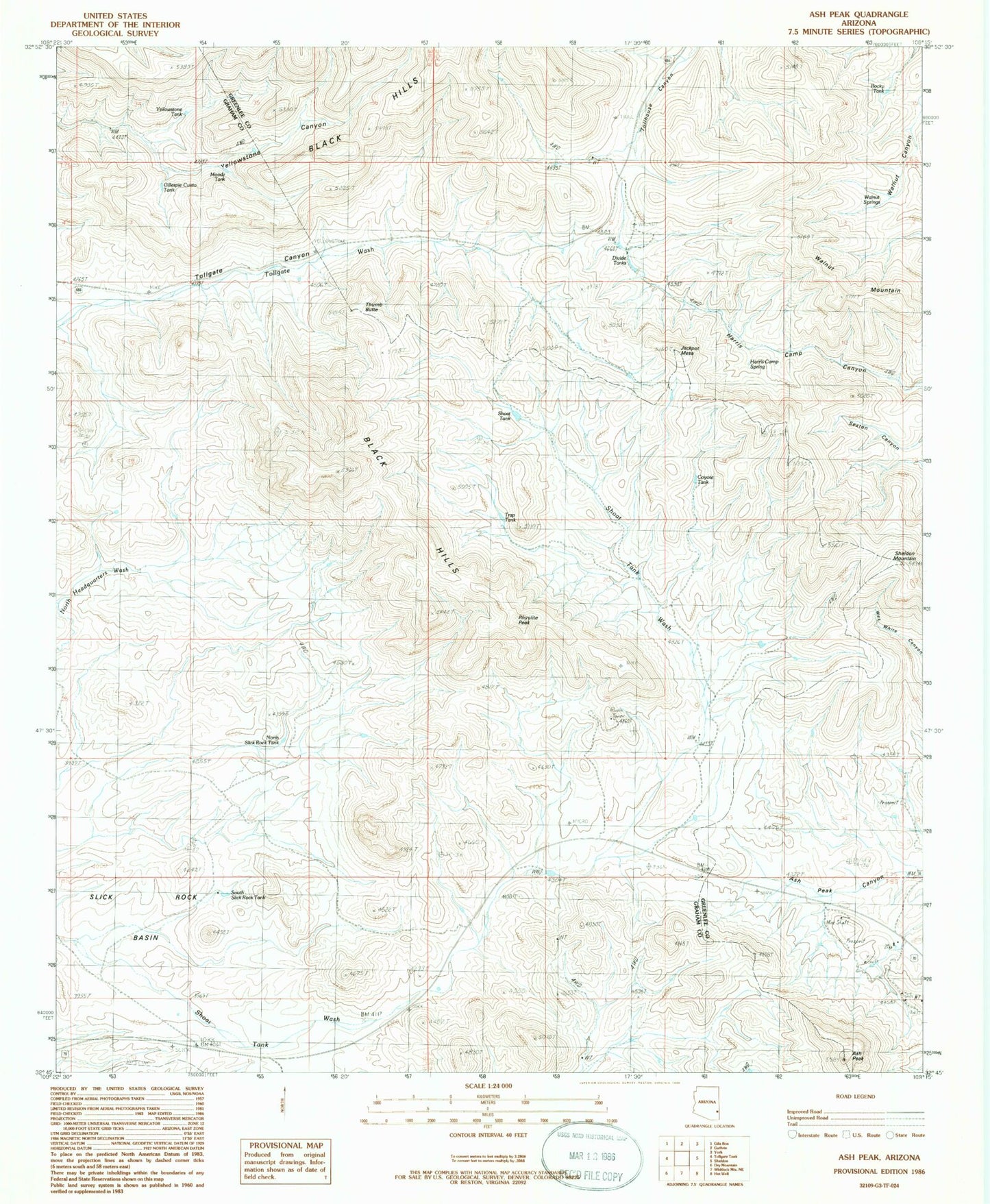
Classic USGS Ash Peak Arizona 7.5'x7.5' Topo Map
Couldn't load pickup availability
Historical USGS topographic quad map of Ash Peak in the state of Arizona. Map scale may vary for some years, but is generally around 1:24,000. Print size is approximately 24" x 27"
This quadrangle is in the following counties: Graham, Greenlee.
The map contains contour lines, roads, rivers, towns, and lakes. Printed on high-quality waterproof paper with UV fade-resistant inks, and shipped rolled.
Contains the following named places: Ash Peak, Ash Peak Mine, Black Hills, Coyote Tank, Divide Tanks, Gillespie Cueto Tank, Godfrey Mines, Hardy, Harris Camp Spring, Jackpot Mesa, Moody Tank, North Slick Rock Tank, Rhyolite Peak, Rocky Tank, Shamrock Shaft, Shoat Tank, Slick Rock Basin, South Slick Rock Tank, Thumb Butte, Trap Tank, Walnut Mountain, Walnut Springs, Williams Well, Yellowstone Tank, ZIP Code: 85546