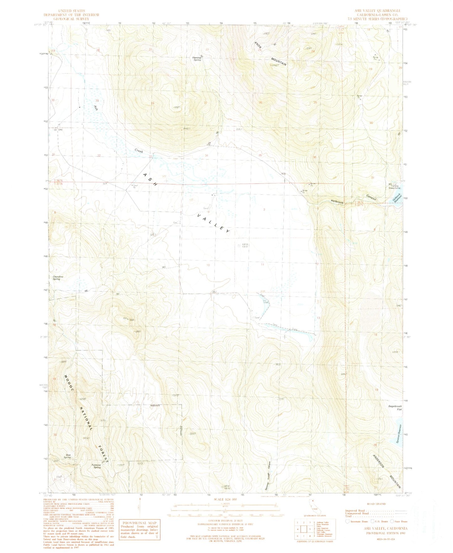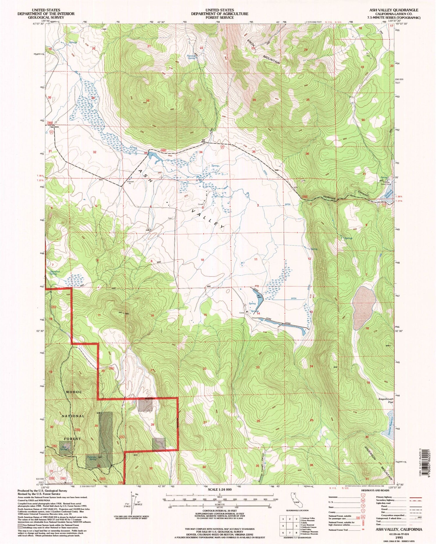
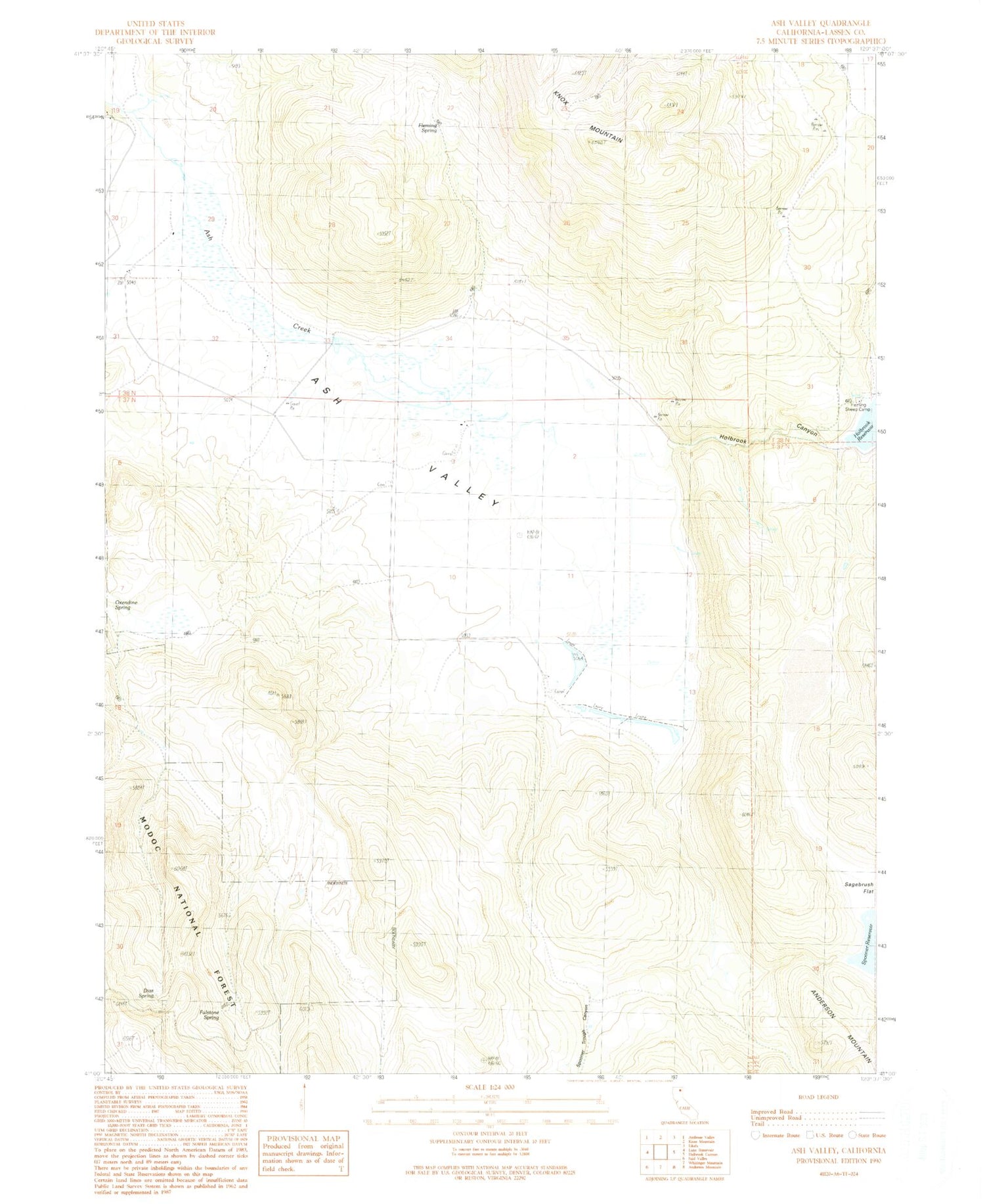
MyTopo
Classic USGS Ash Valley California 7.5'x7.5' Topo Map
Regular price
$16.95
Regular price
Sale price
$16.95
Unit price
per
Couldn't load pickup availability
Historical USGS topographic quad map of Ash Valley in the state of California. Map scale may vary for some years, but is generally around 1:24,000. Print size is approximately 24" x 27"
This quadrangle is in the following counties: Lassen.
The map contains contour lines, roads, rivers, towns, and lakes. Printed on high-quality waterproof paper with UV fade-resistant inks, and shipped rolled.
Contains the following named places: Diaz Spring, Fleming Sheep Camp, Fleming Spring, Fulstone Spring, Holbrook Canyon, Holbrook Reservoir, Oxendine Draw, Sowvlen 1237 Dam, Spooner 1249-005 Dam, Spooner Reservoir, Spooner Trough Canyon