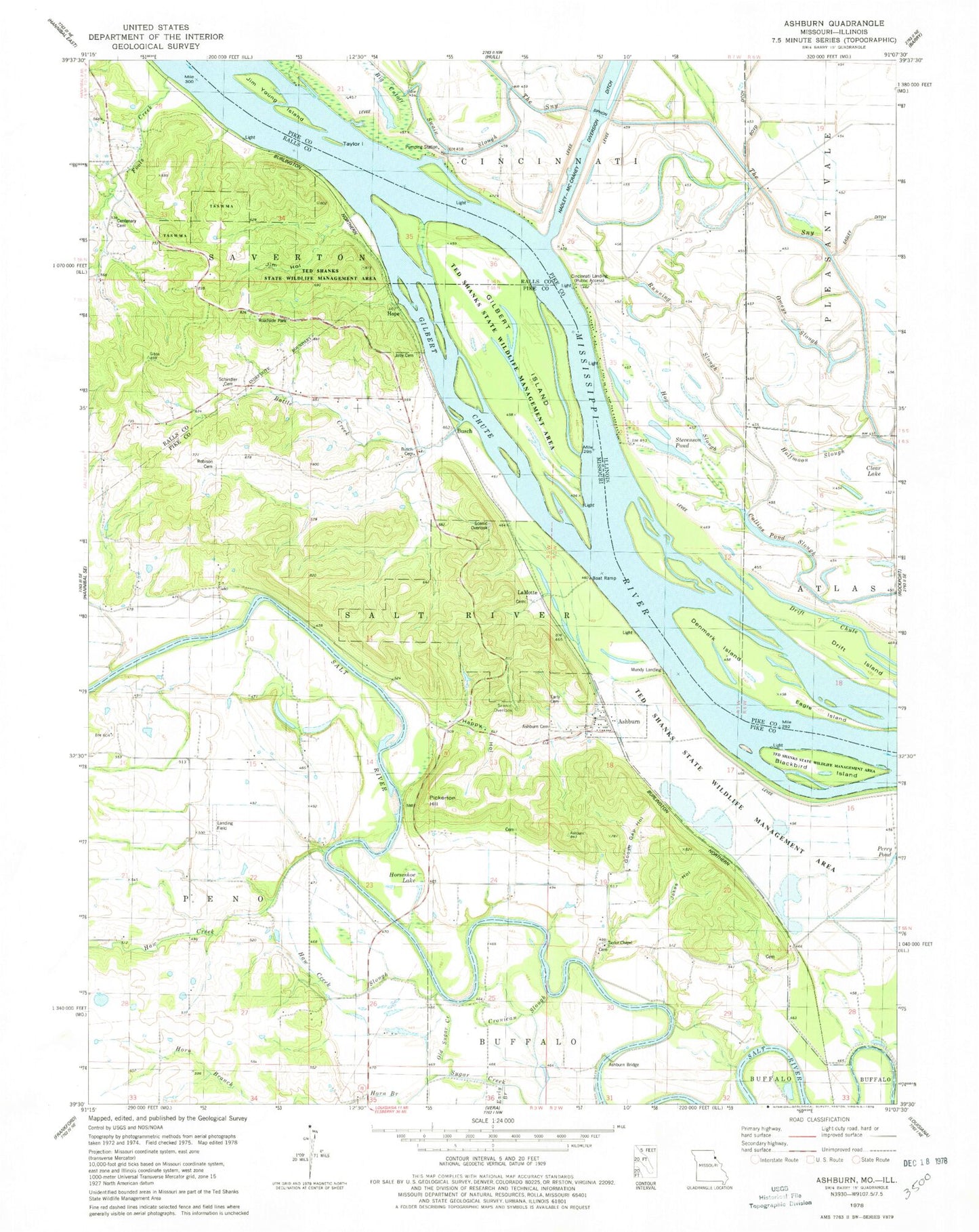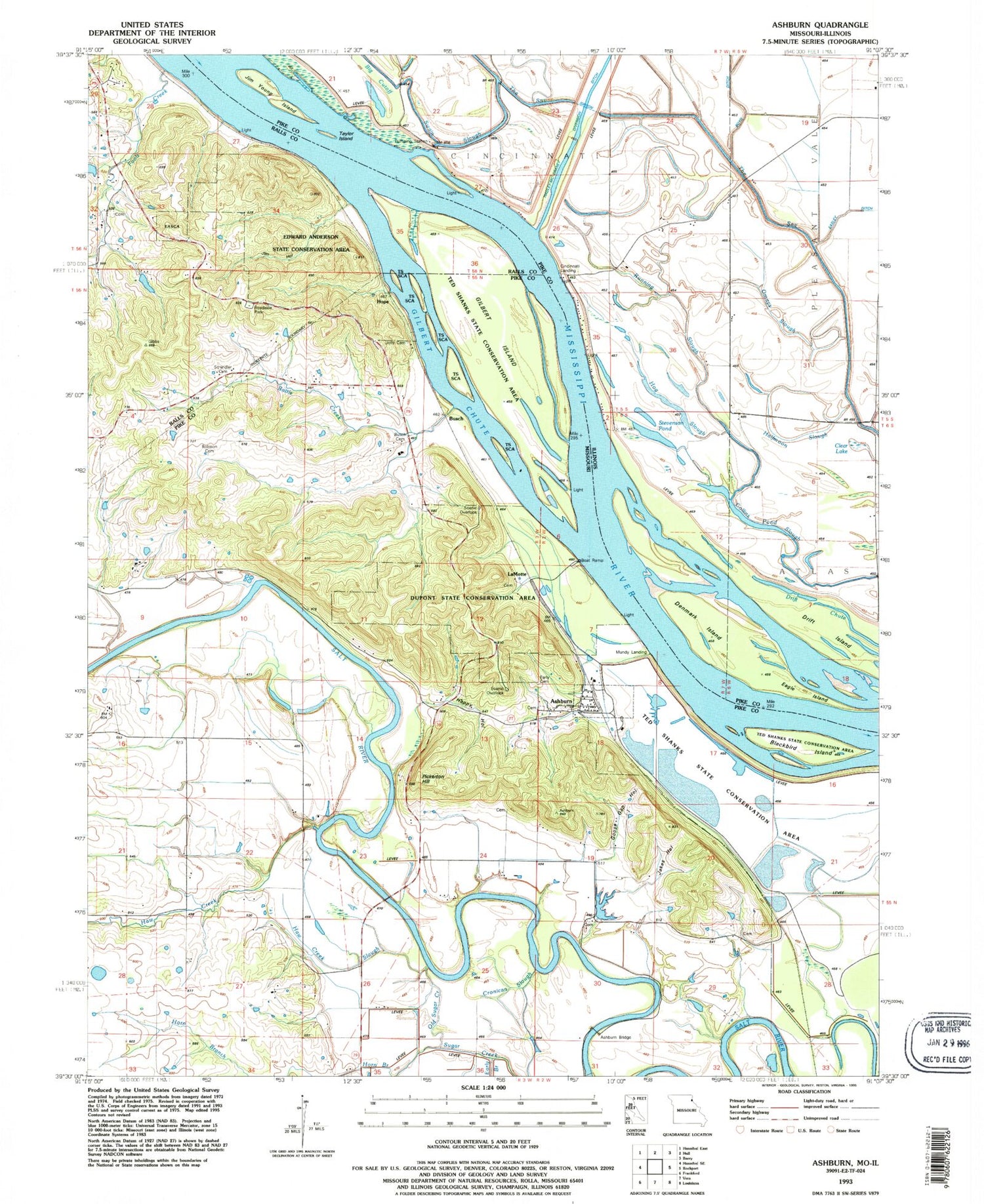
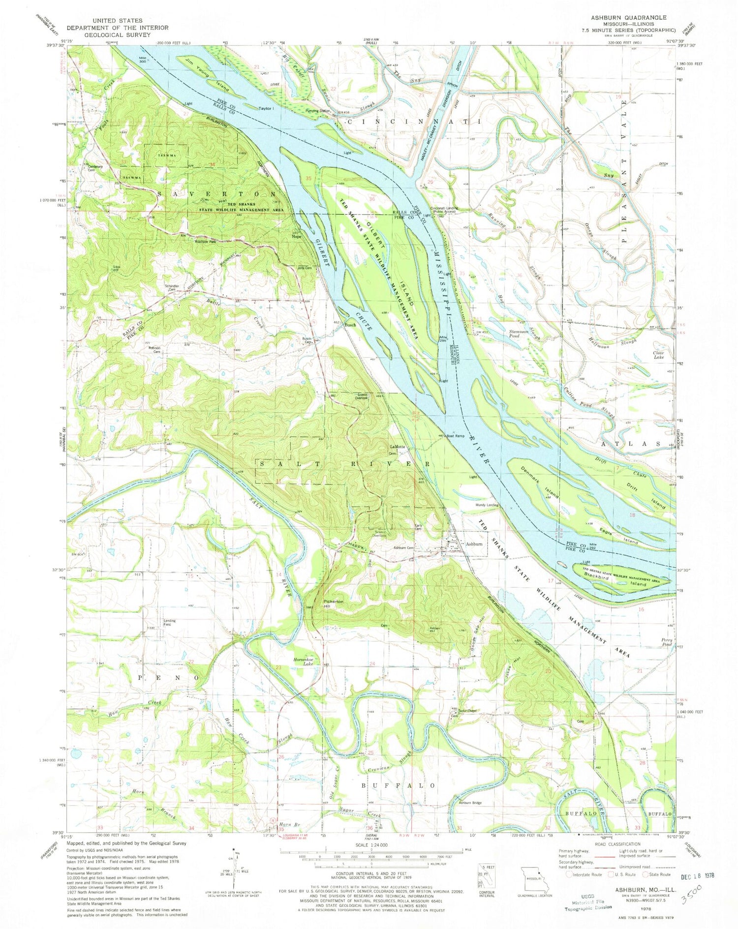
MyTopo
Classic USGS Ashburn Missouri 7.5'x7.5' Topo Map
Couldn't load pickup availability
Historical USGS topographic quad map of Ashburn in the states of Missouri, Illinois. Typical map scale is 1:24,000, but may vary for certain years, if available. Print size: 24" x 27"
This quadrangle is in the following counties: Pike, Ralls.
The map contains contour lines, roads, rivers, towns, and lakes. Printed on high-quality waterproof paper with UV fade-resistant inks, and shipped rolled.
Contains the following named places: Ted Shanks Conservation Area, Ashburn, Ashburn Cemetery, Battle Creek, Blackbird Island, Busch Cemetery, Centenary Cemetery, Cronican Slough, Early Branch, Early Cemetery, Fools Creek, Gilbert Chute, Goose Gap Hollow, Happy Hollow, Haw Creek, Haw Creek Slough, Horn Branch, Horseshoe Lake, Jakes Hollow, Jim Hollow, Jolly Cemetery, Old Sugar Creek, Pickerton Hill, Robison Cemetery, Schindler Cemetery, Gilbert Island, Taylor Chapel, Shaleton (historical), Busch, Hope, LaMotte, Mundy Landing, Centenary School (historical), Haw Creek School (historical), Love School (historical), Riverland (historical), Ashburn Bridge, Township of Salt River, Dupont Reservation Conservation Area, Town of Ashburn, Ashburn Rural Volunteer Fire Department, Vernon School (historical), Walker Airport, Big Cutoff, Clear Lake, Collins Pond Slough, Denmark Island, Drift Island, Eagle Island, Halfmoon Slough, Hog Slough, Jim Young Island, Omeys Slough, Running Slough, Stevenson Pond, Swain Slough, Taylor Island, Cincinnati Landing, Blackjack School (historical), Cincinnati School (historical), Goose Pond (historical), Pfeiffer School (historical)