

MyTopo
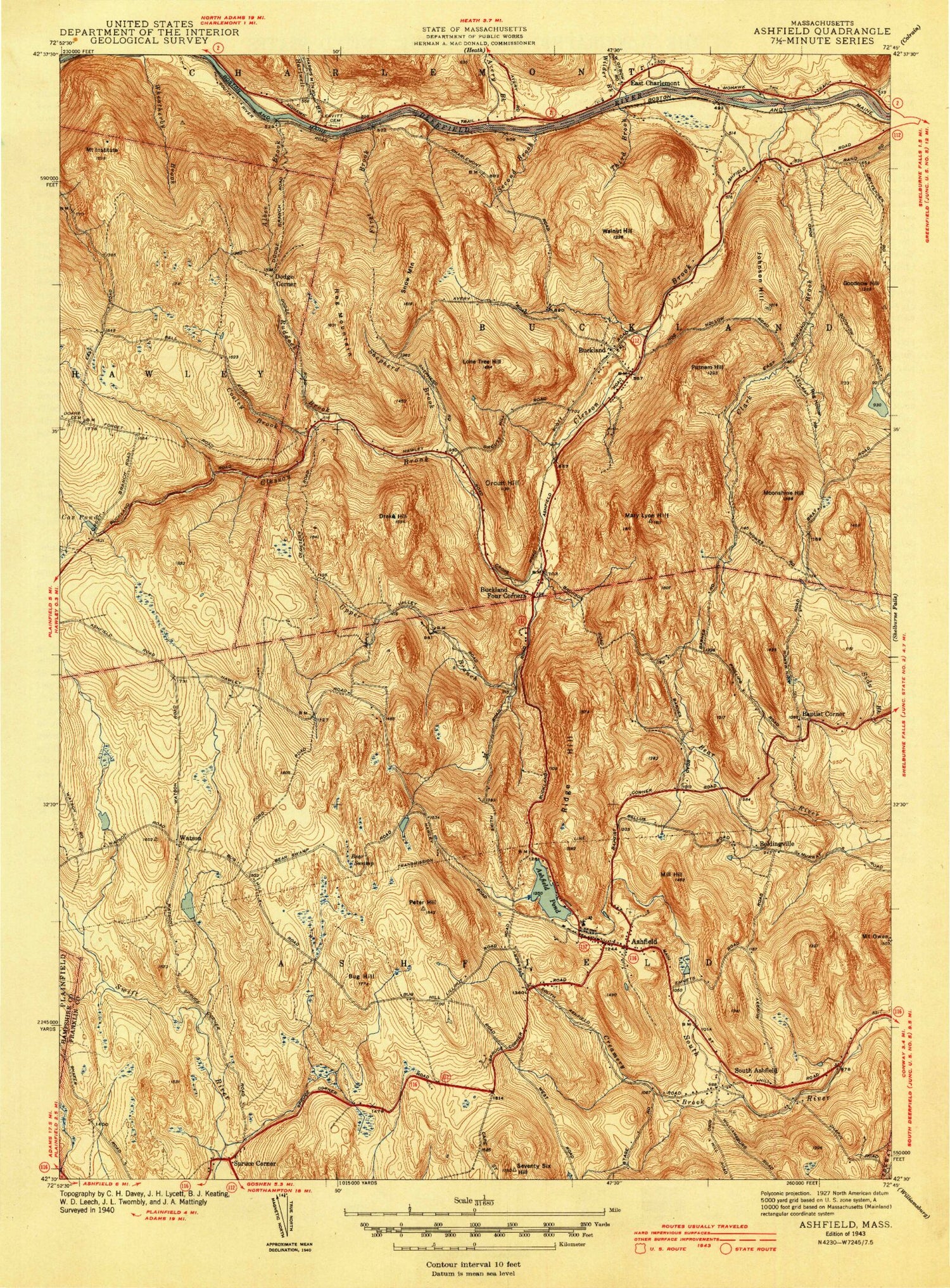
Classic USGS Ashfield Massachusetts 7.5'x7.5' Topo Map
Couldn't load pickup availability
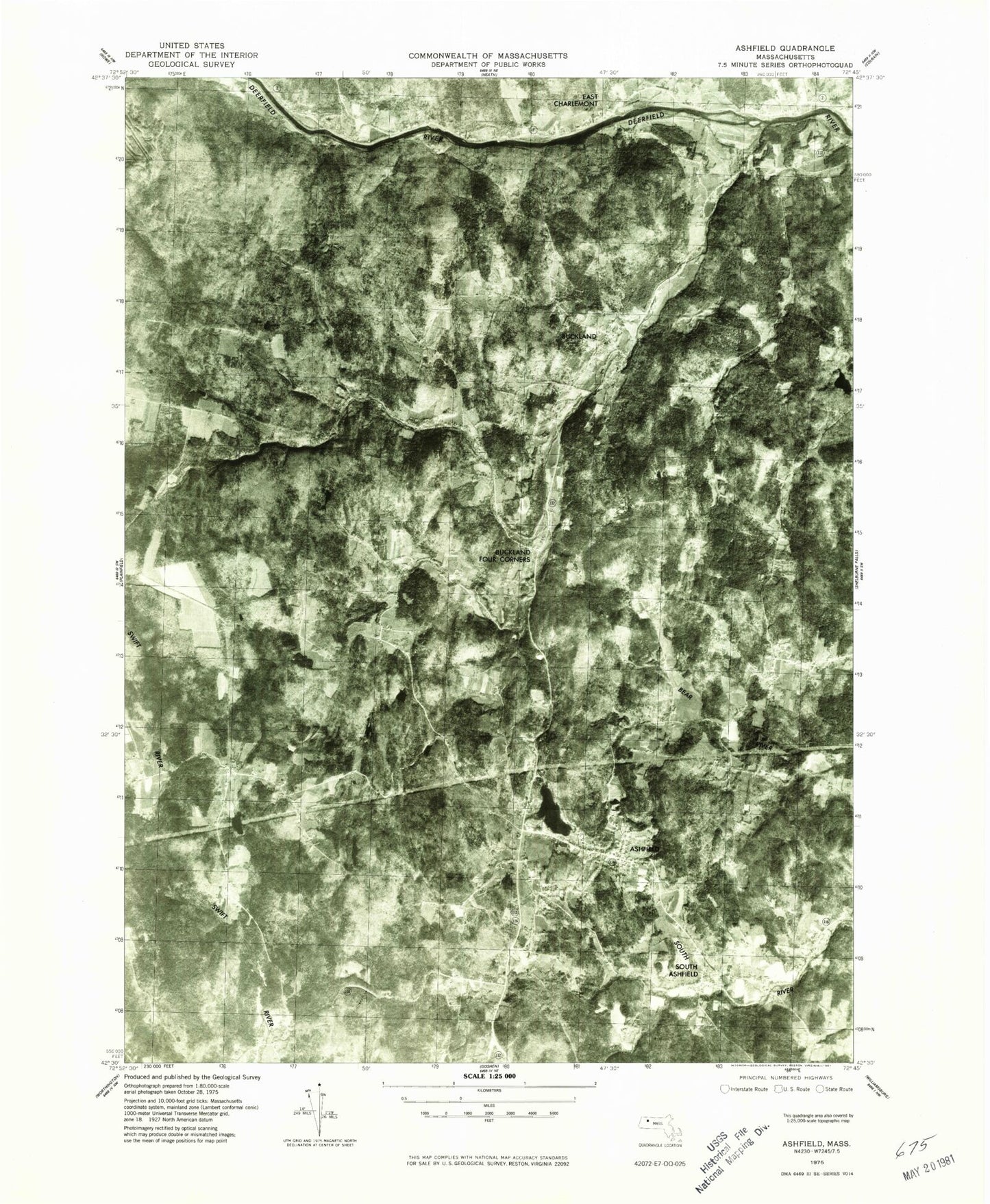
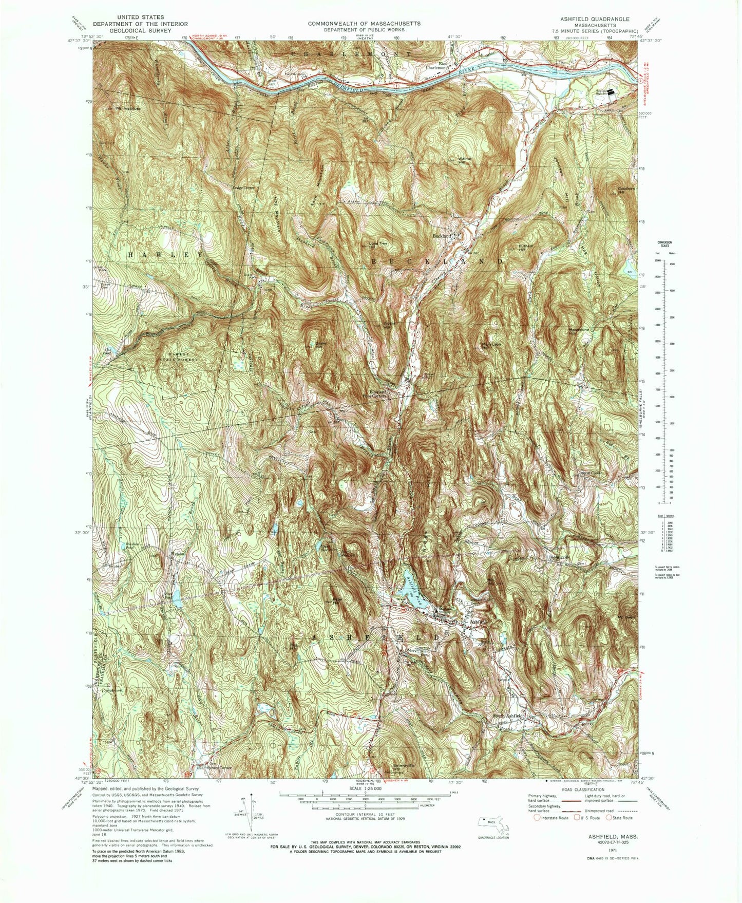
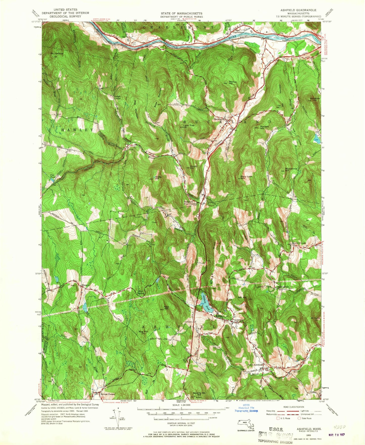
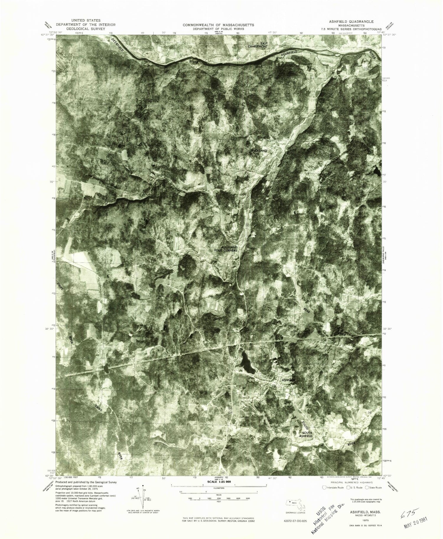
Historical USGS topographic quad map of Ashfield in the state of Massachusetts. Typical map scale is 1:24,000, but may vary for certain years, if available. Print size: 24" x 27"
This quadrangle is in the following counties: Franklin, Hampshire.
The map contains contour lines, roads, rivers, towns, and lakes. Printed on high-quality waterproof paper with UV fade-resistant inks, and shipped rolled.
Contains the following named places: Doane Cemetery, East Charlemont Church, Leavitt Cemetery, Buckland Regional High School, Hill Cemetery, Ashfield Plain Cemetery, Hawley State Forest, Ashfield Pond Dam, Ford Pond Dam, Uppper Reservoir Dam, Forget Road Dam, Hillman Ice Pond Dam, Hillman Ice Pond, Howesville (historical), Buckland State Forest, Albee Brook, Ashfield, Ashfield Pond, Avery Brook, Baptist Corner, Bear Swamp, Beldingville, Buckland, Buckland Four Corners, Bug Hill, Clark Brook, Clesson Brook, Cooley Brook, Cox Pond, Dodge Corner, Drake Hill, East Charlemont, First Brook, Goodnow Hill, Hartwell Brook, Hog Hollow, Hog Mountain, Mount Institute, Johnson Hill, Lone Tree Hill, Mary Lyon Hill, Mill Hill, Moonshine Hill, Orcutt Hill, Peter Hill, Putnam Hill, Ridge Hill, Ruddock Brook, Second Brook, Seventy Six Hill, Shepherd Brook, Snow Mountain, South Ashfield, Spruce Corner, Taylor Brook, Third Brook, Upper Branch Clesson Brook, Walnut Hill, Watson, Williams Pond, Mount Owen, North Pond Brook, Wilder Brook, East Oxbow Brook, Oxbow Brook, Ford Brook, Smith Brook, Lower Reservoir, Upper Reservoir, Ford Pond, Wauban Pond, Billings Brook, Town of Buckland, Wilder Brook, Town of Ashfield, Ashfield Post Office, Buckland Post Office, First Congregational Church, Mary Lyon Church, Saint Johns Episcopal Church, The Academy at Charlemont, Buckland Fire District, Ashfield Fire Department, East Charlemont Cemetery, Ashfield Police Department, Doane Cemetery, East Charlemont Church, Leavitt Cemetery, Buckland Regional High School, Hill Cemetery, Ashfield Plain Cemetery, Hawley State Forest, Ashfield Pond Dam, Ford Pond Dam, Uppper Reservoir Dam, Forget Road Dam, Hillman Ice Pond Dam, Hillman Ice Pond, Howesville (historical), Buckland State Forest, Albee Brook, Ashfield, Ashfield Pond, Avery Brook, Baptist Corner, Bear Swamp, Beldingville, Buckland, Buckland Four Corners, Bug Hill, Clark Brook, Clesson Brook, Cooley Brook, Cox Pond, Dodge Corner, Drake Hill, East Charlemont, First Brook, Goodnow Hill, Hartwell Brook, Hog Hollow, Hog Mountain, Mount Institute, Johnson Hill, Lone Tree Hill, Mary Lyon Hill, Mill Hill, Moonshine Hill, Orcutt Hill, Peter Hill, Putnam Hill, Ridge Hill, Ruddock Brook, Second Brook, Seventy Six Hill, Shepherd Brook, Snow Mountain, South Ashfield, Spruce Corner, Taylor Brook, Third Brook, Upper Branch Clesson Brook, Walnut Hill, Watson, Williams Pond, Mount Owen, North Pond Brook, Wilder Brook, East Oxbow Brook, Oxbow Brook, Ford Brook, Smith Brook, Lower Reservoir, Upper Reservoir, Ford Pond, Wauban Pond, Billings Brook, Town of Buckland, Wilder Brook, Town of Ashfield, Ashfield Post Office, Buckland Post Office, First Congregational Church, Mary Lyon Church, Saint Johns Episcopal Church, The Academy at Charlemont, Buckland Fire District, Ashfield Fire Department, East Charlemont Cemetery, Ashfield Police Department, Doane Cemetery, East Charlemont Church, Leavitt Cemetery, Buckland Regional High School, Hill Cemetery, Ashfield Plain Cemetery, Hawley State Forest, Ashfield Pond Dam, Ford Pond Dam, Uppper Reservoir Dam, Forget Road Dam, Hillman Ice Pond Dam, Hillman Ice Pond, Howesville (historical), Buckland State Forest, Albee Brook, Ashfield, Ashfield Pond, Avery Brook, Baptist Corner, Bear Swamp, Beldingville, Buckland, Buckland Four Corners, Bug Hill, Clark Brook, Clesson Brook, Cooley Brook, Cox Pond, Dodge Corner, Drake Hill, East Charlemont, First Brook, Goodnow Hill, Hartwell Brook, Hog Hollow, Hog Mountain, Mount Institute, Johnson Hill, Lone Tree Hill, Mary Lyon Hill, Mill Hill, Moonshine Hill, Orcutt Hill, Peter Hill, Putnam Hill, Ridge Hill, Ruddock Brook, Second Brook, Seventy Six Hill, Shepherd Brook, Snow Mountain, South Ashfield, Spruce Corner, Taylor Brook, Third Brook, Upper Branch Clesson Brook, Walnut Hill, Watson, Williams Pond, Mount Owen, North Pond Brook, Wilder Brook, East Oxbow Brook, Oxbow Brook, Ford Brook