
MyTopo
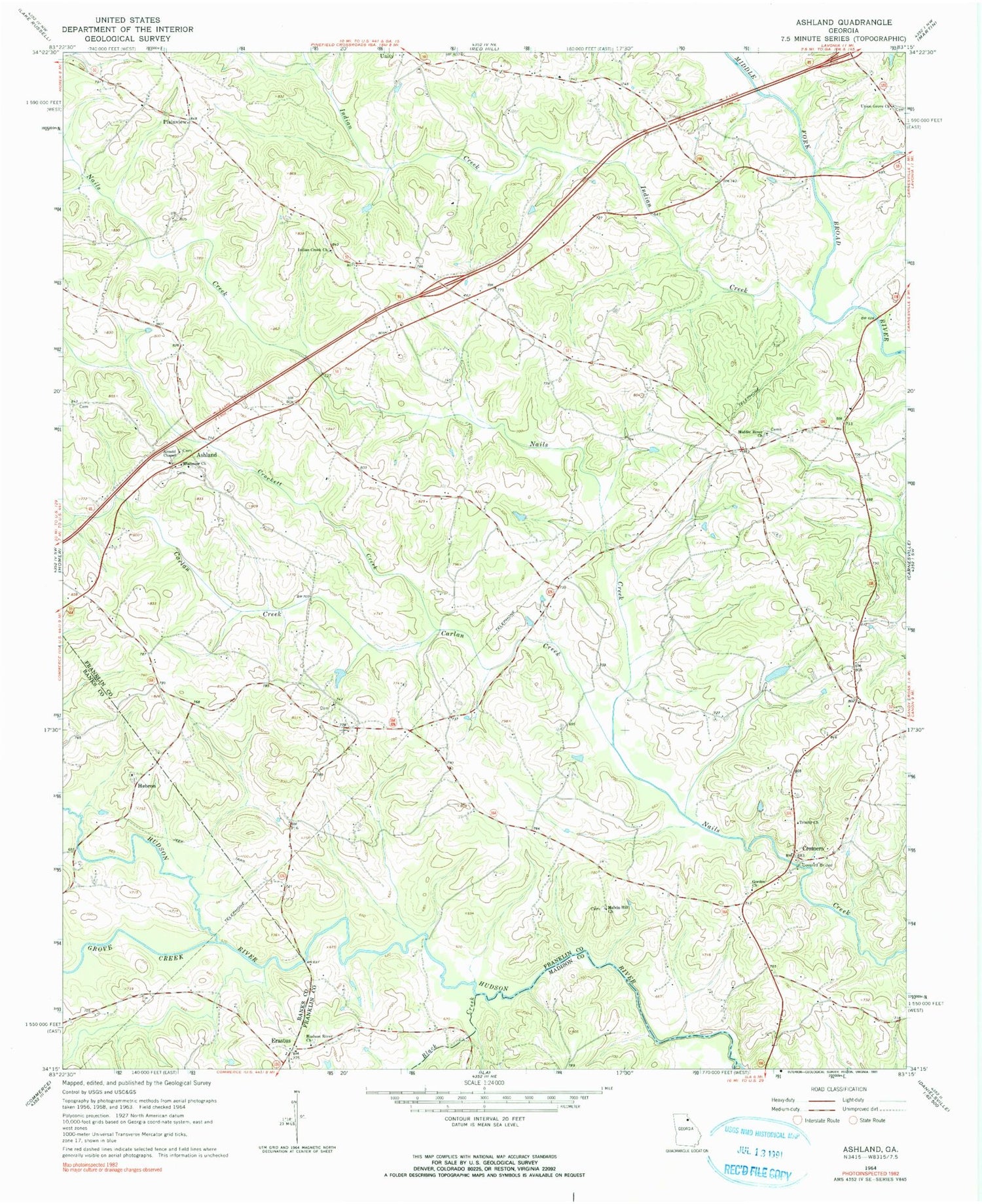
Classic USGS Ashland Georgia 7.5'x7.5' Topo Map
Couldn't load pickup availability
Historical USGS topographic quad map of Ashland in the state of Georgia. Map scale may vary for some years, but is generally around 1:24,000. Print size is approximately 24" x 27"
This quadrangle is in the following counties: Banks, Franklin, Madison.
The map contains contour lines, roads, rivers, towns, and lakes. Printed on high-quality waterproof paper with UV fade-resistant inks, and shipped rolled.
Contains the following named places: Alston Dam, Alston Lake, Alston Lake Dam, Arnold Chapel, Ashland, Bald Springs Church, Black Creek, Bold Springs Fire Department, Carlan Creek, Crockett Creek, Cromers, Cromers Mill Covered Bridge, Ebenezer Cemetery, Ebenezer Church, Erastus, Gordon Church, Grove Creek, Hebron, Hebron Academy, Hebron Cemetery, Hebron Church, Hudson River Church, Hudson River Landing, Indian Creek, Indian Creek Church, McIntires Bridge, Melvin Hill Church, Middle River Church, Nails Creek Church, Plainview, Ragsdale Creek, Sandy Cross Division, Trinity Church, Union Grove Church, Walnut Hill, Wrights Bridge, ZIP Code: 30521


