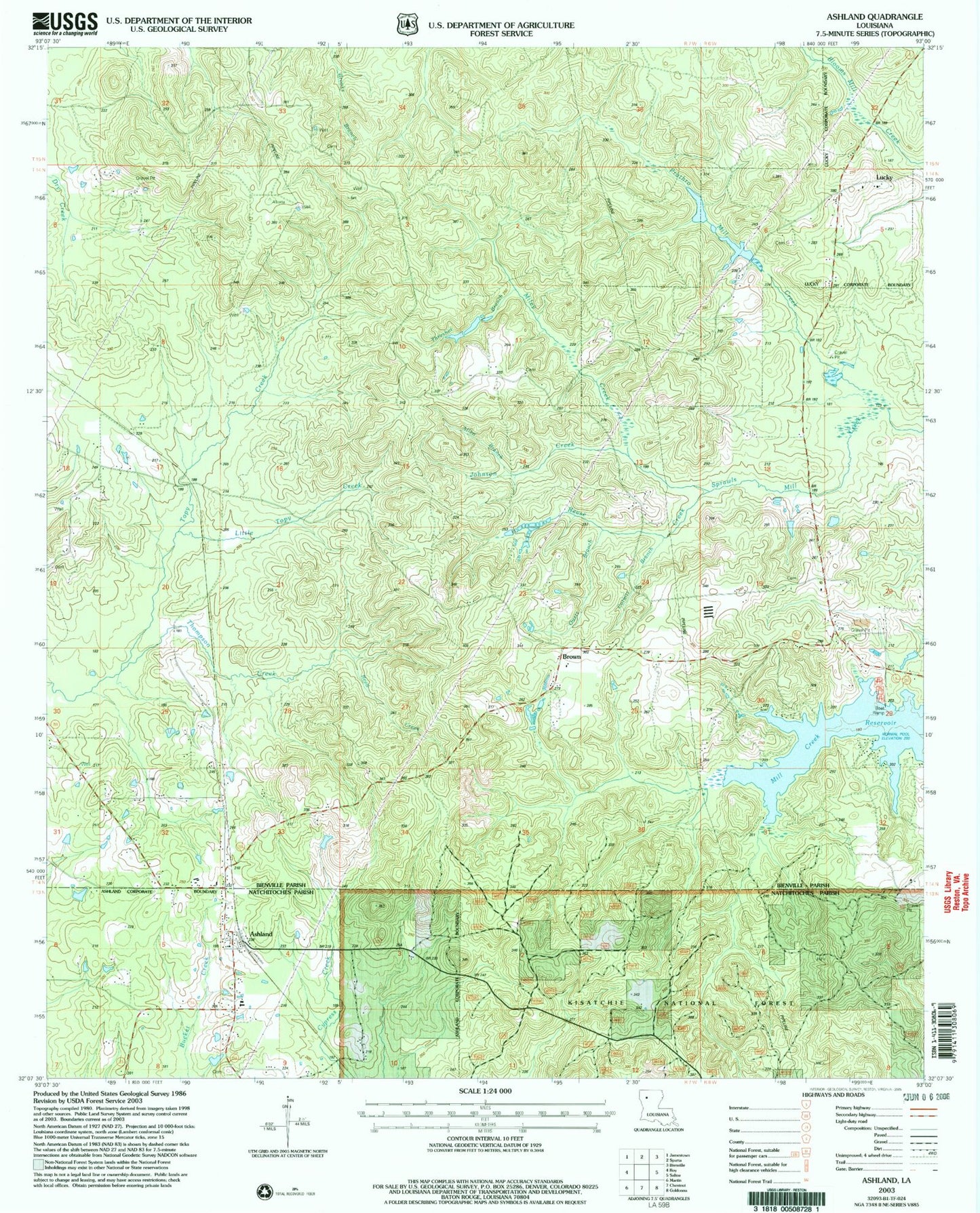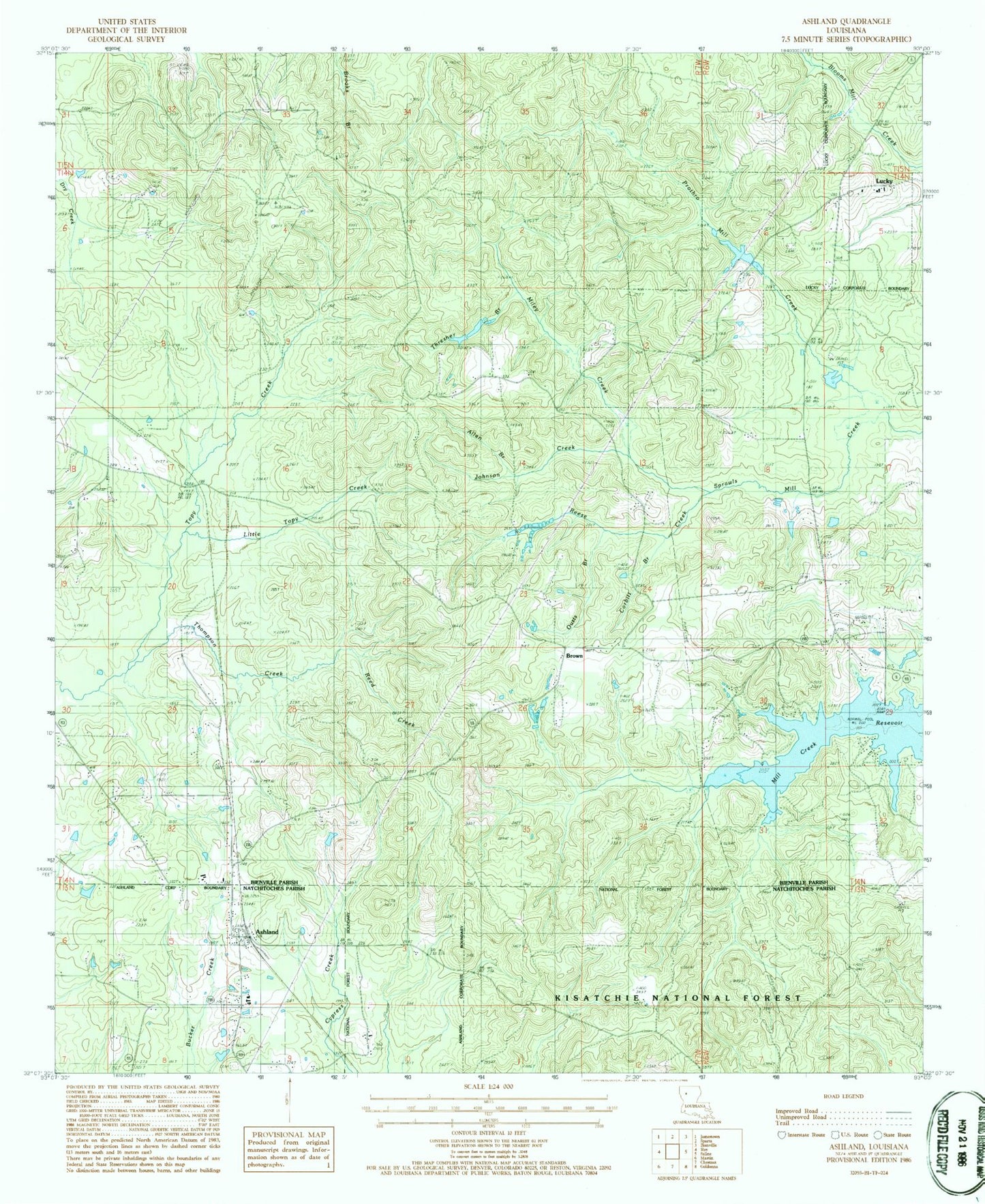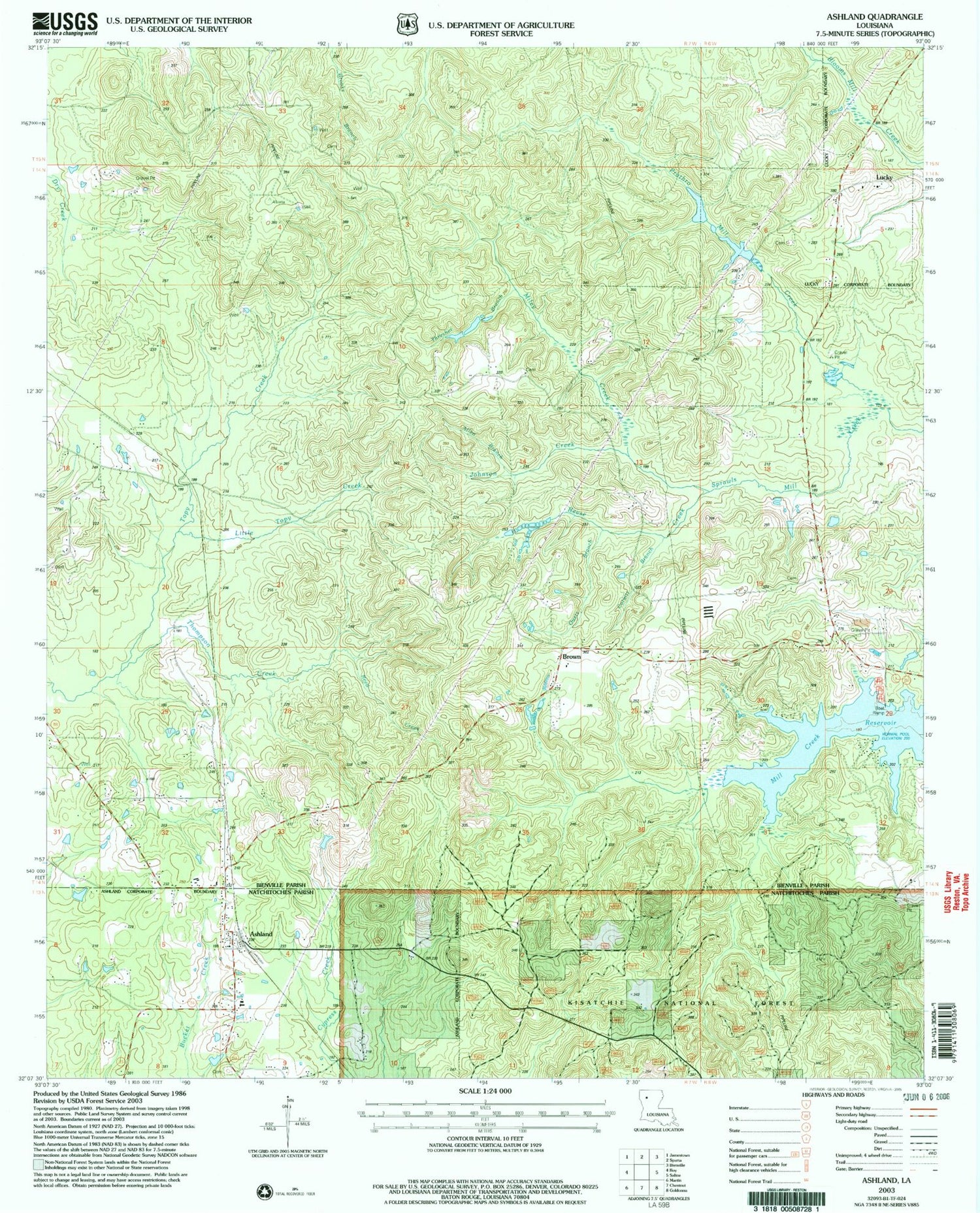

MyTopo
Classic USGS Ashland Louisiana 7.5'x7.5' Topo Map
Couldn't load pickup availability
Historical USGS topographic quad map of Ashland in the state of Louisiana. Map scale may vary for some years, but is generally around 1:24,000. Print size is approximately 24" x 27"
This quadrangle is in the following counties: Bienville, Natchitoches.
The map contains contour lines, roads, rivers, towns, and lakes. Printed on high-quality waterproof paper with UV fade-resistant inks, and shipped rolled.
Contains the following named places: Allen Branch, Ashland, Ashland Post Office, Bienville Parish Fire Protection Ward 7 Station 2 Brown Town, Bienville Parish Fire Protection Ward 7 Station 9 Sand Springs, Brown, Burkplace, Burt Cemetery, Castor Gas Field, Corbitt Branch, Driggers Pond, Guynes, Johnson Creek, Little Topy Creek, Miley Creek, Natchitoches Fire Protection District 8, New Ramah, New Ramah Church, Old Saline, Old Saline Cemetery, Old Saline Church, Ouzts Branch, Parish Governing Authority District 6, Pine Grove, Pine Grove Church, Prothro Mill Creek, Ramah Cemetery, Reed Creek, Reese Creek, Ridge, Ridge Church, Shell Hill, Thompson Creek, Thresher Branch, Wallace Church, ZIP Code: 71016