MyTopo
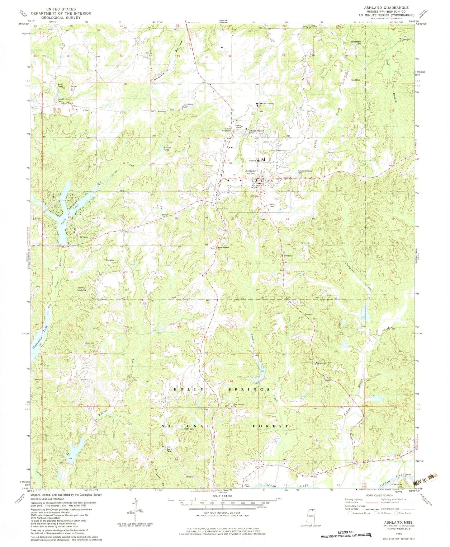
Classic USGS Ashland Mississippi 7.5'x7.5' Topo Map
Couldn't load pickup availability
Historical USGS topographic quad map of Ashland in the state of Mississippi. Map scale may vary for some years, but is generally around 1:24,000. Print size is approximately 24" x 27"
This quadrangle is in the following counties: Benton.
The map contains contour lines, roads, rivers, towns, and lakes. Printed on high-quality waterproof paper with UV fade-resistant inks, and shipped rolled.
Contains the following named places: Ashland, Ashland Baptist Church, Ashland Cemetery, Ashland Church of Christ, Ashland Elementary School, Ashland Fire Department, Ashland High School, Ashland Middle School, Ashland Post Office, Ayers Cemetery, Ayers Chapel, Bains Chapel, Benton County, Benton County Fairground, Benton County Sheriff's Office, Bethlehem Cemetery, Big Snow Lake Dam, Bluff Springs Cemetery, Bluff Springs Church, Bluff Springs Lake, Bogard Cemetery, Campbell Creek, Country Church, Good Hope Church, Gray Academy, Hamer Cemetery, Hamer Hill, John Farese Airpark, Jordan Cemetery, Liberty Cemetery, Liberty Church, Little Hope Church, LT 7-11 Dam, LT 7-11 Pleasant Hill Lake, LT 7-5 Dam, Macedonia Church, May Lake Dam, McGaughy Lake, Mercy Temple, Old Salem School, Paseur Lake Dam, Pippin Lake Dam, Pleasant Hill Cemetery, Pleasant Hill Church, Pleasant Hill Lake, Reaves Pond, Rhoden Creek, Salem, Snow Lake, Snow Lake Shores, Snow Lake Volunteer Fire Department, South Ashland Church, Stillhouse Branch, Tippah, Town of Ashland, Town of Snow Lake Shores, Wagner Lake, ZIP Code: 38603