MyTopo
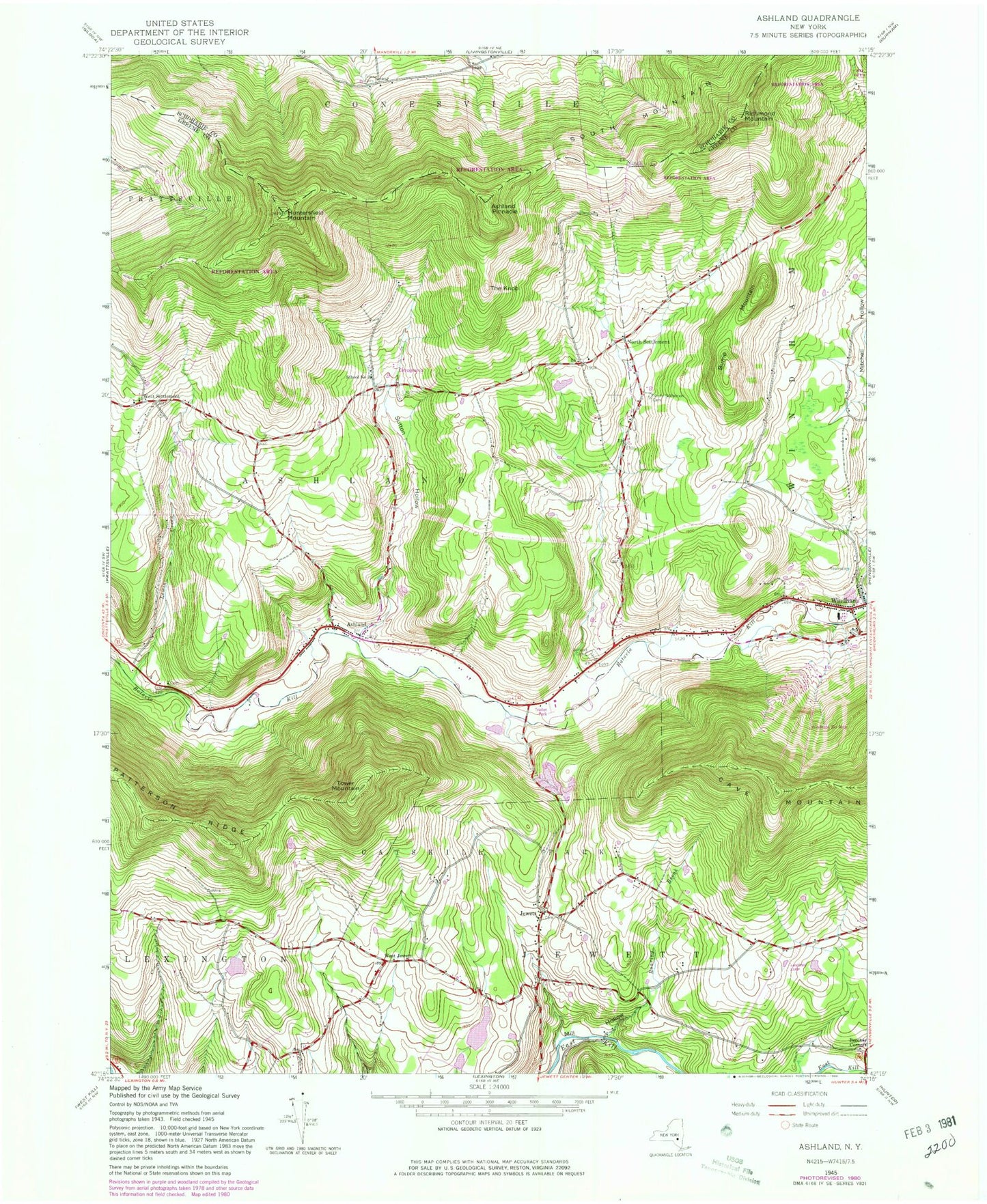
Classic USGS Ashland New York 7.5'x7.5' Topo Map
Couldn't load pickup availability
Historical USGS topographic quad map of Ashland in the state of New York. Typical map scale is 1:24,000, but may vary for certain years, if available. Print size: 24" x 27"
This quadrangle is in the following counties: Greene, Schoharie.
The map contains contour lines, roads, rivers, towns, and lakes. Printed on high-quality waterproof paper with UV fade-resistant inks, and shipped rolled.
Contains the following named places: Ashland, Ashland Cemetery, Ashland Pinnacle, Bump Mountain, Freese Cemetery, Huntersfield Mountain, Jewett, Lewis Creek, Mitchell Hollow, North Settlement Cemetery, Richmond Mountain, Roaring Brook, Sutton Hollow, Sutton Hollow Cemetery, The Knob, Tower Mountain, South Mountain, Windham, North Settlement, West Jewett, West Settlement, School Number 3 (historical), School Number 6 (historical), Town of Ashland, Windham Ski Area, Central School, School Number 5 (historical), School Number 6 (historical), School Number 7 (historical), West Settlement Cemetery, Saint Joseph's Chapel, Saint Joseph's Chapel Cemetery, Jewett Heights Cemetery, Hull - Peck Cemetery, Towner Cemetery, North Settlement United Methodist Church, Bald Mountain Tree Farm, Kerns Nursery, Ashland Community United Methodist Church, Windham Public Library, Windham Post Office, Jewett Fire Department, Ashland Fire Department, Windham Fire Department, Jewett Post Office, Ashland Post Office