MyTopo
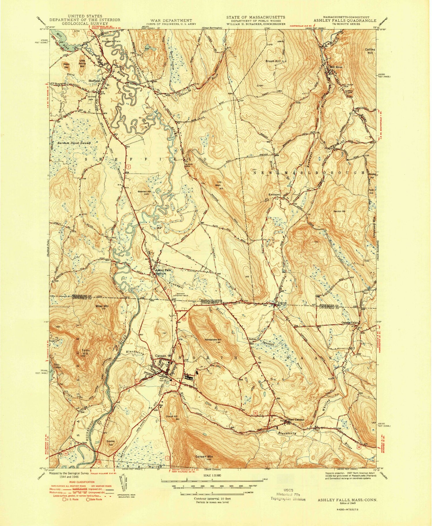
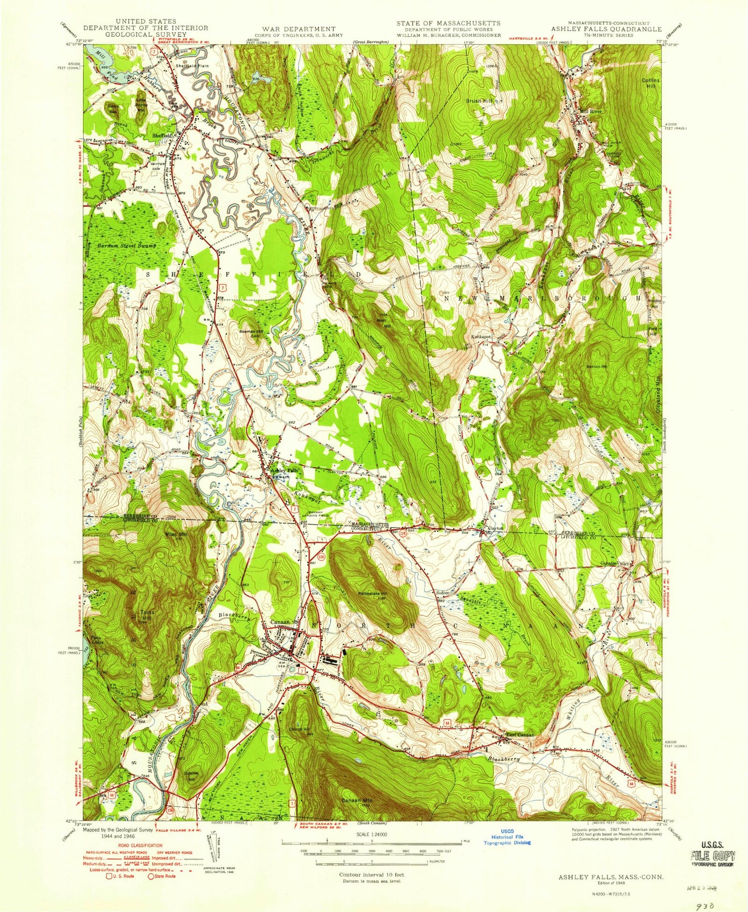
Classic USGS Ashley Falls Massachusetts 7.5'x7.5' Topo Map
Couldn't load pickup availability
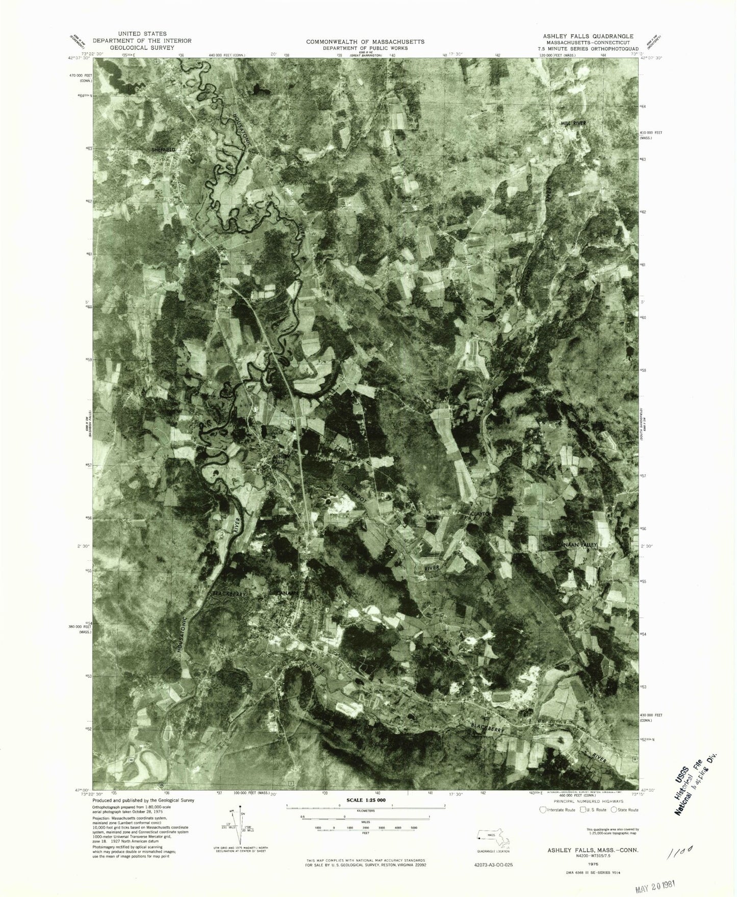
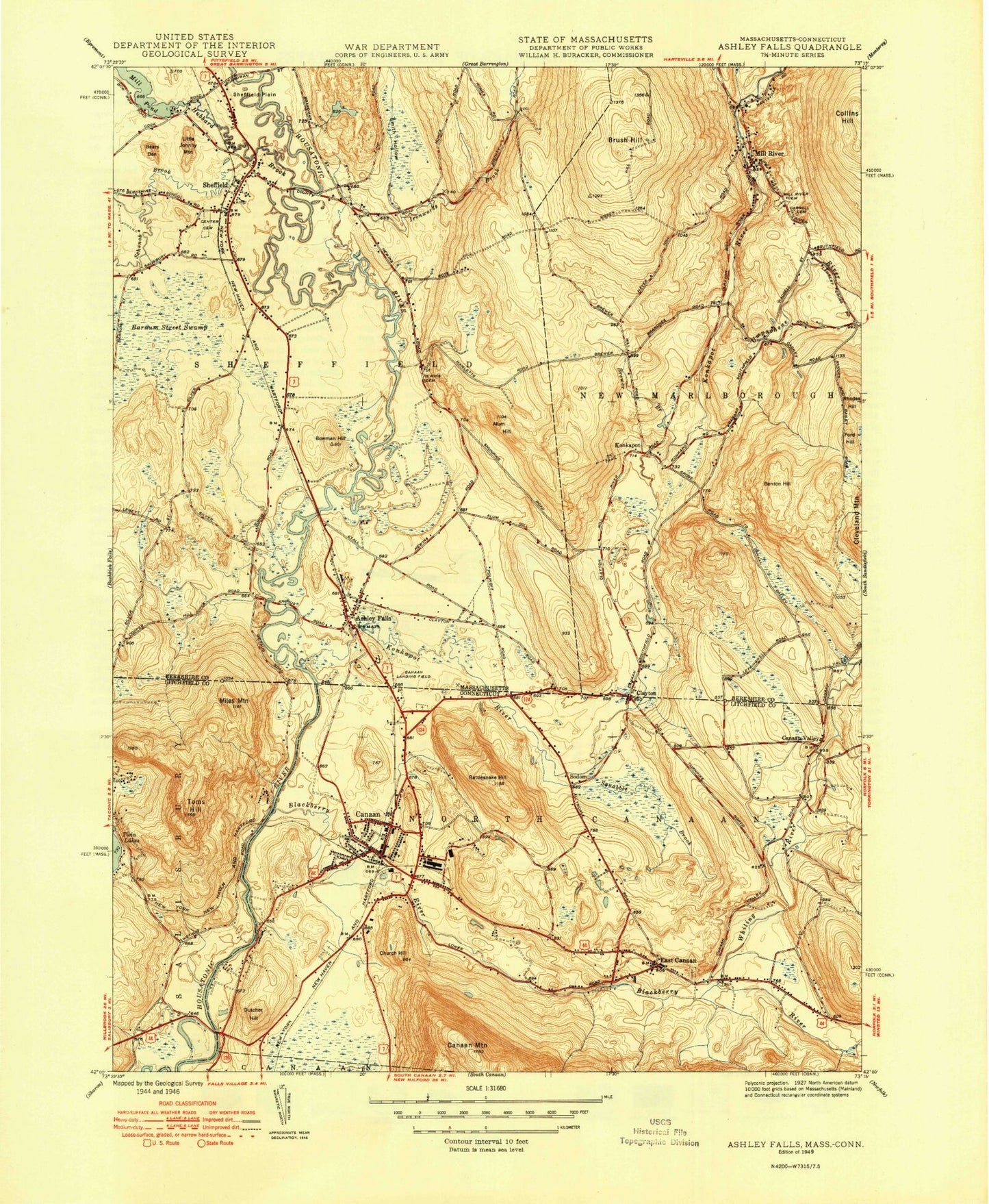
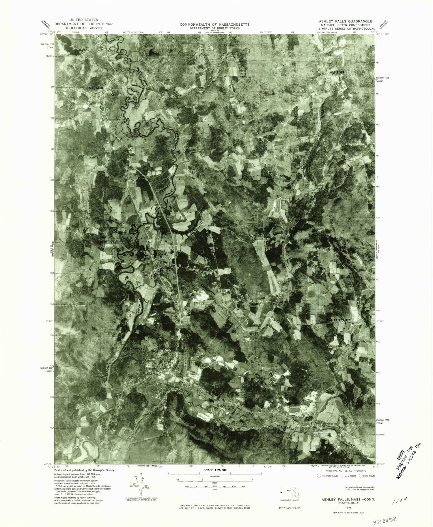
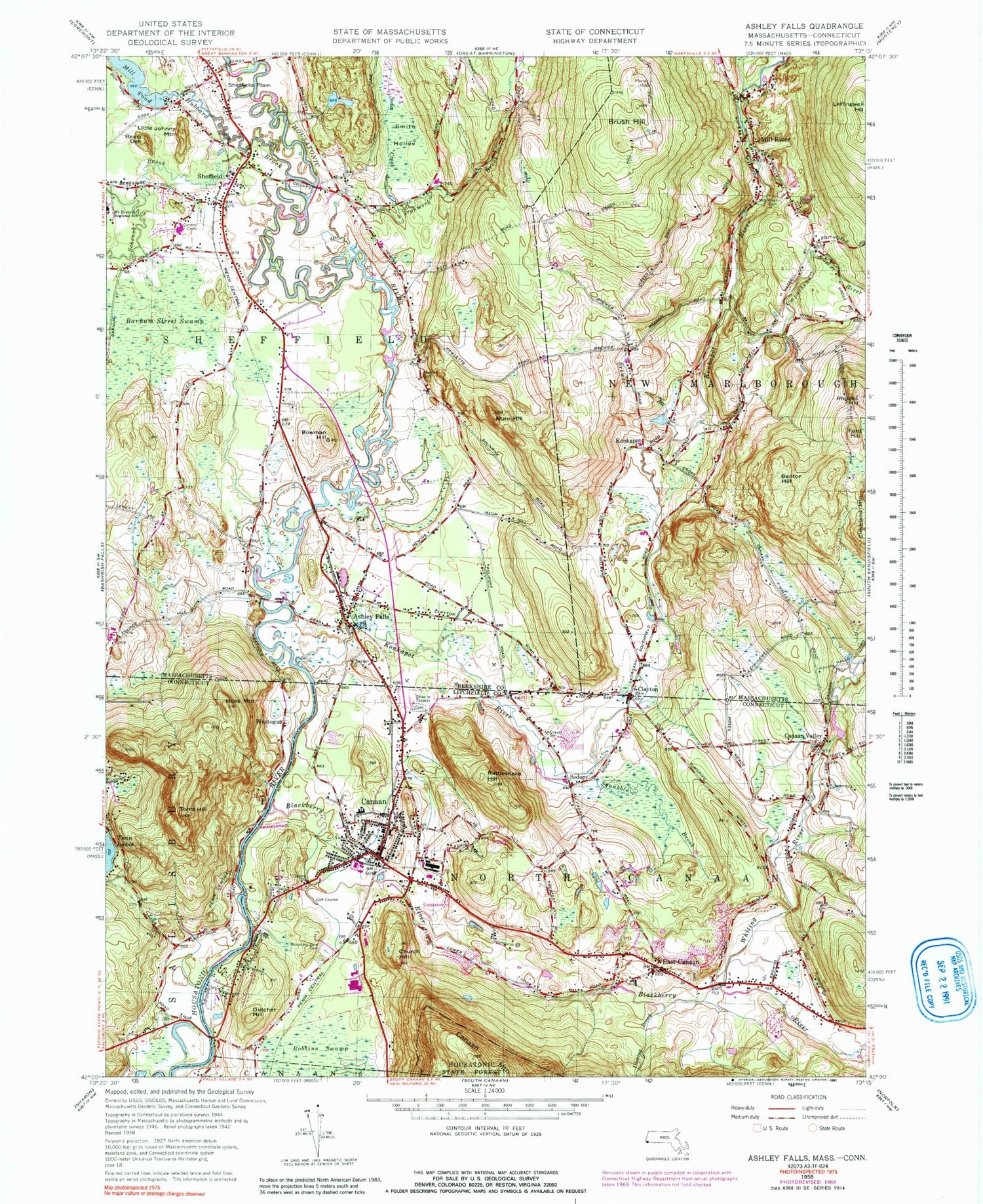
Historical USGS topographic quad map of Ashley Falls in the states of Massachusetts, Connecticut. Typical map scale is 1:24,000, but may vary for certain years, if available. Print size: 24" x 27"
This quadrangle is in the following counties: Berkshire, Litchfield.
The map contains contour lines, roads, rivers, towns, and lakes. Printed on high-quality waterproof paper with UV fade-resistant inks, and shipped rolled.
Contains the following named places: Carroll Cemetery, Peyser Dam, Mill Pond Dam, Umpachene Falls, Old Covered Bridge, Covered Bridge, Bartholomews Cobble, Colonel Ashley House, Alum Hill, Ashley Falls, Barnum Street Swamp, Bears Den, Benton Hill, Bowman Hill, Brewer Brook, Brush Hill, Clayton, East Sheffield, Ford Hill, Hubbard Brook, Ironwork Brook, Little Johnny Mountain, Mill River, Rhodes Hill, Sheffield, Sheffield Plain, Smith Hollow, Soda Creek, Stony Brook, Umpachene River, Schenob Brook, Mill River Cemetery, Hewins Cemetery, Center Cemetery, Konkapot River, Town of Sheffield, Ashley Falls Post Office, Barnard Cemetery, Gomorrah, Grace Bible Church, Mill River Post Office, Mill River Town Hall, Sheffield Plain Historic District, Sheffield Post Office, Sheffield Town Hall, Mount Everett Regional School Library, Cmelak Field, Sheffield Fire Department, Sheffield Police Department, New Marlborough Police Department, Blackberry River, Canaan, Canaan Valley, Church Hill, Duming Brook, Dutcher Hill, East Canaan, Miles Mountain, Mountain View Cemetery, Rattlesnake Hill, Sodom, Squabble Brook, Toms Hill, Weatogue, North Canaan Aviation Facilities Inc Airport, Town of North Canaan, Whiting River, Whiting River Dam, Whiting River Reservoir, C H Pease Museum, Camp Wangum, Saint Joseph Cemetery, Canaan Country Club, Canaan Post Office, Canaan United Methodist Church, Canaan Village Historic District, Connecticut Railroad Historical Museum, Douglas Library, Dutcher Bridge Cemetery, Dutchers Bridge, East Canaan Post Office, East Canaan Congregational Church, Eddy Field, Foley (historical), Geer Memorial Health Center, Lawrence FIeld, Lone Oaks Campsites, North Canaan Community Pool, North Canaan Elementary School, North Canaan Town Hall, Wangum Village, Canaan Census Designated Place, Canaan Fire Company, North Canaan Volunteer Ambulance Corps, Connecticut State Police Troop B - Canaan, East Canaan Cemetery, Carroll Cemetery, Peyser Dam, Mill Pond Dam, Umpachene Falls, Old Covered Bridge, Covered Bridge, Bartholomews Cobble, Colonel Ashley House, Alum Hill, Ashley Falls, Barnum Street Swamp, Bears Den, Benton Hill, Bowman Hill, Brewer Brook, Brush Hill, Clayton, East Sheffield, Ford Hill, Hubbard Brook, Ironwork Brook, Little Johnny Mountain, Mill River, Rhodes Hill, Sheffield, Sheffield Plain, Smith Hollow, Soda Creek, Stony Brook, Umpachene River, Schenob Brook, Mill River Cemetery, Hewins Cemetery, Center Cemetery, Konkapot River, Town of Sheffield, Ashley Falls Post Office, Barnard Cemetery, Gomorrah, Grace Bible Church, Mill River Post Office, Mill River Town Hall, Sheffield Plain Historic District, Sheffield Post Office, Sheffield Town Hall, Mount Everett Regional School Library, Cmelak Field, Sheffield Fire Department, Sheffield Police Department, New Marlborough Police Department, Blackberry River, Canaan, Canaan Valley, Church Hill, Duming Brook, Dutcher Hill, East Canaan, Miles Mountain, Mountain View Cemetery, Rattlesnake Hill, Sodom, Squabble Brook, Toms Hill, Weatogue, North Canaan Aviation Facilities Inc Airport, Town of North Canaan, Whiting River, Whiting River Dam, Whiting River Reservoir, C H Pease Museum, Camp Wangum, Saint Joseph Cemetery, Canaan Country Club, Canaan Post Office, Canaan United Methodist Church, Canaan Village Historic District, Connecticut Railroad Historical Museum, Douglas Library, Dutcher Bridge Cemetery, Dutchers Bridge, East Canaan Post Office, East Canaan Congregational Church, Eddy Field, Foley (historical), Geer Memorial Health Center, Lawrence FIeld, Lone Oaks Campsites, North Canaan Community Pool, North Canaan Elementary School, North Canaan Town Hall, Wangum Village, Canaan Census Designated Place, Canaan Fire Company, North Canaan Volunteer Ambulance Corps, Connecticut State Police Troop B - Canaan, East Canaan Cemetery, Carroll Cemetery, Peyser Dam, Mill Pond Dam, Umpachene Falls, Old Covered Bridge, Covered Bridge, Bartholomews Cobble, Colonel Ashley House, Alum Hill, Ashley Falls, Barnum Street Swamp, Bears Den, Benton Hill, Bowman Hill, Brewer Brook, Brush Hill, Clayton, East Sheffield, Ford Hill, Hubbard Brook, Ironwork Brook, Little Johnny Mountain, Mill River, Rhodes Hill, Sheffield, Sheffield Plain, Smith Hollow, Soda Creek, Stony Brook, Umpachene River, Schenob Brook, Mill River Cemetery, Hewins Cemetery, Center Cemetery, Konkapot River, Town of Sheffield, Ashley Falls Post Office, Barnard Cemetery, Gomorrah, Grace Bible Church, Mill River Post Office, Mill River Town Hall, Sheffield Plain Historic District, Sheffield Post Office