MyTopo
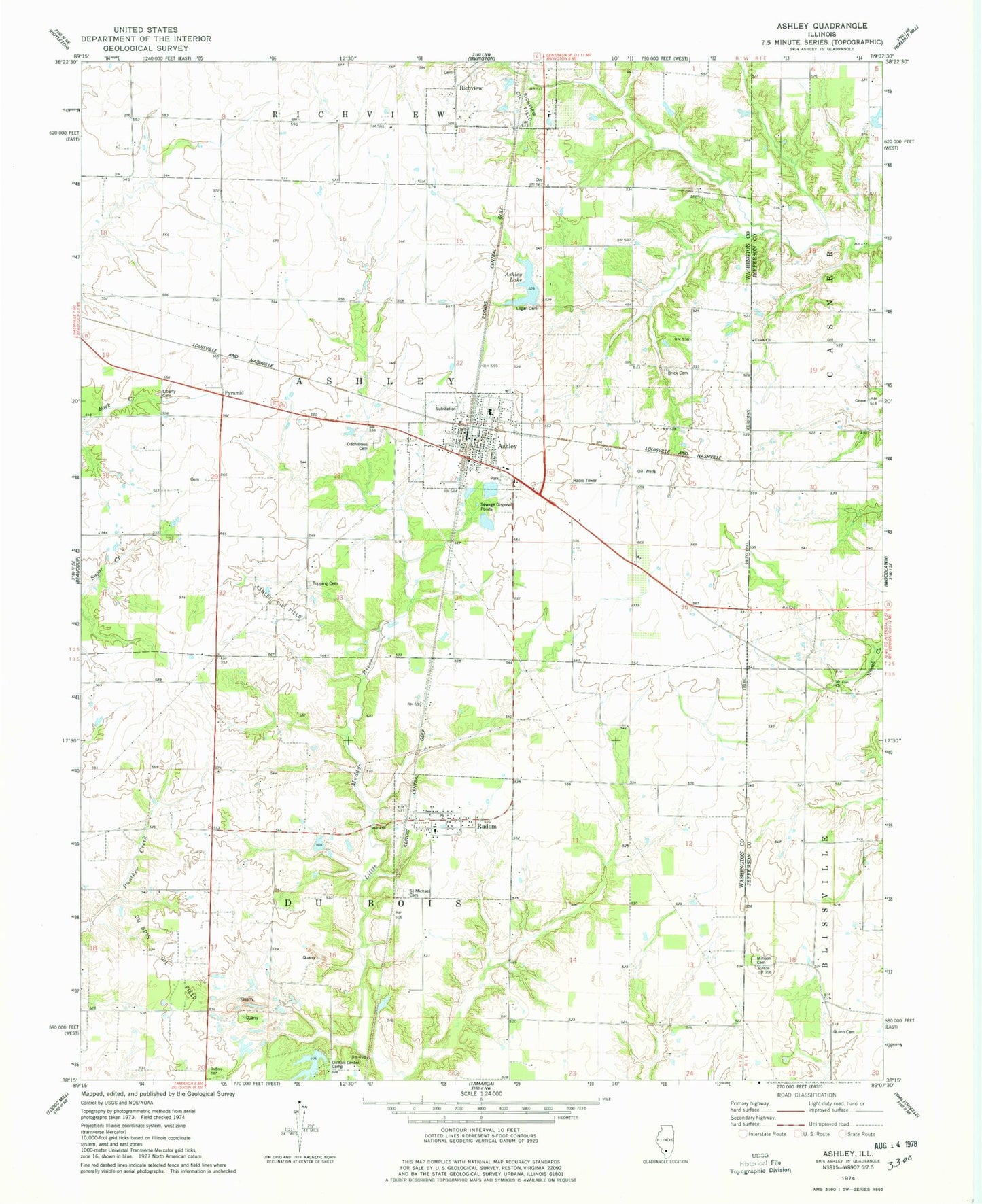
Classic USGS Ashley Illinois 7.5'x7.5' Topo Map
Couldn't load pickup availability
Historical USGS topographic quad map of Ashley in the state of Illinois. Map scale may vary for some years, but is generally around 1:24,000. Print size is approximately 24" x 27"
This quadrangle is in the following counties: Jefferson, Washington.
The map contains contour lines, roads, rivers, towns, and lakes. Printed on high-quality waterproof paper with UV fade-resistant inks, and shipped rolled.
Contains the following named places: Ashley, Ashley Baptist Church, Ashley Cemetery, Ashley Community Consolidated School, Ashley Dam, Ashley Fire Protection District, Ashley Lake, Ashley Oil Field, Ashley Police Department, Ashley Post Office, Ashley Reservoir, Brick Cemetery, Brick School, Casner School, City of Ashley, Dry Arm School, Du Bois Oil Field, DuBois Center, Fairview Church, Fairview School, Flannigan School, Howard School, I C R R Reservoir, I C R R Reservoir Dam, Liberty Cemetery, Liberty School, Logan Cemetery, Minson Cemetery, Minson Church, Mount Zion Cemetery, Mount Zion Church, Old Town School, Pyramid, Quinn Cemetery, Radom, Radom Post Office, Saint Michael Cemetery, Topping Cemetery, Township of Ashley, Township of Du Bois, Township of Richview, Union Church, Village of Radom, White Swan School, ZIP Codes: 62808, 62876